
Nicholson Guide to the Waterways (Waterways Guide)
2003
Thetford and Diss, Breckland and ...
Thetford and Diss, Breckland and Wymondham
2000
Ordnance Survey statlas UK
Ordnance Survey statlas UK
1995
Street atlas Nottinghamshire
Street atlas Nottinghamshire
1994
Ordnance Survey motoring atlas [o...
Ordnance Survey motoring atlas [of Great Britain]
1992
Catalogue of maps and other publi...
Catalogue of maps and other publications of the Ordnance Survey
1991
North Hampshire
Ordnance survey of Great Britain,...
Ordnance survey of Great Britain, England, and Wales
1991
South Hampshire
The County of Kent in 1801
The County of Kent in 1801
1990
East Kent street atlas
East Kent street atlas
1989
Ordnance Survey superscale atlas ...
Ordnance Survey superscale atlas of Great Britain
1989

West Kent street atlas
1989

The Ordnance Survey gazetteer of Great Britain
1987

The Ordnance Survey atlas of Great Britain
1982
Ordnance survey of Jerusalem, mad...
Ordnance survey of Jerusalem, made with the sanction of the Earl de Grey and Ripon, Secretary of State for War
1980
Monastic Britain
Britain before the Norman Conquest
Britain before the Norman Conquest
1973
The overhaul of the 1:2500 county...
The overhaul of the 1:2500 county series maps, Ordnance Survey
1972
Plan availability index
Plan availability index
1970
Gazetteer of Great Britain giving...
Gazetteer of Great Britain giving the national grid references to all features named on the 17 Ordnance Survey quarter-inch maps
1969
Place names on maps of Scotland a...
Place names on maps of Scotland and Wales
1968

The history of the retriangulation of Great Britain, 1935-1962
1967

Map of ancient Britain: north sheet
1964

Map of ancient Britain: south sheet
1964
Map of Southern Britain in the Ir...
Map of Southern Britain in the Iron Age
1962

Map of monastic Britain (North Sheet)
1955
A description of Ordnance Survey ...
A description of Ordnance Survey large scale plans
1954
The geodimeter measurement of the...
The geodimeter measurement of the Ridge Way and Caithness bases
1954
Gazetteer of Great Britain, givin...
Gazetteer of Great Britain, giving the positions of all the names shown on the Ordnance Survey quarter-inch maps in therms of the National Grid
1953
The measurement of the Ridge Way ...
The measurement of the Ridge Way and Caithness bases 1951-1952
1953
A description of Ordnance Survey ...
A description of Ordnance Survey small scale maps
1951
The projection for Ordnance Surve...
The projection for Ordnance Survey maps and plans and the National Reference System
1951
Constants, formulae and methods u...
Constants, formulae and methods used by the Ordnance Survey for computing in the transverse Mercator projection
1950
Map of monastic Britain
Map of monastic Britain
1950

Map of monastic Britain (south sheet)
1950
Projection tables for the transve...
Projection tables for the transverse Mercator projection of Great Britain
1950
A description of Ordnance Survey ...
A description of Ordnance Survey large scale maps
1947
A description of Ordnance Survey ...
A description of Ordnance Survey medium scale maps
1947
Elementary trigonometry for surve...
Elementary trigonometry for surveyors
1946
Gazetteer of Great Britain
Gazetteer of Great Britain
1946
Map of Britain in the Dark Ages
Map of Britain in the Dark Ages
1939
Britain in the Dark Ages
Britain in the Dark Ages
1935
Field archaeology
Map of Neolithic Wessex showing t...
Map of Neolithic Wessex showing the distribution of long barrows, circles, habitation sites,flint mimes
1932
Re-levelling of London commenced ...
Re-levelling of London commenced ... 1931
1932
Map of XVII century England
Map of XVII century England
1930
A description of the large scale ...
A description of the large scale maps of Great Britain produced and published by the Ordnance Survey
1926
Map of Roman Britain
Map of Roman Britain
1924
Measurement of the Semliki Base
Measurement of the Semliki Base
1924
Ordnance survey atlas of Scotland
Ordnance survey atlas of Scotland
1924
Report on the re-levelling in 191...
Report on the re-levelling in 1915-17 of a line from the English Channel to the Bristol Channel originally leveled in 1837
1917
Catalogue of the 6-inch and 25-in...
Catalogue of the 6-inch and 25-inch maps and town plans of England and Wales and the Isle of Man [Scotland and Ireland] and of the one-inch and smaller scale maps, and other publications of the Ordnance Survey of the United Kingdom to 1st April, 1914
1914
Notes on the geology of the Briti...
Notes on the geology of the British Isles
1914
An account of the measurement of ...
An account of the measurement of a geodetic base line at Lossiemouth, in 1909
1912
Re-levelling of Greater London (1...
Re-levelling of Greater London (1931-34); abstract of bench marks
1900


Facsimiles of Anglo-Saxon manuscripts photozincographed by command of Her Majesty Queen Victoria
1878
Facsimiles of national M.S.S. of ...
Facsimiles of national M.S.S. of Ireland
1874
Book of reference to the plan of ...
Book of reference to the plan of the parish of Walthamstow (hundred of Recontree) in the county of Essex
1871
Ordnance survey of the peninsula ...
Ordnance survey of the peninsula of Sinai
1869
Determination of the positions of...
Determination of the positions of Feaghmain and Haverfordwest, longitude stations on the great European arc of parallel
1867
Comparisons of the standards of l...
Comparisons of the standards of length of England, France,Belgium, Prussia, Russia, India, Australia
1866
Book of reference to the plan of ...
Book of reference to the plan of part of the Parish of Hornsey, containing Z973.900 acres, and the Parishof Clerkenwell (Det.), containing 64.542 acres (Hundred of Ossulston), in the County of Middlesex
1865
Ordnance survey of Jerusalem
Ordnance survey of Jerusalem
1865
Extension of the triangulation of...
Extension of the triangulation of the Ordnance Survey into France and Belgium
1863
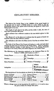
Book of Reference to the Plan of the Parish of ..
1862
Abstracts of the principal lines ...
Abstracts of the principal lines of spirit levelling in England and Wales
1861
Abstracts of the principal lines ...
Abstracts of the principal lines of spirit levelling in Scotland
1861
Book of reference to the plan of ...
Book of reference to the plan of the parish of ..
1860
Tables for the reduction of the m...
Tables for the reduction of the meteorological observations taken at the stations of the Royal Engineers ..
1860
Account of the observations and c...
Account of the observations and calculations
1858
Abstracts of principal lines of s...
Abstracts of principal lines of spirit levelling in Ireland carried on during the years 1839 to 1843 under the direction of the late Major-general Colby
1855
Report on the geology of the coun...
Report on the geology of the county of Londonderry, and of parts of Tyrone and Fermanagh
1843
Ordnance survey of the Country of...
Ordnance survey of the Country of Londonderry
1835
1-25, 000 Map 0588 Middleton-in-T...
1-25, 000 Map 0588 Middleton-in-Teesdale
Year unknown
1-25, 000 Map 0611 Troutbeck & Sh...
1-25, 000 Map 0611 Troutbeck & Shap Fells
Year unknown
1-25, 000 Map 0769 Felinheli (Por...
1-25, 000 Map 0769 Felinheli (Port Dinorw
Year unknown
1:25, 000 Map 1145 South Gower & ...
1:25, 000 Map 1145 South Gower & Mumbles
Year unknown
1-25, 000 Map 1345 Isle of Wight ...
1-25, 000 Map 1345 Isle of Wight (South)
Year unknown
1:50000 O.S. sheet maps of Englan...
1:50000 O.S. sheet maps of England, Wales and Scotland
Year unknown
A4 Motorists Atlas Wire-Stitch
A4 Motorists Atlas Wire-Stitch
Year unknown

AA Leisure Guide : Northumbria & Hadrian's Wall
Year unknown
AA leisure guide to Northumbria a...
AA leisure guide to Northumbria and the Borders
Year unknown
Aa/Ordinance Survey South Downs L...
Aa/Ordinance Survey South Downs Leisure Guide (Ordnance Survey Leisure Guide)
Year unknown

Abbey St.Bathans
Year unknown

Abbots Bromley
Year unknown
ABC London street atlas
ABC London street atlas
Year unknown
Aberdeen

Aberdeen and Banchory
Year unknown
Aberdeen and Banchory (OS Explore...
Aberdeen and Banchory (OS Explorer Map)
Year unknown
Aberdeen and Banchory (OS Explore...
Aberdeen and Banchory (OS Explorer Map)
Year unknown
Aberdeen and Banchory (OS Explore...
Aberdeen and Banchory (OS Explorer Map Active)
Year unknown
Aberdeen, Inverurie and Pitmedden
Aberdeen, Inverurie and Pitmedden
Year unknown

Aberdeen, Inverurie and Pitmedden
Year unknown
Aberdeen, Inverurie & Pitmedden (...
Aberdeen, Inverurie & Pitmedden (OS Landranger Map)
Year unknown
Aberdeen, Inverurie & Pitmedden (...
Aberdeen, Inverurie & Pitmedden (OS Landranger Map)
Year unknown


Abergavenny and the Black Mountains
Year unknown
Abergavenny and the Black Mountai...
Abergavenny and the Black MountainsbSheet 161
Year unknown
Abergele

Aberystwyth and Cwm Rheidol
Year unknown
Aberystwyth and Cwm Rheidol (OS E...
Aberystwyth and Cwm Rheidol (OS Explorer Map Active)
Year unknown

Aberystwyth and Machynlleth
Year unknown
Aberystwyth and Machynlleth
Aberystwyth and Machynlleth
Year unknown
Aberystwyth and Machynlleth
Aberystwyth and Machynlleth
Year unknown

Abingdon, Wantage and Vale of White Horse
Year unknown
Abingdon, Wantage and Vale of Whi...
Abingdon, Wantage and Vale of White Horse (OS Explorer Map)
Year unknown
Abingdon, Wantage & Vale of White...
Abingdon, Wantage & Vale of White Horse, Wallingford & Faringdon
Year unknown


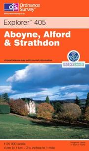
Aboyne, Alford and Strathdon
Year unknown
Aboyne, Alford and Strathdon (OS ...
Aboyne, Alford and Strathdon (OS Explorer Map Active)
Year unknown
Account of the methods and proces...
Account of the methods and processes adopted for the production of the maps of the Ordnance Survey of the UnitedKingdom
Year unknown
Account of the methods and proces...
Account of the methods and processes adopted for the production of the maps of the Ordnance Survey of the United Kingdom drawn up by officers of the Royal Engineers employed under Sir Henry James
Year unknown
Account of the methods employed f...
Account of the methods employed for the reduction of plans by photography, at the Ordnance Survey Office, Southampton
Year unknown
Account of the observations and c...
Account of the observations and calculations
Year unknown


ACT EX OL04 English Lakes North W...
ACT EX OL04 English Lakes North Western
Year unknown
ACT EX OL06 English Lakes South W...
ACT EX OL06 English Lakes South Western
Year unknown
ACT EX OL11 Brighton & Hove
ACT EX OL11 Brighton & Hove
Year unknown
ACT EX OL12 Brecon Beacons Nation...
ACT EX OL12 Brecon Beacons National Park
Year unknown
ACT EX OL13 Brecon Beacons Nation...
ACT EX OL13 Brecon Beacons National Park
Year unknown
ACT EX OL14 Wye Valley & Forest O...
ACT EX OL14 Wye Valley & Forest Of Dean
Year unknown
ACT EX OL16 Cheviot Hills
ACT EX OL16 Cheviot Hills
Year unknown
ACT EX OL22 New Forest Southampton
ACT EX OL22 New Forest Southampton
Year unknown
ACT EX OL25 Eastbourne & Beachy Head
ACT EX OL25 Eastbourne & Beachy Head
Year unknown
ACT EX OL31 North Pennines Teesda...
ACT EX OL31 North Pennines Teesdale &
Year unknown
ACT EX OL33 Haslemere & Petersfield
ACT EX OL33 Haslemere & Petersfield
Year unknown
ACT EX OL35 North Pembrokeshire G...
ACT EX OL35 North Pembrokeshire Gogledd
Year unknown
ACT EX OL36 South Pembrokeshire D...
ACT EX OL36 South Pembrokeshire De Sir
Year unknown
ACT EX OL38 Loch Lomond South
ACT EX OL38 Loch Lomond South
Year unknown
ACT LR 009 Cape Wrath Durness & S...
ACT LR 009 Cape Wrath Durness & Scourie
Year unknown
ACT LR 013 West Lewis & North Harris
ACT LR 013 West Lewis & North Harris
Year unknown
ACT LR 015 Loch Assynt Lochinver ...
ACT LR 015 Loch Assynt Lochinver Kylesku
Year unknown
ACT LR 026 Inverness Loch Ness St...
ACT LR 026 Inverness Loch Ness Strathgla
Year unknown
ACT LR 028 Elgin Dufftown Buckie ...
ACT LR 028 Elgin Dufftown Buckie & Keith
Year unknown
ACT LR 034 Fort Augustus Glen Roy...
ACT LR 034 Fort Augustus Glen Roy Glen
Year unknown
ACT LR 036 Grantown Aviemore Cair...
ACT LR 036 Grantown Aviemore Cairngorm
Year unknown
ACT LR 041 Ben Nevis Ft William G...
ACT LR 041 Ben Nevis Ft William Glen Coe
Year unknown
ACT LR 043 Braemar & Blair Atholl
ACT LR 043 Braemar & Blair Atholl
Year unknown
ACT LR 044 Ballater Glen Clova
ACT LR 044 Ballater Glen Clova
Year unknown
ACT LR 045 Stonehaven & Banchory
ACT LR 045 Stonehaven & Banchory
Year unknown
ACT LR 051 Loch Tay & Glen Dochart
ACT LR 051 Loch Tay & Glen Dochart
Year unknown
ACT LR 056 Loch Lomond & Inveraray
ACT LR 056 Loch Lomond & Inveraray
Year unknown
ACT LR 057 Stirling & The Trossachs
ACT LR 057 Stirling & The Trossachs
Year unknown
ACT LR 058 Perth & Alloa Auchtera...
ACT LR 058 Perth & Alloa Auchterarder
Year unknown
ACT LR 059 St Andrews Kirkcaldy G...
ACT LR 059 St Andrews Kirkcaldy Glenroth
Year unknown
ACT LR 070 Ayr Kilmarnock & Troon
ACT LR 070 Ayr Kilmarnock & Troon
Year unknown
ACT LR 076 Girvan Ballantrae & Ba...
ACT LR 076 Girvan Ballantrae & Barrhill
Year unknown
ACT LR 083 Newton Stewart Kirkcud...
ACT LR 083 Newton Stewart Kirkcudbright
Year unknown
ACT LR 088 Newcastle upon Tyne Du...
ACT LR 088 Newcastle upon Tyne Durham
Year unknown
ACT LR 091 Appleby-In-Westmorland
ACT LR 091 Appleby-In-Westmorland
Year unknown
ACT LR 092 Barnard Castle & Richmond
ACT LR 092 Barnard Castle & Richmond
Year unknown
ACT LR 094 Whitby Esk Dale Robin ...
ACT LR 094 Whitby Esk Dale Robin Hoods B
Year unknown
ACT LR 102 Preston & Blackpool Ly...
ACT LR 102 Preston & Blackpool Lytham
Year unknown
ACT LR 109 Manchester Bolton Warr...
ACT LR 109 Manchester Bolton Warrington
Year unknown
ACT LR 119 Buxton Matlock Chester...
ACT LR 119 Buxton Matlock Chesterfield
Year unknown
ACT LR 124 Porthmadog & Dolgellau
ACT LR 124 Porthmadog & Dolgellau
Year unknown
ACT LR 129 Nottingham Loughboroug...
ACT LR 129 Nottingham Loughborough Melto
Year unknown
ACT LR 137 Ludlow Church Stretton...
ACT LR 137 Ludlow Church Stretton Wenloc
Year unknown
ACT LR 138 Kidderminster & Wyre F...
ACT LR 138 Kidderminster & Wyre Forest
Year unknown
ACT LR 144 Thetford Diss Brecklan...
ACT LR 144 Thetford Diss Breckland Wymon
Year unknown
ACT LR 148 Presteigne HayonWye Ll...
ACT LR 148 Presteigne HayonWye Llanandra
Year unknown
ACT LR 151 StratforduponAvon Warwick
ACT LR 151 StratforduponAvon Warwick
Year unknown
ACT LR 154 Cambridge Newmarket Sa...
ACT LR 154 Cambridge Newmarket Saffron W
Year unknown
ACT LR 161 The Black Mountains
ACT LR 161 The Black Mountains
Year unknown
ACT LR 163 Cheltenham Cirencester...
ACT LR 163 Cheltenham Cirencester Stow
Year unknown
ACT LR 164 Oxford Chipping Norton...
ACT LR 164 Oxford Chipping Norton Bicest
Year unknown
ACT LR 165 Aylesbury Leighton Buz...
ACT LR 165 Aylesbury Leighton Buzz Thame
Year unknown
ACT LR 179 Canterbury East Kent D...
ACT LR 179 Canterbury East Kent Dover
Year unknown
ACT LR 182 Weston super Mare Brid...
ACT LR 182 Weston super Mare Bridgwater
Year unknown
ACT LR 185 Winchester Basingstoke...
ACT LR 185 Winchester Basingstoke Andove
Year unknown
ACT LR 186 Aldershot Guildford Ca...
ACT LR 186 Aldershot Guildford Camberley
Year unknown
ACT LR 188 Maidstone Royal Tunbri...
ACT LR 188 Maidstone Royal Tunbridge Wel
Year unknown
ACT LR 189 Ashford Romney Marsh R...
ACT LR 189 Ashford Romney Marsh Rye Folk
Year unknown
ACT LR 195 Bournemouth Purbeck Wi...
ACT LR 195 Bournemouth Purbeck Wimborne
Year unknown
ACT LR 200 Newquay Bodmin Camelfo...
ACT LR 200 Newquay Bodmin Camelford St A
Year unknown
ACT LR 203 Lands End Isles Scilly...
ACT LR 203 Lands End Isles Scilly St Ive
Year unknown
ACT LR 204 Truro Falmouth Roselan...
ACT LR 204 Truro Falmouth Roseland Penin
Year unknown
ACT OL05 English Lakes North East
ACT OL05 English Lakes North East
Year unknown
ACT OL07 Lakes SE
ACT OL07 Lakes SE
Year unknown
A description of Ordnance Survey ...
A description of Ordnance Survey large scale maps
Year unknown
A description of Ordnance Survey ...
A description of Ordnance Survey large scale plans
Year unknown
A description of Ordnance Survey ...
A description of Ordnance Survey medium scale maps
Year unknown
A description of Ordnance Survey ...
A description of Ordnance Survey small scale maps
Year unknown
A description of the large scale ...
A description of the large scale maps of Great Britain produced and published by the Ordnance Survey
Year unknown
A description of the Ordnance Sur...
A description of the Ordnance Survey large scale plans
Year unknown
A description of the small scale ...
A description of the small scale Ordnance Survey maps with specimens & indexes
Year unknown
Admin Boundary Map
Admin Boundary Map
Year unknown
Admin Boundary Map (Administative...
Admin Boundary Map (Administative Boundary Map)
Year unknown
Admin Boundary Map (Administrativ...
Admin Boundary Map (Administrative Boundary Map)
Year unknown
Administrative areas and 1974 cha...
Administrative areas and 1974 changes
Year unknown
Administrative areas diagram
Administrative areas diagram
Year unknown
Administrative areas diagram (Sco...
Administrative areas diagram (Scotland)
Year unknown
Africa Physical (Wall Map)
Africa Physical (Wall Map)
Year unknown
Africa Physical Wall Map (Wall Ma...
Africa Physical Wall Map (Wall Map S.)
Year unknown
Aird of Sleat
Aird of Sleat
Year unknown

A Landscape History of Alnwick & Morpeth
Year unknown

A Landscape History of Anglesey
Year unknown

A Landscape History of Ashford & Romney Marsh
Year unknown

A Landscape History of Aylesbury & Leighton Buzzard
Year unknown

A Landscape History of Boston & Spalding
Year unknown

A Landscape History of Brighton & Lewes
Year unknown

A Landscape History of Bristol & Bath
Year unknown

A Landscape History of Buxton & Matlock
Year unknown

A Landscape History of Cambridge & Newmarket
Year unknown

A Landscape History of Cardigan & Mynydd Preseli
Year unknown

A Landscape History of Chichester & The South Downs
Year unknown

A Landscape History of Dorchester & Weymouth
Year unknown

A Landscape History of Dorking & Reigate
Year unknown

A Landscape History of Eastbourne & Hastings
Year unknown

A Landscape History of Edinburgh
Year unknown

A Landscape History of Elan Valley & Builth Wells
Year unknown

A Landscape History of Gloucester & Forest of Dean
Year unknown

A Landscape History of Hexham & Haltwhistle
Year unknown

A Landscape History of Kendal & Morecambe
Year unknown

A Landscape History of Kingston Upon Hull
Year unknown

A Landscape History of Lampeter & Llandovery
Year unknown

A Landscape History of Liverpool
Year unknown

A Landscape History of Maidstone & Royal Tunbridge Wells
Year unknown

A Landscape History of Manchester
Year unknown

A Landscape History of Middlesbrough
Year unknown

A Landscape History of North East Norfolk
Year unknown

A Landscape History of Penrith & Keswick
Year unknown

A Landscape History of Plymouth & Launceston
Year unknown

A Landscape History of Presteigne & Hay-on-Wye
Year unknown

A Landscape History of Sheffield & Huddersfield
Year unknown

A Landscape History of Shrewsbury & Oswestry
Year unknown

A Landscape History of Skegness & Horncastle
Year unknown

A Landscape History of Stratford-upon-Avon
Year unknown

A Landscape History of Swindon & Devizes
Year unknown

A Landscape History of Tenby & Pembroke
Year unknown

A Landscape History of The Black Mountains
Year unknown

A Landscape History of Torbay & South Dartmoor
Year unknown

A Landscape History of Vale of Glamorgan
Year unknown

A Landscape History of West Cumbria
Year unknown

A Landscape History of West London
Year unknown

A Landscape History of Weston-super-Mare
Year unknown

A Landscape History of Yeovil & Frome
Year unknown

Aldershot and Guildford, Camberle...
Aldershot and Guildford, Camberley and Haslemere
Year unknown
Aldershot and Guildford, Camberle...
Aldershot and Guildford, Camberley and Haslemere
Year unknown
Aldershot and Guildford, Camberle...
Aldershot and Guildford, Camberley and Haslemere
Year unknown
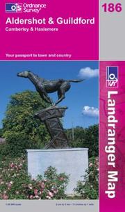
Aldershot and Guildford, Camberley and Haslemere
Year unknown

Aldershot and Guildford, Camberley and Haslemere (Landranger Maps) 186
Year unknown

Alford (Lincolnshire)
Year unknown
Allendale Town and Blanchland
Allendale Town and Blanchland
Year unknown

Allenheads and Rookhope
Year unknown
Alloa

Alnmouth and Dunstanburgh Castle
Year unknown
Alnwick
Alnwick and Amble
Alnwick and Amble
Year unknown
Alnwick and Amble, Craster and Wh...
Alnwick and Amble, Craster and Whittingham
Year unknown
Alnwick and Amble, Craster and Wh...
Alnwick and Amble, Craster and Whittingham (OS Explorer Map Active)
Year unknown

Alnwick and Morpeth, Rothbury and Amble
Year unknown
Alnwick and Rothbury
Alnwick and Rothbury
Year unknown

Alnwick and Whittingham
Year unknown
Alnwick & Morpeth
Alnwick & Morpeth
Year unknown

Alnwick, Morpeth and Surrounding Area
Year unknown
Alnwick & Morpeth, Rothbury & Amb...
Alnwick & Morpeth, Rothbury & Amble (OS Landranger Map)
Year unknown
Alnwick & Morpeth, Rothbury & Amb...
Alnwick & Morpeth, Rothbury & Amble (OS Landranger Map)
Year unknown


Alyth and Glamis
Year unknown
Amble-by-the-Sea
Amble-by-the-Sea
Year unknown
Amlwch and Cemaes Bay
Amlwch and Cemaes Bay
Year unknown


An Account of the Operations Carried Out for Accomplishing a Trigonometrical ...
Year unknown
William Mudge, Isaac Dalby, Thomas Colby , and Ordnance Survey
Ancholme Valley
Ancholme Valley
Year unknown
Ancholme Valley
Ancholme Valley
Year unknown
Ancient Britain
Ancient Britain
Year unknown

Ancient Britain (Historical Map)
Year unknown

Ancient Britain (Historical Map & Guide)
Year unknown
Ancient Britain Historical Map OS 1
Ancient Britain Historical Map OS 1
Year unknown
Ancient Britain (South Sheet)
Ancient Britain (South Sheet)
Year unknown
Andover
A new handbook on hanging;
A new handbook on hanging;
Year unknown
Angelesey / Ynys Mon
Angelesey / Ynys Mon
Year unknown

Anglesey
Anglesey

Anglesey East
Year unknown
Anglesey (North) 1903 =
Anglesey (North) 1903 =
Year unknown

Anglesey West
Year unknown

Anglesey / Ynys Mon (Landranger Maps) 114
Year unknown
An illustrated guide to boundary...
An illustrated guide to boundary making
Year unknown

Annandale

Annandale Annan, Lockerbie and Beattock
Year unknown
Annual report and accounts
Annual report and accounts
Year unknown

Antarctica Physical (Wall Map)
Antarctica Physical (Wall Map)
Year unknown
Antarctica Physical (Wall Map S.)
Antarctica Physical (Wall Map S.)
Year unknown

An Teallach and Dundonnell
Year unknown

An Teallach And Slioch
Year unknown
Antonine Wall
Antonine Wall
Year unknown
Appleby

Appleby-in-Westmorland
Year unknown

Appleby-in-Westmorland
Year unknown
Appleby-in-Westmorland
Appleby-in-Westmorland
Year unknown


Arbroath, Montrose and Carnoustie
Year unknown
Arbroath, Montrose and Carnoustie...
Arbroath, Montrose and Carnoustie (OS Explorer Map Active)
Year unknown
Ardgour and Strontian
Ardgour and Strontian
Year unknown

Ardgour and Strontian, Glenfinnan, Loch Eil and Loch Shiel
Year unknown
Ardgour and Strontian (OS Explore...
Ardgour and Strontian (OS Explorer Map Active)
Year unknown
Ardgour & Strontian
Ardgour & Strontian
Year unknown

Ardlui and Loch Lomond (North)
Year unknown

Ardmore Point
Year unknown

Ardnamurchan
Year unknown

Ardnamurchan Moidart, Sunart and Loch Shiel
Year unknown
Ardnamurchan, Moidart, Sunart and...
Ardnamurchan, Moidart, Sunart and Loch Shiel
Year unknown
Ardnamurchan, Moidart, Sunart and...
Ardnamurchan, Moidart, Sunart and Loch Shiel
Year unknown

Ardossan and Stevenston
Year unknown
Area Book and Book of Reference t...
Area Book and Book of Reference to the Plan of the Parish of Brockworth
Year unknown
Area Book and Book of Reference t...
Area Book and Book of Reference to the Plan of the Parish of Maisemore, Gloucestershire
Year unknown

Arinacrinachd
Year unknown

Arisaig and Lochailort
Year unknown

Armagh
Arran (Central)
Arran (Central)
Year unknown

Arrochar and Ben Lomond
Year unknown
Arundel and Pulborough
Arundel and Pulborough
Year unknown

Arundel and Pulborough
Year unknown

Ashbourne and the Churnet Valley
Year unknown

Ashby De La Zouch
Year unknown

Ashdown Forest
Year unknown
Ashdown Forest - Royal Tunbridge ...
Ashdown Forest - Royal Tunbridge Wells, East Grinstead, Haywards Heath and Crowborough
Year unknown
Ashford

Ashford and Lyminge
Ashford and Lyminge
Year unknown
Ashford and Romney Marsh, Rye and...
Ashford and Romney Marsh, Rye and Folkestone
Year unknown
Ashford and Romney Marsh, Rye and...
Ashford and Romney Marsh, Rye and Folkestone
Year unknown

Ashford and Romney Marsh, Rye and Folkestone
Year unknown
Ashford and Romney Marsh, Rye and...
Ashford and Romney Marsh, Rye and Folkestone (OS Landranger Map)
Year unknown
Ashford & Romney Marsh
Ashford & Romney Marsh
Year unknown

Ashington and Blyth
Year unknown
Ashton-under-Lyne
Ashton-under-Lyne
Year unknown

Atholl
Atholl, Glen Tilt, Beinn Dearg & ...
Atholl, Glen Tilt, Beinn Dearg & Carn nan Gabhar (OS Explorer Map)
Year unknown
Atholl (OS Explorer Map)
Atholl (OS Explorer Map)
Year unknown
Atlas of Scotland
Atlas of Scotland
Year unknown

Auchterarder and Muthill
Year unknown

Auchtermuchty and Cupar
Year unknown
Audenshaw and Droylsden 1916
Audenshaw and Droylsden 1916
Year unknown


Aughton and Carlton in Lindrick
Year unknown
Australia road atlas
Australia road atlas
Year unknown
Aviemore

Aviemore and Boat of Garten
Year unknown
Aviemore and the Cairngorms
Aviemore and the Cairngorms
Year unknown
Aylesbury and Leighton Buzzard
Aylesbury and Leighton Buzzard
Year unknown

Aylesbury and Leighton Buzzard
Year unknown

Aylesbury and Leighton Buzzard, Thame and Berkhamstead
Year unknown
Aylesbury and Leighton Buzzard, T...
Aylesbury and Leighton Buzzard, Thame and Berkhamstead
Year unknown

Aylesbury and Leighton Buzzard, Thame and Berkhamstead (Landranger Maps) 165
Year unknown


Ayr and Troon
Year unknown

Ayr, Kilmarnock and Troon
Year unknown
Ayr, Kilmarnock and Troon
Ayr, Kilmarnock and Troon
Year unknown
Ayr, Kilmarnock and Troon (OS Lan...
Ayr, Kilmarnock and Troon (OS Landranger Map)
Year unknown

Ayr, Prestwick and Troon
Year unknown

A-Z Liverpool Street Atlas
Year unknown

A-Z Southampton and Portsmouth Atlas
Year unknown
Badenoch and Upper Strathspey
Badenoch and Upper Strathspey
Year unknown

Badenoch and Upper Strathspey
Year unknown
Badenoch & Upper Strathspey, King...
Badenoch & Upper Strathspey, Kingussie & Newtonmore
Year unknown

Bala and Lake Vyrnwy
Bala and Lake Vyrnwy
Year unknown

Bala and Lake Vyrnwy
Year unknown

Bala and Lake Vyrnwy (Berwyn-Bala a Llyn Efyrnwy)
Year unknown
Bala and Lake Vyrnwy (Landranger ...
Bala and Lake Vyrnwy (Landranger Maps) 126
Year unknown

Ballantrae and Colmonell
Year unknown

Ballantrae, Barr and Barrhill
Year unknown
Ballantrae, Barr and Barrhill (OS...
Ballantrae, Barr and Barrhill (OS Explorer Map)
Year unknown

Ballater and Crathie
Year unknown

Ballater and Glen Clova
Year unknown
Ballater and Glen Clova
Ballater and Glen Clova
Year unknown

Ballater and Glen Cova
Year unknown
Ballater, Glen Clova and Surround...
Ballater, Glen Clova and Surrounding Area
Year unknown

Ballygrant and Port Askaig
Year unknown
Ballymena (Larne)
Ballymena (Larne)
Year unknown

Baltasound and Cullivoe
Year unknown
Banbury
Banbury, Bicester and Chipping No...
Banbury, Bicester and Chipping Norton
Year unknown
Banbury, Bicester and Chipping No...
Banbury, Bicester and Chipping Norton
Year unknown

Banbury, Bicester and Chipping Norton
Year unknown
Banbury (North)
Banbury (North)
Year unknown


Banff and Cullen
Year unknown
Banff and Huntly, Portsoy and Tur...
Banff and Huntly, Portsoy and Turriff
Year unknown

Banff and Huntly, Portsoy and Turriff
Year unknown

Banff and Surrounding Area
Year unknown
Banff England
Banff England
Year unknown
Banff, Macduff and Turriff
Banff, Macduff and Turriff
Year unknown
Banff, Macduff and Turriff
Banff, Macduff and Turriff
Year unknown

Banff, Macduff and Turriff
Year unknown

Bangor and Llangefni
Year unknown
Barking & Romford
Barking & Romford
Year unknown

Barnard Castle and Gainford
Year unknown
Barnard Castle and Richmond
Barnard Castle and Richmond
Year unknown

Barnard Castle and Surrounding Area
Year unknown
Barnard Castle and Surrounding Ar...
Barnard Castle and Surrounding Area 2016 (OS Landranger Map)
Year unknown
Barnard Castle & Richmond (OS Lan...
Barnard Castle & Richmond (OS Landranger Map)
Year unknown

Barnsley and Penistone
Year unknown
Barnsley & Penistone
Barnsley & Penistone
Year unknown
Barnstaple
Barnstaple and Ilfracombe
Barnstaple and Ilfracombe
Year unknown

Barnstaple and Ilfracombe Area
Year unknown
Barnstaple and Ilfracombe, Lynton...
Barnstaple and Ilfracombe, Lynton and Bideford
Year unknown

Barnstaple and Ilfracombe, Lynton and Bideford
Year unknown
Barnstaple and Ilfracombe, Lynton...
Barnstaple and Ilfracombe, Lynton and Bideford
Year unknown

Barnstaple and Ilfracombe, Lynton and Bideford (Landranger Maps) 180 (OS Landranger Map)
Year unknown

Barra

Barra and South Uist, Vatersay and Eriskay
Year unknown
Barra and Surrounding Islands 1:5...
Barra and Surrounding Islands 1:50000
Year unknown
Barra and Vatersay
Barra and Vatersay
Year unknown

Barra (North)
Year unknown

Barrhead and Eaglesham
Year unknown


Barrow-in-Furness and South Lakeland
Year unknown
Barrow-in-Furness and South Lakeland
Barrow-in-Furness and South Lakeland
Year unknown
Barrow-in-Furness and South Lakeland
Barrow-in-Furness and South Lakeland
Year unknown
Barrow-in-Furness and South Lakel...
Barrow-in-Furness and South Lakeland (Landranger Maps) LR096 (OS Landranger Map)
Year unknown
Barry
Barton Le Willows
Barton Le Willows
Year unknown

Barvas and Gress
Year unknown
Basingstoke
Basingstoke
Basingstoke, Alton and Whitchurch
Basingstoke, Alton and Whitchurch
Year unknown

Basingstoke, Alton and Whitchurch
Year unknown

Batley, 1905
Batley, 1905
Year unknown


Bedale and Pickhill
Year unknown
Bedford and Huntingdon
Bedford and Huntingdon
Year unknown
Bedford and Huntingdon, St. Neots...
Bedford and Huntingdon, St. Neots and Biggleswade
Year unknown

Bedford and Huntingdon, St.Neots and Biggleswade
Year unknown
Bedford and Huntingdon,St. Neots ...
Bedford and Huntingdon,St. Neots and Biggleswade
Year unknown
Bedford and Huntingdon, St.Neots ...
Bedford and Huntingdon, St.Neots and Biggleswade (Landranger Maps) 153
Year unknown
Bedford and Northampton
Bedford and Northampton
Year unknown

Bedford and St.Neots
Year unknown
Bedford and St Neots, Sandy and B...
Bedford and St Neots, Sandy and Biggleswade
Year unknown
Bedford and St.Neots, Sandy and B...
Bedford and St.Neots, Sandy and Biggleswade
Year unknown
Bedford and St.Neots, Sandy and B...
Bedford and St.Neots, Sandy and Biggleswade (OS Explorer Map)
Year unknown
Bedford and St.Neots, Sandy and B...
Bedford and St.Neots, Sandy and Biggleswade (OS Explorer Map)
Year unknown
Bedford & St Neots Map | Sandy & ...
Bedford & St Neots Map | Sandy & Biggleswade | Ordnance Survey | OS Explorer Map 208 | England | Walks | Hiking | Maps | Adventure
Year unknown
Beds, Bucks and Herts, North West...
Beds, Bucks and Herts, North West London
Year unknown
Beds, Bucks and Herts, North West...
Beds, Bucks and Herts, North West London
Year unknown
Beeston & Beeston Hill
Beeston & Beeston Hill
Year unknown


Beinn Dearg and Loch Broom, Ben Wyvis
Year unknown
Beinn Dearg and Loch Broom, Ben W...
Beinn Dearg and Loch Broom, Ben Wyvis
Year unknown
Beinn Dearg and Loch Broom, Ben W...
Beinn Dearg and Loch Broom, Ben Wyvis (OS Landranger Map)
Year unknown

Beinn Dearg and Loch Fannich
Year unknown
Beinn Dearg and Loch Fannich (OS ...
Beinn Dearg and Loch Fannich (OS Explorer Map)
Year unknown

Beinn Dearg and Surrounding Area
Year unknown

Beinn Dhorain
Year unknown

Belford, Seahouses and Farne Islands
Year unknown
Bellingham and Kirkwhelpington
Bellingham and Kirkwhelpington
Year unknown
Belper


Ben Alder, Loch Ericht and Loch Laggan
Year unknown
Ben Alder, Loch Ericht and Loch L...
Ben Alder, Loch Ericht and Loch Laggan (OS Explorer Map)
Year unknown

Benbecula and South Uist
Benbecula and South Uist
Year unknown
Benbecula and South Uist
Benbecula and South Uist
Year unknown

Benbecula and South Uist
Year unknown

Benbecula and South Uist/Beinn Na Faoghla Agus Uibhist a Deas
Year unknown
Benbecula and South Uist/Beinn Na...
Benbecula and South Uist/Beinn Na Faoghla Agus Uibhist a Deas (OS Explorer Map)
Year unknown

Benbecula (North)
Year unknown

Benbecula (South)
Year unknown

Ben Hope, Ben Loyal and Kyle of Tongue
Year unknown
Ben Kilbreck and Ben Armine (OS E...
Ben Kilbreck and Ben Armine (OS Explorer Map)
Year unknown
Ben Klibreck and Ben Armine
Ben Klibreck and Ben Armine
Year unknown

Ben Klibreck and Ben Armine
Year unknown

Ben Lawers and Glen Lyon
Year unknown

Ben Lawers and Lower Loch Tay
Year unknown

Ben Nevis
Ben Nevis and Fort William
Ben Nevis and Fort William
Year unknown

Ben Nevis and Fort William, The Mamores and The Grey Corries
Year unknown
Ben Nevis and Glencoe
Ben Nevis and Glencoe
Year unknown

Ben Nevis and Glen Coe - West Highland Way from Fort William to Crianlarich
Year unknown
Ben Nevis & Fort William
Ben Nevis & Fort William
Year unknown

Ben Nevis, Fort William and Glen Coe
Year unknown
Ben Nevis, Fort William and Glen Coe
Ben Nevis, Fort William and Glen Coe
Year unknown
Ben Nevis Fort William & Glen Coe
Ben Nevis Fort William & Glen Coe
Year unknown
Ben Nevis, Fort William & surroun...
Ben Nevis, Fort William & surrounding area
Year unknown

Ben Wyvis and Strathpeffer
Ben Wyvis and Strathpeffer
Year unknown

Ben Wyvis and Strathpeffer
Year unknown
Bere Regis
[Berkeley] Sheet 31/69
[Berkeley] Sheet 31/69
Year unknown
Berkshire, Buckinghamshire and Ox...
Berkshire, Buckinghamshire and Oxfordshire Administrative Map (Administrative Area Diagrams)
Year unknown
Berkshire street atlas
Berkshire street atlas
Year unknown


Berwick, North
Year unknown
Berwick-upon-Tweed
Berwick-upon-Tweed
Year unknown

Berwick-upon-Tweed
Year unknown

Berwick-upon-Tweed
Year unknown

Berwick-upon-Tweed
Year unknown

Berwick-upon-Tweed and Surrounding Area
Year unknown
Berwick-upon-Tweed, Holy Island &...
Berwick-upon-Tweed, Holy Island & Wooler
Year unknown
Berwick-Upon-Tweed (OS Explorer A...
Berwick-Upon-Tweed (OS Explorer Active Map)
Year unknown
Berwick-Upon-Tweed (OS Landranger...
Berwick-Upon-Tweed (OS Landranger Map)
Year unknown

Beverley

Beverley (North)
Year unknown
Bible Lands (Wall Map S.)
Bible Lands (Wall Map S.)
Year unknown
Bicester

Bideford
Bideford and Atherington
Bideford and Atherington
Year unknown
Bideford, Ilfracombe and Barnstable
Bideford, Ilfracombe and Barnstable
Year unknown
Bideford, Ilfracombe and Barnstab...
Bideford, Ilfracombe and Barnstable (OS Explorer Map Active)
Year unknown

Bideford, Ilfracombe and Barnstaple
Year unknown
Bideford, Ilfracombe and Barnstaple
Bideford, Ilfracombe and Barnstaple
Year unknown


Biggar and Broughton (Explorer)
Year unknown

Billingham and Tees Mouth
Year unknown

Birmingham


Birmingham and Wolverhampton
Year unknown
Birmingham and Wolverhampton
Birmingham and Wolverhampton
Year unknown
Birmingham and Wolverhampton
Birmingham and Wolverhampton
Year unknown
Birmingham and Wolverhampton (OS ...
Birmingham and Wolverhampton (OS Landranger Map)
Year unknown
Birmingham and WolverhamptonSheet...
Birmingham and WolverhamptonSheet 139
Year unknown
Birmingham Central
Birmingham Central
Year unknown
Birmingham, Walsall, Solihull and...
Birmingham, Walsall, Solihull and Redditch (OS Explorer Map)
Year unknown
Birmingham, Walsall, Solihull and...
Birmingham, Walsall, Solihull and Redditch (OS Explorer Map Active)
Year unknown
Bishop Auckland
Bishop Auckland
Year unknown

Bishop Auckland
Year unknown
Bishop Auckland - Spennymoor and ...
Bishop Auckland - Spennymoor and Newtown
Year unknown

Bishop's Castle and Clun
Year unknown
Blackburn and Burnley, Clitheroe ...
Blackburn and Burnley, Clitheroe and Skipton
Year unknown

Blackburn and Burnley, Clitheroe and Skipton
Year unknown
Blackburn and Burnley, Clitheroe ...
Blackburn and Burnley, Clitheroe and Skipton
Year unknown

Blackburn and Burnley, Clitheroe and Skipton (Landranger Maps) LR103
Year unknown
Blackburn & Burnley
Blackburn & Burnley
Year unknown

Blackburn, Burnley and Surrounding Area
Year unknown
Black Isle

Black Isle (OS Explorer Map)
Black Isle (OS Explorer Map)
Year unknown
Black Mountains
Black Mountains
Year unknown
Black Mountains (Landranger Maps)
Black Mountains (Landranger Maps)
Year unknown

Blackpool and Preston
Blackpool and Preston
Year unknown

Blackpool and Preston
Year unknown
Blackpool and Preston
Blackpool and Preston
Year unknown
Blackwater Estuary
Blackwater Estuary
Year unknown
Blackwater Estuary
Blackwater Estuary
Year unknown

Blair Atholl and Killiecrankie
Year unknown
Blairgowrie
Blairgowrie and Forest of Alyth
Blairgowrie and Forest of Alyth
Year unknown

Blairgowrie and Forest of Alyth
Year unknown

Blairgowrie and Surrounding Area
Year unknown

Blairgowrie, Kirriemuir and Glamis
Year unknown
Blairgowrie, Kirriemuir and Glami...
Blairgowrie, Kirriemuir and Glamis (OS Explorer Map Active)
Year unknown
Blairgowrie: sheet 49/ Scale 1:63...
Blairgowrie: sheet 49/ Scale 1:63,360 (or) 1 inch to 1 mile
Year unknown
Blairgowrie & surrounding area
Blairgowrie & surrounding area
Year unknown

Blaydon and Prudhoe
Year unknown
Bodleian Map of Great Britain (Hi...
Bodleian Map of Great Britain (Historical Map & Guide S.)
Year unknown
Bodmin and Launceston
Bodmin and Launceston
Year unknown
Bodmin Moor

Bodmin Moor (OS Explorer Map)
Bodmin Moor (OS Explorer Map)
Year unknown
Bodmin Moor (OS Explorer Map Active)
Bodmin Moor (OS Explorer Map Active)
Year unknown
Bolton Abbey and Blubberhouses
Bolton Abbey and Blubberhouses
Year unknown
Bolton & Blackburn
Bolton & Blackburn
Year unknown

Bolton (South)
Year unknown
Bolton, Wigan and Warrington
Bolton, Wigan and Warrington
Year unknown

Bolton, Wigan and Warrington
Year unknown
Bolton, Wigan and Warrington (OS ...
Bolton, Wigan and Warrington (OS Explorer Active Map)
Year unknown
Bolton, Wigan and Warrington (OS ...
Bolton, Wigan and Warrington (OS Explorer Map)
Year unknown

Bonar Bridge
Year unknown
Bonvilston
Book of Reference to the Plan of ...
Book of Reference to the Plan of the Parish of Minsterworth
Year unknown
Boston
Boston

Boston and Spalding
Boston and Spalding
Year unknown
Boston and Spalding
Boston and Spalding
Year unknown

Boston and Spalding
Year unknown

Boston and Swineshead
Year unknown

Boston (Explorer Maps) 261
Year unknown
Boston & Spalding (OS Landranger ...
Boston & Spalding (OS Landranger Active Map)
Year unknown
Botesdale
Bourne and Heckington
Bourne and Heckington
Year unknown

Bourne and Heckington
Year unknown

Bourne and Heckington (Explorer Maps) 248 1:25k
Year unknown
Bournemouth and Purbeck
Bournemouth and Purbeck
Year unknown
Bournemouth and Purbeck, Wimborne...
Bournemouth and Purbeck, Wimborne Minster and Ringwood
Year unknown
Bournemouth and Purbeck, Wimborne...
Bournemouth and Purbeck, Wimborne Minster and Ringwood
Year unknown

Bournemouth and Purbeck, Wimborne Minster and Ringwood
Year unknown

Bournemouth and Purbeck, Wimborne Minster and Ringwood
Year unknown
Bournemouth, Purbeck and Surround...
Bournemouth, Purbeck and Surrounding Area
Year unknown
Bournemouth & Purbeck, Wimborne M...
Bournemouth & Purbeck, Wimborne Minster & Ringwood (OS Landranger Map)
Year unknown
Bourne (North)
Bourne (North)
Year unknown

Bourne (South) and Ryhall
Year unknown

Bowmore (Islay)
Year unknown

Bracadale
Brackley and Banbury (South)
Brackley and Banbury (South)
Year unknown
Bradford

Bradford and Huddersfield
Year unknown

Bradford (West Yorks)
Year unknown
Braemar and Blair Atholl
Braemar and Blair Atholl
Year unknown

Braemar and Blair Atholl
Year unknown
Braemar and Blair Atholl
Braemar and Blair Atholl
Year unknown
Braemar and Blair Atholl
Braemar and Blair Atholl
Year unknown
Braemar & Blair Atholl (OS Landra...
Braemar & Blair Atholl (OS Landranger Map#43)
Year unknown
Braemar to Blair Atholl
Braemar to Blair Atholl
Year unknown

Braemar, Tomintoul and Glen Avon
Year unknown
Braemar, Tomintoul and Glen Avon ...
Braemar, Tomintoul and Glen Avon (OS Explorer Map Active)
Year unknown
Braemar, Tomintoul & Glen Avon, B...
Braemar, Tomintoul & Glen Avon, Beinn a' Bhuird & Ben Avon (OS Explorer Map)
Year unknown

Braintree and Saffron Walden
Year unknown
Bramley 1906
Bramley 1906
Year unknown

Brechin (North West)
Year unknown
Brecon
Brecon Beacons
Brecon Beacons
Year unknown

Brecon Beacons
Year unknown
Brecon Beacons
Brecon Beacons
Year unknown

Brecon Beacons
Year unknown

Brecon Beacons and Glamorgan Walks
Year unknown

Brecon Beacons National Park
Year unknown
Brecon Beacons National Park
Brecon Beacons National Park
Year unknown

Brecon Beacons National Park
Year unknown
Brecon Beacons - National Park Ea...
Brecon Beacons - National Park Eastern Area
Year unknown
Brecon Beacons National Park - Ea...
Brecon Beacons National Park - Eastern Area (Explorer Maps)
Year unknown
Brecon Beacons National Park - Ea...
Brecon Beacons National Park - Eastern Area/Parc Cenedlaethol Bannau Brycheiniog - Ardal Ddwyreiniol (OS Explorer Map Active)
Year unknown
Brecon Beacons National Park / Pa...
Brecon Beacons National Park / Parc Cenedlaethol Bannau Brycheiniog Map | Eastern Area / Ardal ddwyreiniol | Ordnance Survey | OS Explorer Map OL13 | Wales | Walks | Hiking | Maps | Adventure
Year unknown
Brecon Beacons National Park - We...
Brecon Beacons National Park - Western and Central Areas/Parc Cenedlaethol Bannau Brycheiniog - Ardaloedd Gorllewinol a Chanolog (OS Explorer Map Active)
Year unknown
Brecon Beacons National Park - We...
Brecon Beacons National Park - Western & Central Areas
Year unknown
Brecon Beacons (OS Landranger Map...
Brecon Beacons (OS Landranger Map Active)
Year unknown
Brecon Brecons National Park - We...
Brecon Brecons National Park - West and Central Areas
Year unknown

Brent Knoll
Brentwood
Brentwood: sheet 1
Brentwood: sheet 1
Year unknown
Bridgend (South) and Porthcawl
Bridgend (South) and Porthcawl
Year unknown

Bridge of Cally
Year unknown

Bridge of Earn and Dunning
Year unknown

Bridge of Weir
Year unknown

Bridgnorth and Much Wenlock
Year unknown


Bridlington, Driffield and Hornsea
Year unknown
Bridlington, Driffield and Hornsea
Bridlington, Driffield and Hornsea
Year unknown
Bridlington, Driffield & Hornsea
Bridlington, Driffield & Hornsea
Year unknown

Brigg and Caistor
Year unknown

Brighton and Hove
Year unknown
Brighton and Hove 122 1
Brighton and Hove 122 1
Year unknown

Brighton and Lewes, Haywards Heath
Year unknown
Brighton and Lewes, Haywards Heath
Brighton and Lewes, Haywards Heath
Year unknown

Brighton and Lewes, Haywards Heath (Landranger Maps) 198 (OS Landranger Map)
Year unknown
Brighton and Lewes, Worthing, Hor...
Brighton and Lewes, Worthing, Horsham and Haywards Heath
Year unknown
Brighton and The Downs
Brighton and The Downs
Year unknown
Brighton and the Sussex Vale
Brighton and the Sussex Vale
Year unknown
Brighton & Lewes
Brighton & Lewes
Year unknown
Brigstock
Bristol and Avon Street Atlas
Bristol and Avon Street Atlas
Year unknown
Bristol and Avon Street Atlas
Bristol and Avon Street Atlas
Year unknown

Bristol and Bath
Year unknown

Bristol and Bath
Year unknown
Bristol and Bath
Bristol and Bath
Year unknown
Bristol and Bath (OS Explorer Map)
Bristol and Bath (OS Explorer Map)
Year unknown
Bristol and Bath, Thornbury and C...
Bristol and Bath, Thornbury and Chew Magna
Year unknown

Bristol and Bath, Thornbury and Chew Magna
Year unknown

Bristol and Bath, Thornbury and Chew Magna (Landranger Maps) 172
Year unknown
Bristol & Bath
Bristol & Bath
Year unknown
Bristol Bath & surrounding area
Bristol Bath & surrounding area
Year unknown
Bristol & Bath, Thornbury & Chew ...
Bristol & Bath, Thornbury & Chew Magna (OS Landranger Active Map)
Year unknown
Bristol & Newport
Bristol & Newport
Year unknown
Bristol & Stroud
Bristol & Stroud
Year unknown

Bristol West and Portishead
Year unknown
Bristol West and Portishead
Bristol West and Portishead
Year unknown
Britain before the Norman conquest
Britain before the Norman conquest
Year unknown
Britain in the dark ages
Britain in the dark ages
Year unknown
Britain on Backroads
Britain on Backroads
Year unknown
BRITAIN ON THE BACK ROADS
BRITAIN ON THE BACK ROADS
Year unknown
British Isles
British Isles
Year unknown
British Isles Communication (OS W...
British Isles Communication (OS Wall Maps)
Year unknown
British Isles Communications (Wal...
British Isles Communications (Wall Map S.)
Year unknown
British Isles Communication Wall Map
British Isles Communication Wall Map
Year unknown
British Isles Physical Wall Map
British Isles Physical Wall Map
Year unknown
British Walks 1995 Calendar
British Walks 1995 Calendar
Year unknown
British Walks Calendar
British Walks Calendar
Year unknown
Bromyard


Buchlyvie and Balmaha
Year unknown
Buckfastleigh and Widecombe-in-th...
Buckfastleigh and Widecombe-in-the-Moor
Year unknown


Buckie and Keith
Year unknown

Buckingham and Milton Keynes
Year unknown
Buckingham & Milton Keynes Map | ...
Buckingham & Milton Keynes Map | Leighton Buzzard & Woburn | Ordnance Survey | OS Explorer Map 192 | England | Walks | Hiking | Maps | Adventure
Year unknown
Buckinghamshire
Buckinghamshire
Year unknown
Buckinghamshire street atlas
Buckinghamshire street atlas
Year unknown
Buckinghamshire street atlas
Buckinghamshire street atlas
Year unknown
Buckinghamshire street atlas
Buckinghamshire street atlas
Year unknown

Bucks county street atlas
Year unknown
Bude and Clovelly
Bude and Clovelly
Year unknown
Bude and Clovelly, Boscastle and ...
Bude and Clovelly, Boscastle and Holsworthy
Year unknown

Bude and Clovelly, Boscastle and Holsworthy
Year unknown

Bude and Clovelly, Boscastle and Holsworthy (Landranger Maps) 190 (OS Landranger Map)
Year unknown
Bude and Clovelly (Landranger Maps)
Bude and Clovelly (Landranger Maps)
Year unknown

Bude, Boscastle and Tintagel
Year unknown
Bude, Boscastle and Tintagel
Bude, Boscastle and Tintagel
Year unknown
Bude, Boscastle and Tintagel (OS ...
Bude, Boscastle and Tintagel (OS Explorer Map)
Year unknown

Bude, Clovelly and Surrounding Area
Year unknown

Builth Wells
Year unknown

Builth Wells, Painscastle and Talgarth
Year unknown

Bungay and Harleston
Year unknown


Burrow Head and Isle of Whithorn
Year unknown
Burton-in-Kendal & Caton
Burton-in-Kendal & Caton
Year unknown
Burton-upon-Trent
Burton-upon-Trent
Year unknown

Burton-upon-Trent
Year unknown
Bury
Bury 1908

Bury, Rochdale and Littleborough
Year unknown
Bury St.Edmunds and Stowmarket
Bury St.Edmunds and Stowmarket
Year unknown
Bury St.Edmunds and Stowmarket (E...
Bury St.Edmunds and Stowmarket (Explorer Maps)
Year unknown
Bury St.Edmunds and Stowmarket (O...
Bury St.Edmunds and Stowmarket (OS Explorer Map)
Year unknown
Bury St Edmunds and Stowmarket (O...
Bury St Edmunds and Stowmarket (OS Explorer Map Active)
Year unknown

Bury St.Edmunds, Sudbury and Stowmarket
Year unknown
Bury St.Edmunds, Sudbury and Stow...
Bury St.Edmunds, Sudbury and Stowmarket (Landranger Maps)
Year unknown
Bury St.Edmunds, Sudbury and Stow...
Bury St.Edmunds, Sudbury and Stowmarket (Landranger Maps) 155 (OS Landranger Map)
Year unknown
Bury St Edmunds Sudbury & Stowmarket
Bury St Edmunds Sudbury & Stowmarket
Year unknown

Butt of Lewis
Year unknown
Buxton and Matlock
Buxton and Matlock
Year unknown

Buxton and Matlock, Bakewell and Dove Dale
Year unknown
Buxton and Matlock, Chesterfield,...
Buxton and Matlock, Chesterfield, Bakewell and Dove Dale
Year unknown

Buxton and Matlock, Chesterfield, Bakewell and Dove Dale (Landranger Map) 119
Year unknown
Buxton and Stockport
Buxton and Stockport
Year unknown
Buxton & Matlock
Buxton & Matlock
Year unknown
Buxton, Matlock and Dove Dale
Buxton, Matlock and Dove Dale
Year unknown
Buxton, Matlock and Dove Dale Area
Buxton, Matlock and Dove Dale Area
Year unknown
Byfield and Badby
Byfield and Badby
Year unknown

Cadair Idris and Bala Lake/Llyn Tegid
Year unknown
Cadair Idris and Bala Lake/Llyn T...
Cadair Idris and Bala Lake/Llyn Tegid
Year unknown
Cadair Idris and Bala Lake/Llyn T...
Cadair Idris and Bala Lake/Llyn Tegid (OS Explorer Map Active)
Year unknown
Cadair Idris and Bala Lake/Llyn T...
Cadair Idris and Bala Lake/Llyn Tegid (OS Explorer Map Active)
Year unknown
Cadair Idris and Llyn Tegid (OS E...
Cadair Idris and Llyn Tegid (OS Explorer Map)
Year unknown
Cadair Idris & Llyn Tegid (OS Exp...
Cadair Idris & Llyn Tegid (OS Explorer Map)
Year unknown

Caernarvon and Bangor
Caernarvon and Bangor
Year unknown
Cairn Gorm and Aviemore
Cairn Gorm and Aviemore
Year unknown

Cairn Gorm and Ben Macdhui
Year unknown
Cairn Gorm and Ben Macdhui (Explo...
Cairn Gorm and Ben Macdhui (Explorer Maps)
Year unknown
Cairn Gorm & Aviemore, Loch Morli...
Cairn Gorm & Aviemore, Loch Morlich (OS Explorer Map)
Year unknown
Cairngorms

Cairngorms - Aviemore and Glen Avon
Year unknown

Cairngorms Walks
Year unknown


Callander, Doune and Dunblane
Year unknown

Cambridge

Cambridge and Newmarket, Saffron Walden
Year unknown
Cambridge and Newmarket, Saffron ...
Cambridge and Newmarket, Saffron Walden (Landranger Maps) 154 (OS Landranger Map)
Year unknown
Cambridge (Explorer Maps) 209 (OS...
Cambridge (Explorer Maps) 209 (OS Explorer Map)
Year unknown
Cambridge (Local Red Book)
Cambridge (Local Red Book)
Year unknown
Cambridge & Newmarket
Cambridge & Newmarket
Year unknown
Cambridge, Newmarket and Saffron ...
Cambridge, Newmarket and Saffron Walden (OS Landranger Map)
Year unknown

Cambridge (North) and Burwell
Year unknown
Cambridge, Royston, Duxford and L...
Cambridge, Royston, Duxford and Linton
Year unknown
Cambridge, Royston, Duxford & Linton
Cambridge, Royston, Duxford & Linton
Year unknown
Camelford and Hartland Point
Camelford and Hartland Point
Year unknown

Campbeltown (North)
Year unknown

Campbeltown (South)
Year unknown

Campsie Fells (Explorer)
Year unknown
Campsie Fells (OS Explorer Active...
Campsie Fells (OS Explorer Active Map)
Year unknown
Campsie Fells (OS Explorer Map Ac...
Campsie Fells (OS Explorer Map Active)
Year unknown


Cannock Chase
Cannock Chase
Year unknown
Cannock Chase and Chasewater (OS ...
Cannock Chase and Chasewater (OS Explorer Map Active)
Year unknown
Cannock (North)
Cannock (North)
Year unknown

Canterbury

Canterbury and East Kent, Dover and Margate
Year unknown
Canterbury and East Kent, Dover a...
Canterbury and East Kent, Dover and Margate
Year unknown
Canterbury and East Kent, Dover a...
Canterbury and East Kent, Dover and Margate (Landranger Maps)
Year unknown
Canterbury and the Isle of Thanet
Canterbury and the Isle of Thanet
Year unknown

Canterbury and the Isle of Thanet
Year unknown

Canterbury and the Isle of Thanet (Explorer Maps) 150
Year unknown
Canterbury & East Kent
Canterbury & East Kent
Year unknown
Canterbury & the Isle of Thanet, ...
Canterbury & the Isle of Thanet, Herne Bay, Deal & Whitstable, showing part of the North DownsWay
Year unknown
Cape Wrath

Cape Wrath, Durness and Scourie
Year unknown

Cape Wrath, Durness and Scourie (Landranger Maps) 009
Year unknown

Cape Wrath, Rona and Sula Sgeir
Year unknown
Cardiff

Cardiff and Bridgend/Caerdydd a Phen-y-bont Ar Ogwr
Year unknown
Cardiff and Bridgend/Caerdydd a P...
Cardiff and Bridgend/Caerdydd a Phen-Y-Bont Ar Ogwr (OS Explorer Map Active)
Year unknown
Cardiff and Newport
Cardiff and Newport
Year unknown

Cardiff and Newport, Pontypool
Year unknown
Cardiff and Newport, Pontypool
Cardiff and Newport, Pontypool
Year unknown
Cardiff and Newport, Pontypool (L...
Cardiff and Newport, Pontypool (Landranger Maps)
Year unknown
Cardiff and Newport, Pontypool (O...
Cardiff and Newport, Pontypool (OS Landranger Map)
Year unknown
Cardiff, Swansea and Glamorgan St...
Cardiff, Swansea and Glamorgan Street Atlas
Year unknown
Cardigan and Mynydd Preseli
Cardigan and Mynydd Preseli
Year unknown

Cardigan and Mynydd Preseli
Year unknown
Cardigan and Mynydd Preseli (OS L...
Cardigan and Mynydd Preseli (OS Landranger Map)
Year unknown

Cardigan and New Quay, Aberaeron
Year unknown
Cardigan and New Quay, Aberaeron ...
Cardigan and New Quay, Aberaeron (OS Explorer Map)
Year unknown
Cardigan and New Quay, Aberaeron ...
Cardigan and New Quay, Aberaeron (OS Explorer Map Active)
Year unknown
Cardigan and New Quay/Aberteifi a...
Cardigan and New Quay/Aberteifi a Cheinewydd
Year unknown
Carlisle

Carlisle and Solway Firth, Gretna Green
Year unknown
Carlisle and Solway Firth, Gretna...
Carlisle and Solway Firth, Gretna Green
Year unknown

Carlisle and Solway Firth, Gretna Green (Landranger Maps)
Year unknown

Carlisle, Brampton, Longtown and Gretna Green
Year unknown
Carlisle, Brampton, Longtown and ...
Carlisle, Brampton, Longtown and Gretna Green (OS Explorer Map)
Year unknown

Carlisle (East) and Castle Carrock
Year unknown

Carlisle (West) and Kirkbride
Year unknown

Carlton and Elston
Carlton and Elston
Year unknown

Carluke and Forth
Year unknown


Carmarthen and Kidwelly
Year unknown
Carmarthen and Kidwelly / Caerfyr...
Carmarthen and Kidwelly / Caerfyrddin a Chydweli
Year unknown

Carrbridge

Carse of Gowrie and Balmerino
Year unknown
Carte de randonnée
Carte de randonnée
Year unknown


Castle Douglas
Year unknown

Castle Douglas, Loch Ken and New Galloway (Explorer)
Year unknown
Castleford and Pontefract
Castleford and Pontefract
Year unknown
Catalogue of maps and other publi...
Catalogue of maps and other publications of the Ordnance Survey
Year unknown

Catalogue of the maps and plans and other publications of the Ordnance Survey of Ireland
Year unknown
Catalogue of the maps, plans and ...
Catalogue of the maps, plans and other publications of the Ordnance Survey of England and Wales, and the Isle of Man
Year unknown
Catcleugh

Cawdor and Ferness
Year unknown

Central England (Out & About Walking Guides to Great Britain)
Year unknown
Central Glasgow 1893
Central Glasgow 1893
Year unknown
Central Leeds, 1906
Central Leeds, 1906
Year unknown
Central Lewis and Stornaway
Central Lewis and Stornaway
Year unknown

Central Lewis and Stornaway/Meadhan Leodhais Agus Steornabhagh
Year unknown

Central Loch Lomond and Garelochhead
Year unknown

Central Loch Shin
Year unknown
Central Nottingham 1899
Central Nottingham 1899
Year unknown

Central Rannoch Moor
Year unknown
Central Scotland (Administrative ...
Central Scotland (Administrative Boundary Map)
Year unknown
Central Scotland and Northumberland
Central Scotland and Northumberland
Year unknown

Cerne Abbas and Bere Regis
Year unknown
Cerne Abbas and Bere Regis
Cerne Abbas and Bere Regis
Year unknown

Cerne Abbas and Bere Regis, Blandford Forum and Beaminster
Year unknown
Cerne Abbas and Bere Regis, Bland...
Cerne Abbas and Bere Regis, Blandford Forum and Beaminster
Year unknown
Cerne Abbas and Bere Regis, Bland...
Cerne Abbas and Bere Regis, Blandford Forum and Beaminster (OS Explorer Map)
Year unknown

Cerrigydrudion and Mynydd Hiraethog
Year unknown
Chapel Allerton & Gledhow 1906
Chapel Allerton & Gledhow 1906
Year unknown
Chatton and Ellingham
Chatton and Ellingham
Year unknown
Cheddar Gorge and Mendip Hills West
Cheddar Gorge and Mendip Hills West
Year unknown

Cheddar Gorge and Mendip Hills West
Year unknown
Cheddar Gorge and Mendip Hills We...
Cheddar Gorge and Mendip Hills West (OS Explorer Map)
Year unknown
Cheddar Gorge and Mendip Hills We...
Cheddar Gorge and Mendip Hills West (OS Explorer Map Active)
Year unknown
Chelmsford
Chelmsford and Harlow
Chelmsford and Harlow
Year unknown
Chelmsford and the Rodings
Chelmsford and the Rodings
Year unknown

Chelmsford and the Rodings
Year unknown
Chelmsford and the Rodings (OS Ex...
Chelmsford and the Rodings (OS Explorer Map)
Year unknown
Chelmsford, Harlow and Bishop's S...
Chelmsford, Harlow and Bishop's Stortford
Year unknown
Chelmsford, Harlow and Bishop's S...
Chelmsford, Harlow and Bishop's Stortford
Year unknown

Chelmsford, Harlow and Bishop's Stortford
Year unknown
Chelmsford, Harlow & Bishop's Sto...
Chelmsford, Harlow & Bishop's Stortford (Landranger Maps)
Year unknown
Cheltenham and Cirencester
Cheltenham and Cirencester
Year unknown

Cheltenham and Cirencester, Stow-on-the-Wold
Year unknown
Cheltenham and Cirencester, Stow-...
Cheltenham and Cirencester, Stow-on-the-Wold
Year unknown

Cheltenham Cirencester Stowonthewold
Year unknown
Cheltenham & Evesham
Cheltenham & Evesham
Year unknown
Chepstow
Chesham and Wendover
Chesham and Wendover
Year unknown

Cheshire
Chester

Chester and Wrexham
Year unknown
Chester and Wrexham, Ellesmere Port
Chester and Wrexham, Ellesmere Port
Year unknown

Chester and Wrexham, Ellesmere Port
Year unknown

Chester and Wrexham, Ellesmere Port (Landranger Maps) 117 (OS Landranger Map)
Year unknown

Chester (East)
Year unknown

Chesterfield
Year unknown

Chesterfield and Alfreton
Year unknown
Chesterfield and Alfreton
Chesterfield and Alfreton
Year unknown
Chester & Wrexham
Chester & Wrexham
Year unknown
Cheviot Hill and Kielder Forest Area
Cheviot Hill and Kielder Forest Area
Year unknown

Cheviot Hills and Kielder Forest Area
Year unknown
Cheviot Hills and Kielder Water
Cheviot Hills and Kielder Water
Year unknown

Cheviot Hills and Kielder Water
Year unknown
Cheviot Hills and Kielder Water
Cheviot Hills and Kielder Water
Year unknown

Chichester and the South Downs
Year unknown
Chichester and the South Downs, B...
Chichester and the South Downs, Bognor Regis and Arundel
Year unknown

Chichester and the South Downs, Bognor Regis and Arundel
Year unknown
Chichester and the South Downs, B...
Chichester and the South Downs, Bognor Regis and Arundel
Year unknown

Chichester and the South Downs (Landranger Maps) 197 (OS Landranger Map)
Year unknown

Chichester, South Harting and Selsey
Year unknown
Chichester, South Harting and Selsey
Chichester, South Harting and Selsey
Year unknown

Chichester, South Harting and Selsey (Explorer Maps) 120 (OS Explorer Map)
Year unknown
Chichester, South Harting & Selse...
Chichester, South Harting & Selsey (OS Explorer Map)
Year unknown
Chichester & the South Downs
Chichester & the South Downs
Year unknown
CHILDRENS ILLUSTRATED BIBLE THE O...
CHILDRENS ILLUSTRATED BIBLE THE OLD TESTAMENT
Year unknown

Chiltern Hills East
Year unknown
Chiltern Hills North
Chiltern Hills North
Year unknown

Chiltern Hills North
Year unknown
Chiltern Hills North (Explorer Maps)
Chiltern Hills North (Explorer Maps)
Year unknown
Chiltern Hills North (OS Explorer...
Chiltern Hills North (OS Explorer Map)
Year unknown
Chiltern Hills North (OS Explorer...
Chiltern Hills North (OS Explorer Map)
Year unknown

Chiltern Hills South
Year unknown
Chiltern Hills West
Chiltern Hills West
Year unknown

Chiltern Hills West
Year unknown
Chiltern Hills West, Henley-on-Th...
Chiltern Hills West, Henley-on-Thames and Wallingford (OS Explorer Map)
Year unknown
Chippenham and Bradford-on-Avon
Chippenham and Bradford-on-Avon
Year unknown

Chippenham and Bradford-on-Avon
Year unknown
Chippenham and Bradford-on-Avon
Chippenham and Bradford-on-Avon
Year unknown
Chippenham and Bradford-on-Avon (...
Chippenham and Bradford-on-Avon (OS Explorer Map Active)
Year unknown
Chippenham & Castle Combe
Chippenham & Castle Combe
Year unknown
Chipping Norton and Adlestrop
Chipping Norton and Adlestrop
Year unknown

Chirk and Ellesmere
Year unknown
Chirnside

Chorley and Burscough Bridge
Year unknown

Church Stretton
Year unknown
Cirencester
Cirencester
Cirencester and Swindon
Cirencester and Swindon
Year unknown

Cirencester and Swindon, Fairford and Cricklade
Year unknown
Cirencester and Swindon, Fairford...
Cirencester and Swindon, Fairford and Cricklade (OS Explorer Map)
Year unknown
Cirencester & Swindon
Cirencester & Swindon
Year unknown
City of London
City of London
Year unknown

Clachan and Skipness
Year unknown
Clatteringshaws
Clatteringshaws
Year unknown
Cleveland and Darlington
Cleveland and Darlington
Year unknown
Clovelly and Hartland
Clovelly and Hartland
Year unknown
Clovelly and Hartland
Clovelly and Hartland
Year unknown

Clovelly and Hartland
Year unknown

Clumber Park and East Markham
Year unknown

Clwydian Range
Year unknown
Clwydian Range, Prestatyn, Mold a...
Clwydian Range, Prestatyn, Mold and Ruthin
Year unknown
Clydach and Pontardawe
Clydach and Pontardawe
Year unknown
Clydebank

Clydebank and Milngavie
Year unknown
Coast to Coast Walk East - Keld t...
Coast to Coast Walk East - Keld to Robin Hood's Bay
Year unknown
Coast to coast walk walk
Coast to coast walk walk
Year unknown

Coast to Coast Walk West - St.Bees Head to Keld
Year unknown


Coggeshall and Earls Colne
Year unknown

Coigach and Summer Isles
Year unknown
Coigach & Summer Isles, Inverpolly
Coigach & Summer Isles, Inverpolly
Year unknown

Colchester
Colchester and The Blackwater
Colchester and The Blackwater
Year unknown
Colchester and the Blackwater Area
Colchester and the Blackwater Area
Year unknown
Colchester, Halstead and Maldon
Colchester, Halstead and Maldon
Year unknown

Colchester, Halstead and Maldon
Year unknown

Colchester, Halstead and Maldon (Landranger Maps)
Year unknown
Colchester, Harwich and Clacton-o...
Colchester, Harwich and Clacton-on-Sea
Year unknown
Colchester (OS Explorer Map)
Colchester (OS Explorer Map)
Year unknown


Coll and Tiree
Year unknown

Coll and Tiree
Year unknown
Coll and Tiree
Coll and Tiree
Year unknown
Coll and Tiree (OS Explorer Map A...
Coll and Tiree (OS Explorer Map Active)
Year unknown
Coll and Tiree: sheet 44/ scale 1...
Coll and Tiree: sheet 44/ scale 1:63,360 (or) 1 inch to 1 mile. 7th series
Year unknown

Coll (Arinagour)
Year unknown
Collins' parliamentary map of Eng...
Collins' parliamentary map of England & Wales
Year unknown

Coll (North)
Year unknown
Colonsay
Colonsay and Oronsay
Colonsay and Oronsay
Year unknown

Colonsay and Oronsay (Explorer)
Year unknown
Colonsay and Oronsay (OS Explorer...
Colonsay and Oronsay (OS Explorer Map)
Year unknown

Colsterworth and Waltham-on-the-Wolds
Year unknown
Colwyn Bay
Comparisons of the standards of l...
Comparisons of the standards of length of England, France, Belgium, Prussia, Russia, India, Australia
Year unknown

Congleton: sheet SJ 86/96
Congleton: sheet SJ 86/96
Year unknown

Consett and Derwent Reservior (OS...
Consett and Derwent Reservior (OS Explorer Map Active)
Year unknown

Consett and Derwent Reservoir
Year unknown
Constants,formulae and methods us...
Constants,formulae and methods used by the Ordnance Survey for computing in the Transverse Mercator Projection
Year unknown
Constants, formulae and methods u...
Constants, formulae and methods used by the Ordnance Survey for computing in the transverse Mercator projection, with some notes on the triangulation of Great Britain and choice of projection
Year unknown
Construction Forecasts : 1986-198...
Construction Forecasts : 1986-1987-1988
Year unknown
Copyright
Copyright & other services
Copyright & other services
Year unknown
Corby

Corby, Kettering and Wellingborough
Corby, Kettering and Wellingborough
Year unknown

Corby (North) and Uppingham
Year unknown
Corby (North) & Uppingham
Corby (North) & Uppingham
Year unknown
Coreen Hills and Glenlivet
Coreen Hills and Glenlivet
Year unknown

Coreen Hills and Glenlivet, Bennachie and Ladder Hills, Insch and Rhynie
Year unknown

Cork City and District Atlas (City Atlas Series)
Year unknown
Cork District Map
Cork District Map
Year unknown

Cork, Limerick, Tipperary, Waterford
Year unknown
Cork Street Map
Cork Street Map
Year unknown


Cornwall

Cornwall and the Isles of Scilly
Year unknown
Cornwall (OS Travel Map - Tour Map)
Cornwall (OS Travel Map - Tour Map)
Year unknown
Cornwall with Isles of Scilly
Cornwall with Isles of Scilly
Year unknown
Correen Hills & Glenlivet, Bennac...
Correen Hills & Glenlivet, Bennachie & Ladder Hills, Insch & Rhynie
Year unknown

Corrieyairack
Year unknown

Corwen
Cotswolds

Counties and districts
Counties and districts
Year unknown
Coventry and Warwick (OS Explorer...
Coventry and Warwick (OS Explorer Map Active)
Year unknown

Coventry and Warwick, Royal Leamington Spa and Kenilworth
Year unknown
Coventry and Warwick, Royal Leami...
Coventry and Warwick, Royal Leamington Spa and Kenilworth (Explorer Maps) (Explorer Maps)
Year unknown

Coventry (North) and Meriden
Year unknown
Coventry (North) & Meriden
Coventry (North) & Meriden
Year unknown

Coventry (South) and Kenilworth
Year unknown
Cowal East Dunoon and Inveraray (...
Cowal East Dunoon and Inveraray (OS Explorer Map Active)
Year unknown
Cowal East, Dunoon & Inverary (OS...
Cowal East, Dunoon & Inverary (OS Explorer Map)
Year unknown

Cowal East (Explorer)
Year unknown
Cowal West and Isle of Bute
Cowal West and Isle of Bute
Year unknown

Cowal West and Isle of Bute (Explorer)
Year unknown

Cowbit and Gedney Hill
Year unknown

Cowdenbeath and Cleish Hills
Year unknown


Crawley and Horsham
Year unknown

Crawley and Horsham, Cranleigh and Billingshurst
Year unknown
Crawley & Horsham : Cranleigh & B...
Crawley & Horsham : Cranleigh & Billingshurst
Year unknown

Crewe and Nantwich, Whitchurch an...
Crewe and Nantwich, Whitchurch and Tattenhall
Year unknown
Crewe and Nantwich, Whitchurch an...
Crewe and Nantwich, Whitchurch and Tattenhall
Year unknown

Crewe and Nantwich, Whitchurch and Tattenhall
Year unknown

Crich and Bullbridge
Year unknown
Cricklade


Crieff, Comrie and Glen Artney (Explorer)
Year unknown
Crieff, Comrie and Glen Artney (O...
Crieff, Comrie and Glen Artney (OS Explorer Map Active)
Year unknown

Croft-on-Tees
Year unknown

Cromalt Hills and Glen Oykel
Year unknown

Cromarty and Balintore
Year unknown
Cromer
Cromer and Happisburgh
Cromer and Happisburgh
Year unknown

Crook and West Auckland
Year unknown

Crossbost and Achmore
Year unknown
Cross Gates & Halton (North) 1906
Cross Gates & Halton (North) 1906
Year unknown

Crowlin Islands
Year unknown
Cruden Bay

Cuillin and Torridon Hills
Year unknown

Cumbernauld and Kirkintilloch
Year unknown

Cumnock and Dalmellington (Explorer)
Year unknown

Cumnock (South) and Patna
Year unknown
Cyclist's Britain
Cyclist's Britain
Year unknown

Dalbeattie and New Abbey
Year unknown

Dalbeattie Forest
Year unknown

Daliburgh (South Uist)
Year unknown

Dalmellington
Year unknown
Dalmellington and New Galloway, G...
Dalmellington and New Galloway, Galloway Forest Park
Year unknown

Dalmellington and New Galloway, Galloway Forest Park
Year unknown

Dalmellington to New Galloway
Year unknown


Dalton and Coxwold
Year unknown


Danure and Dalrymple
Year unknown

Darlington and Richmond
Darlington and Richmond
Year unknown

Darlington and Richmond
Year unknown


Dartmoor
Dartmoor
Dartmoor
Dartmoor
**DARTMOOR (OUTDOOR LEISURE)
**DARTMOOR (OUTDOOR LEISURE)
Year unknown
Daventry

Daventry and Southam
Year unknown
Daventry & Southam
Daventry & Southam
Year unknown

Deddington

Denbigh


Denbigh and Colwyn Bay
Year unknown
Denbigh and Colwyn Bay
Denbigh and Colwyn Bay
Year unknown
Denbigh and Colwyn Bay
Denbigh and Colwyn Bay
Year unknown
Denbigh and Colwyn Bay
Denbigh and Colwyn Bay
Year unknown
Denbigh and Colwyn Bay Area
Denbigh and Colwyn Bay Area
Year unknown
Denbigh and Colwyn Bay (OS Landra...
Denbigh and Colwyn Bay (OS Landranger Map)
Year unknown
Derby and Burton upon Trent
Derby and Burton upon Trent
Year unknown
Derby and Burton-upon-Trent
Derby and Burton-upon-Trent
Year unknown

Derby and Burton-upon-Trent
Year unknown

Derby and Etwall
Year unknown
Derby & Etwall
Derby & Etwall
Year unknown
Derby (OS Explorer Map Active)
Derby (OS Explorer Map Active)
Year unknown
Derbyshire
Derbyshire
Derbyshire and Nottinghamshire
Derbyshire and Nottinghamshire
Year unknown
Derbyshire street atlas
Derbyshire street atlas
Year unknown
Derby (South) 1899
Derby (South) 1899
Year unknown

Derby, Uttoxeter, Ashbourne and Cheadle
Year unknown
Derwent Dale (North)
Derwent Dale (North)
Year unknown

Devil's Elbow
Year unknown
Devizes


Devon and Cornwall
Year unknown

Devon and Exmoor
Year unknown

Devon and Somerset West
Year unknown
Dewsbury 1905
Dewsbury 1905
Year unknown

Dewsbury and Wakefield (North)
Year unknown
Diagram of Warwickshire
Diagram of Warwickshire
Year unknown

Diebidale Forest
Year unknown
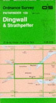
Dingwall and Strathpeffer
Year unknown
Discoverer Map 15
Discoverer Map 15
Year unknown

Discoverer Map Series
Year unknown
Discovery
Discovery 42 Meath - West Meath
Discovery 42 Meath - West Meath
Year unknown
Discovery Map
Discovery Map
Year unknown

Discovery Map 0007
Year unknown
Discovery Map 0021
Discovery Map 0021
Year unknown
Discovery Map 80 IRD 008 002
Discovery Map 80 IRD 008 002
Year unknown

Discovery Maps 0028
Year unknown

Discovery Series
Year unknown

Diss and Harleston
Year unknown
Diss and Harleston (Explorer Maps...
Diss and Harleston (Explorer Maps) (Explorer Maps)
Year unknown
Diss and Harleston (OS Explorer M...
Diss and Harleston (OS Explorer Map Active)
Year unknown
Diss & Harleston
Diss & Harleston
Year unknown

Diss (North) and Kenninghall
Year unknown
Diss (South) and Botesdale
Diss (South) and Botesdale
Year unknown
District Map
District Map
Year unknown
Dolgellau
Dolgellau and Porthmadog
Dolgellau and Porthmadog
Year unknown

Dolgellau and Surrounding Area
Year unknown

Domesday book
Year unknown

Domesday book ; or, The great survey of England of William the Conqueror, A.D. MLXXXVI
Year unknown

Domesday book; or, The great survey of England of William the Conqueror, A.D. MLXXXVI [electronic resource] ; facsimile of the part relating to Somersetshire
Year unknown
Henry James and Ordnance Survey
Doncaster

Doncaster and Dearne
Year unknown

Doncaster, Conisbrough, Maltby and Thorne
Year unknown

Doncaster (East) and Epworth
Year unknown
Dorchester
Dorchester and Weymouth
Dorchester and Weymouth
Year unknown
Dorchester and Weymouth, Cerne Ab...
Dorchester and Weymouth, Cerne Abbas and Bere Regis
Year unknown

Dorchester and Weymouth, Cerne Abbas and Bere Regis
Year unknown

Dorchester and Weymouth, Cerne Abbas and Bere Regis
Year unknown
Dorchester and Weymouth, Cerne Ab...
Dorchester and Weymouth, Cerne Abbas and Bere Regis
Year unknown

Dorchester Weymouth
Year unknown
Dorchester, Weymouth
Dorchester, Weymouth
Year unknown
Dorchester, Weymouth and Surround...
Dorchester, Weymouth and Surrounding Area
Year unknown
Dorchester & Weymouth, Cerne Abba...
Dorchester & Weymouth, Cerne Abbas & Bere Regis (OS Landranger Map)
Year unknown
Dorchester, Weymouth & surroundin...
Dorchester, Weymouth & surrounding area
Year unknown
Dorking and Reigate, Crawley and ...
Dorking and Reigate, Crawley and Horsham
Year unknown
Dorking, Box Hill and Reigate
Dorking, Box Hill and Reigate
Year unknown
Dorking, Box Hill and Reigate
Dorking, Box Hill and Reigate
Year unknown
Dorking, Box Hill and Reigate, Le...
Dorking, Box Hill and Reigate, Leatherhead and Caterham
Year unknown
Dorking, Box Hill & Reigate
Dorking, Box Hill & Reigate
Year unknown
Dorking & Kingston
Dorking & Kingston
Year unknown
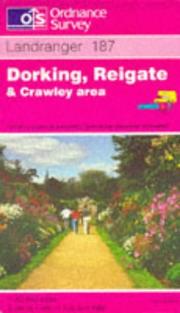
Dorking, Reigate and Crawley Area
Year unknown
Dorking, Reigate and Crawley Area
Dorking, Reigate and Crawley Area
Year unknown
Dorking, Reigate and Crawley Area
Dorking, Reigate and Crawley Area
Year unknown
Dorking, Reigate and Crawley Area
Dorking, Reigate and Crawley Area
Year unknown
Dorking, Reigate & Crawley
Dorking, Reigate & Crawley
Year unknown
Dorking, Reigate & Crawley (OS La...
Dorking, Reigate & Crawley (OS Landranger Map)
Year unknown

Dornoch and Alness, Invergordon and Tain
Year unknown
Dornoch and Tain
Dornoch and Tain
Year unknown

Dornoch and Tain
Year unknown
Dornoch Firth
Dornoch Firth
Year unknown

Dornoch Firth and Tarbat Ness
Year unknown

Dorrington and Cressage
Year unknown

Dorset, Somerset East, Bath and Bristol
Year unknown
Dorset, Somerset East, Bath and B...
Dorset, Somerset East, Bath and Bristol
Year unknown

Dorset, Somerset East, Bath Bristol
Year unknown

Douglas and Symington
Year unknown

Dover, Folkedtone & Hythe 1
Dover, Folkedtone & Hythe 1
Year unknown
Dover, Folkestone and Hythe
Dover, Folkestone and Hythe
Year unknown
Dover, Folkestone & Hythe
Dover, Folkestone & Hythe
Year unknown

Dover, Folkstone and Hythe
Year unknown
Dover, Folkstone and Hythe (OS Ex...
Dover, Folkstone and Hythe (OS Explorer Map)
Year unknown

Downham Market and Marham
Year unknown
Doyce
Droitwich (SO 86/96)
Droitwich (SO 86/96)
Year unknown


Duart Point (Mull)
Year unknown

Dublin City Centre Atlas
Dublin City Centre Atlas
Year unknown
Dublin City Centre Atlas
Dublin City Centre Atlas
Year unknown
Dublin Pocket Map
Dublin Pocket Map
Year unknown

Dublin Street Guide (Street Atlas)
Year unknown
Dublin Street Map
Dublin Street Map
Year unknown


Dumfries and Castle Douglas
Year unknown
Dumfries and Castle DouglasSheet 84
Dumfries and Castle DouglasSheet 84
Year unknown

Dumfries and Dalbeattie
Year unknown
Dunbar


Dunbar and North Berwick (Explorer)
Year unknown
Dundee
Dundee

Dundee and Montrose, Forfar and Arbroath
Year unknown

Dundee and Sidlaw Hills (Explorer)
Year unknown
Dundee and Sidlaw Hills (OS Explo...
Dundee and Sidlaw Hills (OS Explorer Map Active)
Year unknown

Dundee (East)
Year unknown
Dundee & Montrose,Forfar & Arbroath
Dundee & Montrose,Forfar & Arbroath
Year unknown
Dundee to Montrose
Dundee to Montrose
Year unknown

Dundee (West)
Year unknown

Dunfermline, Kirkcaldy and Glenro...
Dunfermline, Kirkcaldy and Glenrothes South
Year unknown

Dunfermline, Kirkcaldy and Glenrothes South (Explorer)
Year unknown
Dunfermline, Kirkcaldy and Glenro...
Dunfermline, Kirkcaldy and Glenrothes South (OS Explorer Map Active)
Year unknown

Dunkeld, Aberfeldy and Glen Almond (Explorer)
Year unknown
Dunkeld and Blairgowrie
Dunkeld and Blairgowrie
Year unknown
Dunmow

Duns and Dunbar
Duns and Dunbar
Year unknown

Duns and Longformacus
Year unknown

Dunscore and Ae
Year unknown

Duns, Dunbar and Eyemouth
Year unknown
Duns, Dunbar and Eyemouth
Duns, Dunbar and Eyemouth
Year unknown
Duns, Dunbar and Eyemouth
Duns, Dunbar and Eyemouth
Year unknown

Duns, Dunbar and Eyemouth Area
Year unknown
Duns, Dunbar & Eyemouth (OS Landr...
Duns, Dunbar & Eyemouth (OS Landranger Active Map)
Year unknown
Dunvegan


Dunvegan Head and Moonen Bay
Year unknown
Durham


Durham and Sunderland
Year unknown
Durham and Sunderland (OS Explore...
Durham and Sunderland (OS Explorer Map Active)
Year unknown
Durham street atlas
Durham street atlas
Year unknown
Durham street atlas
Durham street atlas
Year unknown
Dursley and Wotton-under-Edge
Dursley and Wotton-under-Edge
Year unknown
Dursley & Wotton-under-Edge
Dursley & Wotton-under-Edge
Year unknown

East Anglia

Eastbourne and Beachy Head
Year unknown
Eastbourne and Hastings
Eastbourne and Hastings
Year unknown
Eastbourne and Hastings (Battle a...
Eastbourne and Hastings (Battle and Heathfield)
Year unknown
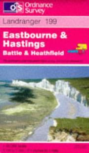
Eastbourne and Hastings, Battle and Heathfield
Year unknown
Eastbourne and Hastings, Battle a...
Eastbourne and Hastings, Battle and Heathfield (Landranger Maps)
Year unknown
Eastbourne and Seaford
Eastbourne and Seaford
Year unknown
Eastbourne & Beachy Head, Newhave...
Eastbourne & Beachy Head, Newhaven, Seaford, Hailsham & Heathfield (OS Explorer Map)
Year unknown
East Dereham and Aylsham
East Dereham and Aylsham
Year unknown
East Dereham and Aylsham
East Dereham and Aylsham
Year unknown
East Dereham and Aylsham
East Dereham and Aylsham
Year unknown

East Dereham and Castle Acre
Year unknown
Eastern Highlands
Eastern Highlands
Year unknown

East Essex Street Atlas
East Essex Street Atlas
Year unknown
East Kent street atlas
East Kent street atlas
Year unknown
East Kilbride
East Kilbride
Year unknown
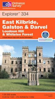
East Kilbride, Galston and Darvel (Explorer)
Year unknown
East Kilbride, Galston and Darvel...
East Kilbride, Galston and Darvel (OS Explorer Map Active)
Year unknown
East London
East London, Billericay and Grave...
East London, Billericay and Gravesend
Year unknown

East London, Billericay and Gravesend
Year unknown
East London, Billericay and Grave...
East London, Billericay and Gravesend (Landranger Maps) 177 (OS Landranger Map)
Year unknown
East London, Billericay & Gravese...
East London, Billericay & Gravesend (OS Landranger Map)
Year unknown
East Midlands and East Anglia inc...
East Midlands and East Anglia including London
Year unknown

East Midlands and East Anglia Including London
Year unknown
East Midlands and East Anglia Inc...
East Midlands and East Anglia Including London (Road Map)
Year unknown
East Midlands and East Anglia Inc...
East Midlands and East Anglia Including London (Travelmaster S.)
Year unknown

East Midlands and East Anglica and London (Road Map)
Year unknown
East Midlands and Yorkshire
East Midlands and Yorkshire
Year unknown

East Midlands & East Anglia
Year unknown

East Retford (North) and Blyth
Year unknown
East Sussex street atlas
East Sussex street atlas
Year unknown


Eccles (Greater Manchester)
Year unknown

Edge Hill and Fenny Compton
Year unknown
Edge Hill and Fenny Compton
Edge Hill and Fenny Compton
Year unknown
Edge Hill and Fenny Compton (OS E...
Edge Hill and Fenny Compton (OS Explorer Map)
Year unknown

Edinburgh
Edinburgh
Edinburgh
Edinburgh
Edinburgh and East Central Scotla...
Edinburgh and East Central Scotland street atlas
Year unknown
Edinburgh and Glasgow (City Link ...
Edinburgh and Glasgow (City Link Maps)
Year unknown

Edinburgh (Explorer)
Year unknown
Edinburgh & Midlothian area
Edinburgh & Midlothian area
Year unknown
Edinburgh (OS Explorer Map)
Edinburgh (OS Explorer Map)
Year unknown
Edinburgh (OS Explorer Map Active)
Edinburgh (OS Explorer Map Active)
Year unknown

Edinburgh, Penicuik and North Berwick
Year unknown
Edinburgh, Penicuik & North Berwi...
Edinburgh, Penicuik & North Berwick LR066 1
Year unknown

Eigg, Muck and Rhum (South)
Year unknown
Eighth report from the Estimates ...
Eighth report from the Estimates Committee
Year unknown

Elan Valley and Builth Wells
Year unknown
Elan Valley and Builth Wells / Cw...
Elan Valley and Builth Wells / Cwm Elan a Llanfair-ym-Muallt (Landranger Map 147)
Year unknown
Elan Valley & Builth Wells
Elan Valley & Builth Wells
Year unknown
Elan Valley & Builth Wells
Elan Valley & Builth Wells
Year unknown


Elgin, Dufftown and Surrounding Area
Year unknown

Elgin, Dufftown, Buckie and Keith
Year unknown
Elgin, Dufftown, Buckie and Keith
Elgin, Dufftown, Buckie and Keith
Year unknown

Elgin, Forres and Lossiemouth
Year unknown
Elgin, Forres and Lossiemouth
Elgin, Forres and Lossiemouth
Year unknown
Elland 1905

Ellesmere (East) and Prees
Year unknown

Ellesmere Port (East)
Year unknown

Ellesmere Port (West)
Year unknown
Ellon and Inverurie
Ellon and Inverurie
Year unknown

Ellon and Inverurie
Year unknown

Elloughton and Brough
Year unknown

Elsrickle and Romannobridge
Year unknown

Ely and Newmarket, Mildenhall and Soham
Year unknown
Ely and Newmarket, Mildenhall and...
Ely and Newmarket, Mildenhall and Soham (OS Explorer Map)
Year unknown

Ely and Wisbech
Year unknown

Ely and Wisbech, Downham Market
Year unknown
Ely & Newmarket Map | Mildenhall ...
Ely & Newmarket Map | Mildenhall & Soham | Ordnance Survey | OS Explorer Map 226 | England | Walks | Hiking | Maps | Adventure
Year unknown

Ely (North) and Littleport
Year unknown

Ely (South), Haddenham and Soham
Year unknown
Ely & Wisbech
Ely & Wisbech
Year unknown

Ely, Wisbech and Downham Market (Landranger Maps) 143 (OS Landranger Map)
Year unknown
Encapsulated Wall Map 12e
Encapsulated Wall Map 12e
Year unknown
Encapsulated Wall Maps 08e
Encapsulated Wall Maps 08e
Year unknown
England and Wales
England and Wales
Year unknown
England, Northern Road
England, Northern Road
Year unknown
English Lakes - North Eastern Area
English Lakes - North Eastern Area
Year unknown
English Lakes - North Eastern Area
English Lakes - North Eastern Area
Year unknown
English Lakes - North Western Area
English Lakes - North Western Area
Year unknown
English Lakes - North Western Area
English Lakes - North Western Area
Year unknown
English Lakes - North Western Area
English Lakes - North Western Area
Year unknown
English Lakes - South Eastern Area
English Lakes - South Eastern Area
Year unknown
English Lakes - South Eastern Area
English Lakes - South Eastern Area
Year unknown
English Lakes - South Western Area
English Lakes - South Western Area
Year unknown
Epping Forest and Lee Valley
Epping Forest and Lee Valley
Year unknown
Epping Forest and Lee Valley
Epping Forest and Lee Valley
Year unknown
Epping Forest and Lee Valley
Epping Forest and Lee Valley
Year unknown
Epping Forest and Lee Valley (OS ...
Epping Forest and Lee Valley (OS Explorer Map)
Year unknown
Epping Forest & Lee Valley (Explo...
Epping Forest & Lee Valley (Explorer Maps)
Year unknown
Epping Forest & Lee Valley (OS Ex...
Epping Forest & Lee Valley (OS Explorer Map)
Year unknown

Eskdale and Castle O'er Forest
Year unknown
Eskdale and Castle O'er Forest
Eskdale and Castle O'er Forest
Year unknown
Eskdale and Castle O'er Forest (O...
Eskdale and Castle O'er Forest (OS Explorer Map)
Year unknown

Eskdalemuir Forest
Eskdalemuir Forest
Year unknown
Essex and North East London
Essex and North East London
Year unknown

Essex and North East London
Year unknown
Essex Atlas
Essex Base Map (Administrative Ar...
Essex Base Map (Administrative Area Diagrams)
Year unknown

Europe Physical Wall Map
Europe Physical Wall Map
Year unknown
Europe Political (Wall Map S.)
Europe Political (Wall Map S.)
Year unknown
Europe Wall Map (OS Wall Maps)
Europe Wall Map (OS Wall Maps)
Year unknown
Europe (Wall Map S.)
Europe (Wall Map S.)
Year unknown
Evesham and Stratford-on-Avon
Evesham and Stratford-on-Avon
Year unknown
Exeter
Exeter and Dartmouth
Exeter and Dartmouth
Year unknown
Exeter and Sidmouth
Exeter and Sidmouth
Year unknown
Exeter and Sidmouth, Exmouth and ...
Exeter and Sidmouth, Exmouth and Teignmouth
Year unknown

Exeter and Sidmouth, Exmouth and Teignmouth
Year unknown

Exeter and Sidmouth, Exmouth and Teignmouth (Landranger Maps) 192 (OS Landranger Map)
Year unknown
Exeter and the Exe Valley
Exeter and the Exe Valley
Year unknown

Exeter and the Exe Valley
Year unknown
Exeter and the Exe Valley (Explor...
Exeter and the Exe Valley (Explorer Map Active)
Year unknown
Exeter and the Exe Valley (OS Exp...
Exeter and the Exe Valley (OS Explorer Active Map)
Year unknown

Exeter, Sidmouth and Surrounding Area
Year unknown
Exeter & Sidmouth, Exmouth & Teig...
Exeter & Sidmouth, Exmouth & Teignmouth (OS Landranger Active Map)
Year unknown
Exeter & Sidmouth, Exmouth & Teig...
Exeter & Sidmouth, Exmouth & Teignmouth (OS Landranger Map)
Year unknown


Exmoor

Exmoor (OS Explorer Map)
Exmoor (OS Explorer Map)
Year unknown
Exmoor (OS Explorer Map Active)
Exmoor (OS Explorer Map Active)
Year unknown

Exmouth and Sidmouth
Year unknown
Exmouth and Sidmouth (OS Explorer...
Exmouth and Sidmouth (OS Explorer Map)
Year unknown
Exmouth and Sidmouth (OS Explorer...
Exmouth and Sidmouth (OS Explorer Map Active)
Year unknown
Exmouth & Sidmouth
Exmouth & Sidmouth
Year unknown
EXP 106 Newquay & Padstow
EXP 106 Newquay & Padstow
Year unknown
EXP 107 St Austell Liskeard Fowey...
EXP 107 St Austell Liskeard Fowey Looe
Year unknown
EXP 111 Bude Boscastle & Tintagel
EXP 111 Bude Boscastle & Tintagel
Year unknown
EXP 112 Launceston & Holsworthy
EXP 112 Launceston & Holsworthy
Year unknown
EXP 113 Okehampton
EXP 113 Okehampton
Year unknown
EXP 116 Lyme Regis & Bridport
EXP 116 Lyme Regis & Bridport
Year unknown
EXP 117 Cerne Abbas Bere Regis Bl...
EXP 117 Cerne Abbas Bere Regis Blandford
Year unknown
EXP 125 Romney Marsh Rye & Winche...
EXP 125 Romney Marsh Rye & Winchelsea
Year unknown
EXP 137 Ashford
EXP 137 Ashford
Year unknown
EXP 138 Dover Folkstone & Hythe
EXP 138 Dover Folkstone & Hythe
Year unknown
EXP 146 Dorking Box Hill & Reigate
EXP 146 Dorking Box Hill & Reigate
Year unknown
Exp 146 Dorking Box Hill & Reigat...
Exp 146 Dorking Box Hill & Reigate (Explorer Maps)
Year unknown
EXP 150 Canterbury & Isle of Thanet
EXP 150 Canterbury & Isle of Thanet
Year unknown
EXP 153 Weston-Super-Mare & Blead...
EXP 153 Weston-Super-Mare & Bleadon Hill
Year unknown
EXP 154 Bristol West & Portishead
EXP 154 Bristol West & Portishead
Year unknown
Exp 161 London South (Explorer Ma...
Exp 161 London South (Explorer Maps) (OS Explorer Map)
Year unknown
EXP 165 Swansea Neath & Port Talbot
EXP 165 Swansea Neath & Port Talbot
Year unknown
EXP 166 Rhondda & Merthyr Tydfil
EXP 166 Rhondda & Merthyr Tydfil
Year unknown
EXP 170 Abingdon Wantage Vale Whi...
EXP 170 Abingdon Wantage Vale White Hors
Year unknown
EXP 171 Chiltern Hills W Henley-o...
EXP 171 Chiltern Hills W Henley-on-Thame
Year unknown
EXP 174 Epping Forest & Lee Valley
EXP 174 Epping Forest & Lee Valley
Year unknown
Exp 174 Epping Forest & Lee Valle...
Exp 174 Epping Forest & Lee Valley (Explorer Maps) (OS Explorer Map)
Year unknown
EXP 175 Southend-on-Sea & Basildon
EXP 175 Southend-on-Sea & Basildon
Year unknown
EXP 176 Blackwater Estuary
EXP 176 Blackwater Estuary
Year unknown
Exp 176 Blackwater Estuary (Explo...
Exp 176 Blackwater Estuary (Explorer Maps)
Year unknown
EXP 177 Carmarthen & Kidwelly
EXP 177 Carmarthen & Kidwelly
Year unknown
EXP 182 St Albans & Hatfield
EXP 182 St Albans & Hatfield
Year unknown
EXP 183 Chelmsford & The Rodings
EXP 183 Chelmsford & The Rodings
Year unknown
EXP 184 Colchester Harwich Clacto...
EXP 184 Colchester Harwich Clacton o Sea
Year unknown
EXP 185 Newcastle Emlyn Llandysul...
EXP 185 Newcastle Emlyn Llandysul Cynwyl
Year unknown
EXP 186 Llandeilo Brechfa Forest ...
EXP 186 Llandeilo Brechfa Forest Fforest
Year unknown
EXP 189 Hereford & Ross-on-Wye
EXP 189 Hereford & Ross-on-Wye
Year unknown
EXP 191 Banbury Bicester Chipping...
EXP 191 Banbury Bicester Chipping Norton
Year unknown
EXP 193 Luton Stevenage Hitchin A...
EXP 193 Luton Stevenage Hitchin Ampthill
Year unknown
EXP 194 Hertford & Bishop's Stort...
EXP 194 Hertford & Bishop's Stortford
Year unknown
EXP 195 Braintree & Saffron Walden
EXP 195 Braintree & Saffron Walden
Year unknown
EXP 196 Sudbury Hadleigh & Dedham...
EXP 196 Sudbury Hadleigh & Dedham Vale
Year unknown
EXP 199 Lampeter Tregaron & Llan-non
EXP 199 Lampeter Tregaron & Llan-non
Year unknown
EXP 201 Knighton Presteigne Tref-...
EXP 201 Knighton Presteigne Tref-y-clawd
Year unknown
EXP 203 Ludlow Tenbury Wells Cleo...
EXP 203 Ludlow Tenbury Wells Cleobury
Year unknown
EXP 204 Worcester & Droitwich Spa
EXP 204 Worcester & Droitwich Spa
Year unknown
EXP 205 Stratford-upon-Avon & Eve...
EXP 205 Stratford-upon-Avon & Evesham
Year unknown
EXP 215 Newtown Llanfair Caereinion
EXP 215 Newtown Llanfair Caereinion
Year unknown
EXP 218 Kidderminster & Wyre Forest
EXP 218 Kidderminster & Wyre Forest
Year unknown
EXP 219 Wolverhampton Dudley Stou...
EXP 219 Wolverhampton Dudley Stourbridge
Year unknown
EXP 224 Corby Kettering Wellingbo...
EXP 224 Corby Kettering Wellingborough
Year unknown
EXP 225 Huntingdon St Ives Grafha...
EXP 225 Huntingdon St Ives Grafham Water
Year unknown
EXP 231 Southwold & Bungay
EXP 231 Southwold & Bungay
Year unknown
EXP 235 Wisbech & Peterborough North
EXP 235 Wisbech & Peterborough North
Year unknown
EXP 237 Norwich
EXP 237 Norwich
Year unknown
EXP 238 East Dereham & Aylsham
EXP 238 East Dereham & Aylsham
Year unknown
EXP 239 Lake Vyrnwy Llanfyllin Ta...
EXP 239 Lake Vyrnwy Llanfyllin Tanat Val
Year unknown
EXP 243 Market Drayton Loggerhead...
EXP 243 Market Drayton Loggerheads Eccle
Year unknown
EXP 244 Cannock Chase Chasewater ...
EXP 244 Cannock Chase Chasewater Staffor
Year unknown
Exp 246 Loughborough Melton Mowbr...
Exp 246 Loughborough Melton Mowbray (Explorer Maps)
Year unknown
EXP 246 Loughborough Melton Mowbr...
EXP 246 Loughborough Melton Mowbray Syst
Year unknown
EXP 247 Grantham
EXP 247 Grantham
Year unknown

Exp 247 Grantham (Explorer Maps)
Year unknown
EXP 249 Spalding & Holbeach
EXP 249 Spalding & Holbeach
Year unknown
EXP 251 Norfolk Coast Central
EXP 251 Norfolk Coast Central
Year unknown
EXP 252 Norfolk Coast East
EXP 252 Norfolk Coast East
Year unknown
EXP 259 Derby Uttoxeter Ashbourne...
EXP 259 Derby Uttoxeter Ashbourne Cheadl (EXPLORER MAP)
Year unknown
EXP 260 Nottingham Vale of Belvoir
EXP 260 Nottingham Vale of Belvoir
Year unknown
EXP 261 Boston
EXP 261 Boston
Year unknown
EXP 265 Clwydian Range Prestatyn ...
EXP 265 Clwydian Range Prestatyn Mold
Year unknown
EXP 267 Northwich & Delamere Forest
EXP 267 Northwich & Delamere Forest
Year unknown
EXP 268 Wilmslow Macclesfield Con...
EXP 268 Wilmslow Macclesfield Congleton
Year unknown
EXP 269 Chesterfield & Alfreton
EXP 269 Chesterfield & Alfreton
Year unknown
EXP 270 Sherwood Forest
EXP 270 Sherwood Forest
Year unknown
EXP 271 Newark-on-Trent
EXP 271 Newark-on-Trent
Year unknown

Exp 272 Lincoln Sleaford (Explorer Maps)
Year unknown
EXP 275 Liverpool St Helens Widnes
EXP 275 Liverpool St Helens Widnes
Year unknown
EXP 277 Manchester Salford Oldham...
EXP 277 Manchester Salford Oldham Rochda
Year unknown
EXP 278 Sheffield & Barnsley
EXP 278 Sheffield & Barnsley
Year unknown
EXP 279 Doncaster
EXP 279 Doncaster
Year unknown
EXP 280 Isle Axholme Scunthorpe G...
EXP 280 Isle Axholme Scunthorpe Gainsbor
Year unknown
EXP 281 Ancholme Valley
EXP 281 Ancholme Valley
Year unknown
EXP 282 Lincolnshire Wolds North
EXP 282 Lincolnshire Wolds North
Year unknown

Exp 282 Lincolnshire Wolds North (Explorer Maps)
Year unknown

Exp 283 Louth & Mablethorpe
Year unknown
EXP 283 Louth & Mablethorpe
EXP 283 Louth & Mablethorpe
Year unknown
EXP 284 Grimsby Cleethorpes & Imm...
EXP 284 Grimsby Cleethorpes & Immingham
Year unknown
EXP 285 Southport & Chorley
EXP 285 Southport & Chorley
Year unknown
EXP 286 Blackpool & Preston
EXP 286 Blackpool & Preston
Year unknown

EXP 288 Bradford Huddersfield E Calderda
Year unknown
EXP 295 Bridlington Driffield & H...
EXP 295 Bridlington Driffield & Hornsea
Year unknown
EXP 299 Ripon & Boroughbridge
EXP 299 Ripon & Boroughbridge
Year unknown
EXP 302 Northallerton & Thirsk
EXP 302 Northallerton & Thirsk
Year unknown
EXP 303 Whitehaven & Workington
EXP 303 Whitehaven & Workington
Year unknown
EXP 306 Middlesbrough & Hartlepool
EXP 306 Middlesbrough & Hartlepool
Year unknown
EXP 309 Stranraer & The Rhins
EXP 309 Stranraer & The Rhins
Year unknown
EXP 312 Kirkcudbright Castle Doug...
EXP 312 Kirkcudbright Castle Douglas Gat
Year unknown
EXP 313 Dumfries & Dalbeattie
EXP 313 Dumfries & Dalbeattie
Year unknown
EXP 314 Solway Firth
EXP 314 Solway Firth
Year unknown
EXP 315 Carlisle
EXP 315 Carlisle
Year unknown
EXP 317 Ballantrae Barr & Barrhill
EXP 317 Ballantrae Barr & Barrhill
Year unknown
EXP 318 Galloway Forest Park North
EXP 318 Galloway Forest Park North
Year unknown
EXP 319 Galloway Forest Park South
EXP 319 Galloway Forest Park South
Year unknown
EXP 321 Nithsdale & Dumfries
EXP 321 Nithsdale & Dumfries
Year unknown
EXP 322 Annandale
EXP 322 Annandale
Year unknown
EXP 323 Eskdale & Castle O'er Forest
EXP 323 Eskdale & Castle O'er Forest
Year unknown
EXP 325 Morpeth & Blyth
EXP 325 Morpeth & Blyth
Year unknown
EXP 326 Ayr & Troon
EXP 326 Ayr & Troon
Year unknown
EXP 327 Cumnock & Dalmellington
EXP 327 Cumnock & Dalmellington
Year unknown
EXP 328 Sanquhar & New Cumnock
EXP 328 Sanquhar & New Cumnock
Year unknown
EXP 329 Lowther Hills Sanquhar Le...
EXP 329 Lowther Hills Sanquhar Leadhills
Year unknown
EXP 333 Kilmarnock & Irvine
EXP 333 Kilmarnock & Irvine
Year unknown
EXP 334 East Kilbride Galston & D...
EXP 334 East Kilbride Galston & Darvel
Year unknown
EXP 335 Lanark & Tinto Hills
EXP 335 Lanark & Tinto Hills
Year unknown
EXP 336 Biggar & Broughton
EXP 336 Biggar & Broughton
Year unknown
EXP 337 Peebles & Interleithen
EXP 337 Peebles & Interleithen
Year unknown
EXP 338 Galashiels Selkirk & Melrose
EXP 338 Galashiels Selkirk & Melrose
Year unknown
EXP 339 Kelso Coldstream lower Tw...
EXP 339 Kelso Coldstream lower Tweed Val
Year unknown
EXP 340 Holy Island & Bamburgh
EXP 340 Holy Island & Bamburgh
Year unknown
EXP 341 Greenock Largs & Millport
EXP 341 Greenock Largs & Millport
Year unknown
EXP 342 Glasgow Paisley Ruthergle...
EXP 342 Glasgow Paisley Rutherglen Kirki
Year unknown
EXP 343 Motherwell & Coatbridge
EXP 343 Motherwell & Coatbridge
Year unknown
EXP 344 Pentland Hills
EXP 344 Pentland Hills
Year unknown
EXP 349 Falkirk Cumbernauld Livin...
EXP 349 Falkirk Cumbernauld Livingstone
Year unknown
EXP 351 Dunbar & North Berwick
EXP 351 Dunbar & North Berwick
Year unknown
EXP 354 Colonsay & Oronsay
EXP 354 Colonsay & Oronsay
Year unknown
EXP361 Isle of Arran
EXP361 Isle of Arran
Year unknown
EXP 367 Dunfermline Kirkcaldy Gle...
EXP 367 Dunfermline Kirkcaldy Glenrothes
Year unknown
Exp 367 Dunfermline Kirkcaldy/Gle...
Exp 367 Dunfermline Kirkcaldy/Glenrothes (Explorer Maps)
Year unknown
EXP 369 Perth & Kinross
EXP 369 Perth & Kinross
Year unknown
EXP 370 Glenrothes North Falkland...
EXP 370 Glenrothes North Falkland Lomond
Year unknown
EXP 372 Coll & Tiree
EXP 372 Coll & Tiree
Year unknown
EXP 379 Dunkeld Aberfeldy & Glen ...
EXP 379 Dunkeld Aberfeldy & Glen Almond
Year unknown
EXP 380 Dundee & Sidlaw Hills
EXP 380 Dundee & Sidlaw Hills
Year unknown
EXP 389 Forfar Brechin & Edzell
EXP 389 Forfar Brechin & Edzell
Year unknown
Exp 391 Ardgour & Strontian (Expl...
Exp 391 Ardgour & Strontian (Explorer Maps)
Year unknown
EXP 396 Stonehaven Inverbervie La...
EXP 396 Stonehaven Inverbervie Laurencek
Year unknown
EXP 399 Loch Arkaig
EXP 399 Loch Arkaig
Year unknown
EXP 407 Skye - Dunvegan
EXP 407 Skye - Dunvegan
Year unknown
EXP 409 Raasay Rona & Scalpay
EXP 409 Raasay Rona & Scalpay
Year unknown
EXP 410 Skye - Portree & Bracadale
EXP 410 Skye - Portree & Bracadale
Year unknown
EXP 411 Skye - Cuillin Hills
EXP 411 Skye - Cuillin Hills
Year unknown
EXP 412 Skye - Sleat
EXP 412 Skye - Sleat
Year unknown
Exp 412 Skye Sleat (Explorer Maps)
Exp 412 Skye Sleat (Explorer Maps)
Year unknown
EXP 413 Knoydart Loch Hourn Loch ...
EXP 413 Knoydart Loch Hourn Loch Duich
Year unknown
EXP 414 Glan Shiel & Kintail Forest
EXP 414 Glan Shiel & Kintail Forest
Year unknown
EXP 415 Glen Affric & Glen Moriston
EXP 415 Glen Affric & Glen Moriston
Year unknown
EXP 421 Ellon & Inverurie
EXP 421 Ellon & Inverurie
Year unknown
EXP 431 Glen Urquhart & Strathglass
EXP 431 Glen Urquhart & Strathglass
Year unknown
EXP 432 Black Isle
EXP 432 Black Isle
Year unknown
EXP 433 Torridon Beinn Eighe Liat...
EXP 433 Torridon Beinn Eighe Liathach
Year unknown
EXP 434 Gairloch & Loch Ewe
EXP 434 Gairloch & Loch Ewe
Year unknown
EXP 435 An Teallach & Slioch (EXP...
EXP 435 An Teallach & Slioch (EXPLORER MAP)
Year unknown
EXP 436 Beinn Dearg & Loch Fannich
EXP 436 Beinn Dearg & Loch Fannich
Year unknown
EXP 437 Ben Wyvis & Strathpeffer
EXP 437 Ben Wyvis & Strathpeffer
Year unknown
EXP 439 Coigach & Summer Isles
EXP 439 Coigach & Summer Isles
Year unknown
EXP 445 Foinaven Arkle Kylesku Sc...
EXP 445 Foinaven Arkle Kylesku Scourie
Year unknown
EXP45
EXP 452 Barra Vatersay Barraigh a...
EXP 452 Barra Vatersay Barraigh agus Bha
Year unknown
EXP 457 SE Lewis Taobh an Eardhea...
EXP 457 SE Lewis Taobh an Eardheas Ledh
Year unknown
EXP 459 C Lewis Stornaway Meadhan...
EXP 459 C Lewis Stornaway Meadhan Ledha
Year unknown
EXP 460 N Lewis Ceann a Tuath Led...
EXP 460 N Lewis Ceann a Tuath Ledhais
Year unknown
EXP 461 Orkney - East Mainland
EXP 461 Orkney - East Mainland
Year unknown
EXP 462 Orkney Hoy South Walls Fl...
EXP 462 Orkney Hoy South Walls Flotta
Year unknown
EXP 463 Orkney - West Mainland
EXP 463 Orkney - West Mainland
Year unknown
EXP 465 Orkney Sanday Eday North ...
EXP 465 Orkney Sanday Eday North Ronalds
Year unknown
EXP ACT 101 Isles of Scilly
EXP ACT 101 Isles of Scilly
Year unknown
EXP ACT 103 The Lizard
EXP ACT 103 The Lizard
Year unknown
EXP ACT 104 Redruth & St Agnes
EXP ACT 104 Redruth & St Agnes
Year unknown
EXP ACT 105 Falmouth & Mevagissey
EXP ACT 105 Falmouth & Mevagissey
Year unknown
EXP ACT 106 Newquay & Padstow
EXP ACT 106 Newquay & Padstow
Year unknown
EXP ACT 109 Bodmin Moor
EXP ACT 109 Bodmin Moor
Year unknown
EXP ACT 111 Bude Boscastle & Tint...
EXP ACT 111 Bude Boscastle & Tintagel
Year unknown
EXP ACT 125 Romney Marsh Rye Winc...
EXP ACT 125 Romney Marsh Rye Winchelsea
Year unknown
EXP ACT 126 Clovelly & Hartland
EXP ACT 126 Clovelly & Hartland
Year unknown
EXP ACT 137 Ashford
EXP ACT 137 Ashford
Year unknown
EXP ACT 139 Bideford Ilfracombe B...
EXP ACT 139 Bideford Ilfracombe Barnstab
Year unknown
EXP ACT 147 Sevenoaks & Tonbridge
EXP ACT 147 Sevenoaks & Tonbridge
Year unknown
EXP ACT 148 Maidstone & the Medwa...
EXP ACT 148 Maidstone & the Medway Towns
Year unknown
EXP ACT 149 Sittingbourne & Faver...
EXP ACT 149 Sittingbourne & Faversham
Year unknown
EXP ACT 155 Bristol Bath Keynsham...
EXP ACT 155 Bristol Bath Keynsham Marshf
Year unknown
EXP ACT 160 Windsor Weybridge Bra...
EXP ACT 160 Windsor Weybridge Bracknell
Year unknown
EXP ACT 175 Southend-on-Sea & Bas...
EXP ACT 175 Southend-on-Sea & Basildon
Year unknown
EXP ACT 181 Chiltern Hills North
EXP ACT 181 Chiltern Hills North
Year unknown
EXP ACT 183 Chelmsford & The Rodings
EXP ACT 183 Chelmsford & The Rodings
Year unknown
EXP ACT 188 Builth Wells Llanfair...
EXP ACT 188 Builth Wells Llanfair ym Mua
Year unknown
EXP ACT 188 Builth Wells Llanfair...
EXP ACT 188 Builth Wells Llanfair ym Mua
Year unknown
EXP ACT 189 Hereford & Ross-on-Wye
EXP ACT 189 Hereford & Ross-on-Wye
Year unknown
EXP ACT 194 Hertford Bishop's Sto...
EXP ACT 194 Hertford Bishop's Stortford
Year unknown
EXP ACT 195 Braintree & Saffron W...
EXP ACT 195 Braintree & Saffron Walden
Year unknown
EXP ACT 196 Sudbury Hadleigh Dedh...
EXP ACT 196 Sudbury Hadleigh Dedham Vale
Year unknown
EXP ACT 197 Ipswich Felixstowe Ha...
EXP ACT 197 Ipswich Felixstowe Harwich
Year unknown
EXP ACT 201 Knighton Presteigne T...
EXP ACT 201 Knighton Presteigne Tref y
Year unknown
EXP ACT 202 Leominster & Bromyard
EXP ACT 202 Leominster & Bromyard
Year unknown
EXP ACT 203 Ludlow Tenbury Wells ...
EXP ACT 203 Ludlow Tenbury Wells Cleobur
Year unknown
EXP ACT 211 Bury St Edmunds & Sto...
EXP ACT 211 Bury St Edmunds & Stowmarket
Year unknown
EXP ACT 212 Woodbridge & Saxmundham
EXP ACT 212 Woodbridge & Saxmundham
Year unknown
EXP ACT 224 Corby Kettering Welli...
EXP ACT 224 Corby Kettering Wellingborou
Year unknown
EXP ACT 229 Thetford Forest in th...
EXP ACT 229 Thetford Forest in the Breck
Year unknown
EXP ACT 230 Diss & Harleston
EXP ACT 230 Diss & Harleston
Year unknown
EXP ACT 279 Doncaster
EXP ACT 279 Doncaster
Year unknown
EXP ACT 288 Bradford & Huddersfield
EXP ACT 288 Bradford & Huddersfield
Year unknown
EXP ACT 319 Galloway Forest Park ...
EXP ACT 319 Galloway Forest Park South
Year unknown
EXP ACT 320 Castle Douglas Loch K...
EXP ACT 320 Castle Douglas Loch Ken New
Year unknown
EXP ACT 340 Holy Island & Bamburgh
EXP ACT 340 Holy Island & Bamburgh
Year unknown
EXP ACT 370 Glenrothes N Falkland...
EXP ACT 370 Glenrothes N Falkland Lomond
Year unknown
EXP ACT 374 Isle of Mull North To...
EXP ACT 374 Isle of Mull North Tobermory
Year unknown
EXP ACT 467 Shetland - Mainland C...
EXP ACT 467 Shetland - Mainland Central
Year unknown
Exp Map 001 Flat North West Corne...
Exp Map 001 Flat North West Corner Shetl
Year unknown
Exp Map 003 Flat North West Corne...
Exp Map 003 Flat North West Corner Shetl
Year unknown
Exp Map 004 Flat North West Corne...
Exp Map 004 Flat North West Corner Shetl
Year unknown
Exp Map 005 Flat North West Corne...
Exp Map 005 Flat North West Corner Orkne
Year unknown
Exp Map 154 Flat North West Corne...
Exp Map 154 Flat North West Corner Cambr
Year unknown
EXP OL03 Meon Valley Portsmouth G...
EXP OL03 Meon Valley Portsmouth Gosport
Year unknown
EXP OL11 Brighton & Hove
EXP OL11 Brighton & Hove
Year unknown

Exp/Ol 13 Brecon Nat. Park Eastern Area (Explorer Maps) - Wales (OS Explorer Map)
Year unknown
EXP OL14 Wye Valley & Forest Of Dean
EXP OL14 Wye Valley & Forest Of Dean
Year unknown
EXP OL21 South Pennines
EXP OL21 South Pennines
Year unknown
EXP OL22 New Forest Southampton R...
EXP OL22 New Forest Southampton Ringwood
Year unknown
EXP OL27 North York Moors Eastern...
EXP OL27 North York Moors Eastern Area (OUTDOOR LEISURE)
Year unknown
EXP OL31 North Pennines Teesdale ...
EXP OL31 North Pennines Teesdale & Weard
Year unknown
EXP OL32 Winchester New Alresford...
EXP OL32 Winchester New Alresford East M
Year unknown
EXP OL33 Haslemere & Petersfield
EXP OL33 Haslemere & Petersfield
Year unknown
EXP OL34 Crawley & Horsham
EXP OL34 Crawley & Horsham
Year unknown
EXP OL35 North Pembrokeshire
EXP OL35 North Pembrokeshire
Year unknown
EXP OL36 South Pembrokeshire
EXP OL36 South Pembrokeshire
Year unknown
EXP OL42 Kielder Water & Forest
EXP OL42 Kielder Water & Forest
Year unknown
EXP OL47 Crieff Comrie & Glen Artney
EXP OL47 Crieff Comrie & Glen Artney
Year unknown
EXP OL49 Pitlochry & Loch Tummel
EXP OL49 Pitlochry & Loch Tummel
Year unknown
EXP OL53 Lochnagar Glen Muick Gle...
EXP OL53 Lochnagar Glen Muick Glen Clova
Year unknown
EXP OL60 Lochindorb Grantown On S...
EXP OL60 Lochindorb Grantown On Spey Car
Year unknown
EXP OL61 Grantown On Spey Hills C...
EXP OL61 Grantown On Spey Hills Cromdale
Year unknown

Eyemouth and Grantshouse
Year unknown

Eye Peninsular
Year unknown
Facsimile of the Ordnance Surveyo...
Facsimile of the Ordnance Surveyors' drawings of the London area 1799-1808
Year unknown

Facsimiles of Anglo-Saxon manuscripts photozincographed by command of Her Majesty Queen Victoria
Year unknown
Fairford

Falkirk and Linlithgow, Dunfermline
Year unknown
Falkirk and Linlithgow, Dunfermline
Falkirk and Linlithgow, Dunfermline
Year unknown
Falkirk, Cumbernauld and Livingston
Falkirk, Cumbernauld and Livingston
Year unknown

Falkirk (North)
Year unknown

Falkirk (South)
Year unknown
Falkirk & West Lothian
Falkirk & West Lothian
Year unknown
Falmouth and Mevagissey
Falmouth and Mevagissey
Year unknown
Falmouth and Mevagissey
Falmouth and Mevagissey
Year unknown

Falmouth and Mevagissey
Year unknown
Falmouth and Mevagissey, Truro an...
Falmouth and Mevagissey, Truro and St Mawes (OS Explorer Map)
Year unknown
Falmouth, Mevagissey, Truro and S...
Falmouth, Mevagissey, Truro and St Mawes
Year unknown
Faringdon
Farnborough and Aldershot
Farnborough and Aldershot
Year unknown

Farndon, Holt and Tattenhall
Year unknown
Felixstowe and Harwich
Felixstowe and Harwich
Year unknown


Fetlar (North)
Year unknown
Fetler
Fetler (North)
Fetler (North)
Year unknown
Field archaeology
Field archaeology
Year unknown
Field Archaeology in Great Britain
Field Archaeology in Great Britain
Year unknown
Field Archeology
Field Archeology
Year unknown

Findhorn and Culbin Forest
Year unknown


Fintry and Carron Bridge
Year unknown
Firth of Clyde
Firth of Clyde
Year unknown

Firth of Clyde Area
Year unknown

Firth of Clyde, Greenock and Rothesay
Year unknown
Firth of Clyde, Greenock and Roth...
Firth of Clyde, Greenock and Rothesay
Year unknown
Firth of Clyde, Greenock & Rothes...
Firth of Clyde, Greenock & Rothesay (OS Landranger Active Map)
Year unknown
Firth of Forth
Firth of Forth
Year unknown
Firth of Lorn (North)
Firth of Lorn (North)
Year unknown

Five Penny Borve
Year unknown

Flamborough Head
Year unknown


Fochabers and Glen of Rothes
Year unknown

Foinaven, Arkle, Kylesku and Scourie
Year unknown
Folens/Ordnance Survey UK Atlas
Folens/Ordnance Survey UK Atlas
Year unknown
Folens/Ordnance Survey World Atlas
Folens/Ordnance Survey World Atlas
Year unknown

Folkingham and Billingborough
Year unknown
Follow the Map
Follow the Map
Year unknown

Footpaths of Britain
Year unknown
Footpaths of Britain
Footpaths of Britain
Year unknown

Forest of Bowland and Ribblesdale
Year unknown

Forest of Bowland and Ribblesdale
Year unknown
Forest of Bowland and Ribblesdale
Forest of Bowland and Ribblesdale
Year unknown
Forest of Bowland & Ribblesdale
Forest of Bowland & Ribblesdale
Year unknown
Forest of Bowland & Ribblesdale, ...
Forest of Bowland & Ribblesdale, Pendle Hill, Clitheroe & Settle (OS Explorer Map)
Year unknown
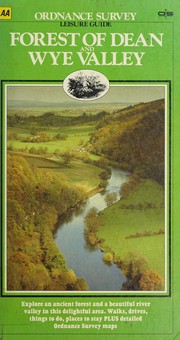
Forest of Dean and Wye Valley
Year unknown
Automobile Association (Great Britain). Publications Division, Great Britain. Ordnance Survey, and Ordnance Survey
Forfar

Forfar, Brechin and Edzell
Year unknown

Formby and Maghull
Year unknown

Forres and Dallas
Year unknown

Fort Augustus and Glen Albyn
Fort Augustus and Glen Albyn
Year unknown

Fort Augustus and Glen Albyn Area
Year unknown

Fort Augustus and Loch Garry
Year unknown

Fort Augustus, Glen Albyn and Glen Roy
Year unknown
Fort Augustus Glen Albyn & Glen Roy
Fort Augustus Glen Albyn & Glen Roy
Year unknown

Fortrose and Munlochy
Year unknown
Fort William
Fort William
Year unknown
Fort William
Fort William
Year unknown


Fountains Abbey and Boroughbridge
Year unknown
Fountains Abbey and Boroughbridge
Fountains Abbey and Boroughbridge
Year unknown
Framlingham and Saxmundham
Year unknown
Frampton on Severn and Slimbridge
Frampton on Severn and Slimbridge
Year unknown

Fraserburgh

Fraserburgh, Peterhead and District
Year unknown
Fraserburgh, Peterhead and Ellon
Fraserburgh, Peterhead and Ellon
Year unknown
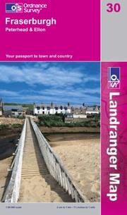
Fraserburgh, Peterhead and Ellon
Year unknown

Fraserburgh, Peterhead and Ellon (Landranger Maps) 030
Year unknown

Frome
Furness Vale 1897
Furness Vale 1897
Year unknown

Fyvie and Rothienorman
Year unknown

Gainsborough (North) and Kirton in Lindsey
Year unknown

Gainsborough (South) and Ingham
Year unknown

Gairloch and Loch Ewe
Year unknown

Gairloch and Ullapool, Loch Maree
Year unknown
Gairloch & Ullapool area
Gairloch & Ullapool area
Year unknown
Gairloch & Ullapool,Loch Maree
Gairloch & Ullapool,Loch Maree
Year unknown
Galashiels and Melrose
Galashiels and Melrose
Year unknown
Galashiels, Selkirk and Melrose (...
Galashiels, Selkirk and Melrose (OS Explorer Map)
Year unknown
Galashiels, Selkirk and Melrose (...
Galashiels, Selkirk and Melrose (OS Explorer Map Active)
Year unknown

Galashiels, Selkirk and Melrose, St Boswell's and Lauder
Year unknown

Galgate and Dolphinholme
Year unknown

Galloway Forest Park
Year unknown

Galloway Forest Park North
Year unknown
Galloway Forest Park North (OS Ex...
Galloway Forest Park North (OS Explorer Map Active)
Year unknown

Galloway Forest Park South
Year unknown
Galloway Forest Park South (OS Ex...
Galloway Forest Park South (OS Explorer Map Active)
Year unknown
Galway

Garforth and Sherburn in Elmet
Year unknown

Gazeteer of Great Britain
Gazeteer of Great Britain
Year unknown
Gazetteer of Great Britain
Gazetteer of Great Britain
Year unknown
Gazetteer of Great Britain
Gazetteer of Great Britain
Year unknown
GB Route Map
GB Route Map
Year unknown
Geodetic measurements across the ...
Geodetic measurements across the English Channel, 1963
Year unknown
Georgian Bath (Historical Map & G...
Georgian Bath (Historical Map & Guide S.)
Year unknown

Gibraltar Point and Wainfleet
Year unknown

Gigha Island
Year unknown

Girvan, Ballantrae and Barrhill
Girvan, Ballantrae and Barrhill
Year unknown

Girvan, Ballantrae and Barrhill
Year unknown
Girvan, Ballantrae and Barrhill (...
Girvan, Ballantrae and Barrhill (OS Landranger Map)
Year unknown
Glasgow
Glasgow
Glasgow and West Central Scotland...
Glasgow and West Central Scotland street atlas
Year unknown

Glasgow (East) and Airdrie
Year unknown

Glasgow (Explorer)
Year unknown
Glasgow (High Street) 1909
Glasgow (High Street) 1909
Year unknown

Glasgow, Motherwell and Airdrie
Year unknown
Glasgow, Motherwell and Airdrie
Glasgow, Motherwell and Airdrie
Year unknown
Glasgow (OS Explorer Map)
Glasgow (OS Explorer Map)
Year unknown
Glasgow, Paisley, Rutherglen & Ki...
Glasgow, Paisley, Rutherglen & Kirkintilloch (OS Explorer Map)
Year unknown

Glasgow (West)
Year unknown

Glen Affric and Glen Moriston
Year unknown


Glen Aray and Glen Shira
Year unknown


Glen Carron and Glen Affric
Year unknown
Glen Carron and Glen Affric (OS L...
Glen Carron and Glen Affric (OS Landranger Map)
Year unknown

Glen Carron and West Monar
Year unknown
Glen Carron and West Monar
Glen Carron and West Monar
Year unknown
Glen Carron & Glen Affric
Glen Carron & Glen Affric
Year unknown
Glen Carron & Glen Afric
Glen Carron & Glen Afric
Year unknown
Glen Cassley and Glen Oykel
Glen Cassley and Glen Oykel
Year unknown

Glen Cassley and Glen Oykel
Year unknown
Glen Cassley and Glen Oykel (OS E...
Glen Cassley and Glen Oykel (OS Explorer Map)
Year unknown


Glen Coe and Glen Etive, Ballachulish and Kinlochleven
Year unknown

Glen Dessarry
Year unknown

Glen Dochart and Lochearnhead
Year unknown

Glendoe Forest
Year unknown

Glen Dye and Glenbervie
Year unknown


Glen Esk and Glen Tanar
Year unknown
Glen Esk and Glen Tanar (OS Explo...
Glen Esk and Glen Tanar (OS Explorer Map)
Year unknown
Glen Esk and Glen Tanar (OS Explo...
Glen Esk and Glen Tanar (OS Explorer Map Active)
Year unknown
Glen Esk & Glen Tanar, Aboyne & M...
Glen Esk & Glen Tanar, Aboyne & Mount Keen
Year unknown


Glen Fiddich
Year unknown

Glen Garry and Loch Rannoch
Glen Garry and Loch Rannoch
Year unknown

Glen Garry and Loch Rannoch
Year unknown

Glen Garry and Loch Rannoch Area
Year unknown
Glen Garry & Loch Rannoch (OS Lan...
Glen Garry & Loch Rannoch (OS Landranger Map#42)
Year unknown

Glengavel Reservoir
Year unknown

Glen Kinglass
Year unknown


Glenluce and Kirkcowan
Glenluce and Kirkcowan
Year unknown

Glenluce and Kirkcowan (Explorer)
Year unknown
Glenluce and Kirkcowan (OS Explor...
Glenluce and Kirkcowan (OS Explorer Map)
Year unknown

Glen Moriston
Year unknown
Glen Orchy

Glen Orchy and Loch Etive
Year unknown
Glen Orchy and Loch Etive
Glen Orchy and Loch Etive
Year unknown

Glen Orchy and Surrounding Area
Year unknown


Glenrothes and Falkland
Year unknown

Glenrothes North, Falkland and Lomond Hills (Explorer)
Year unknown
Glenrothes North, Falkland and Lo...
Glenrothes North, Falkland and Lomond Hills (OS Explorer Map)
Year unknown
Glenrothes North, Falkland and Lo...
Glenrothes North, Falkland and Lomond Hills (OS Explorer Map Active)
Year unknown

Glenshee and Braemar
Year unknown
Glen Shee and Braemar (OS Explore...
Glen Shee and Braemar (OS Explorer Map Active)
Year unknown

Glen Shiel and Kintail Forest
Year unknown

Glen Tennet and Mount Keen
Year unknown


Glentrool Village and Bargrennan
Year unknown
Glen Urquhart and Strathglass
Glen Urquhart and Strathglass
Year unknown

Glen Urquhart and Strathglass
Year unknown
Glossop
Gloucester
Gloucester and The Forest of Dean
Gloucester and The Forest of Dean
Year unknown

Gloucester and The Forest of Dean
Year unknown

Gloucester and The Forest of Dean Area
Year unknown

Gloucester and the Forest of Dean (Landranger Maps) 162
Year unknown

Gloucester, Cheltenham and Stroud
Year unknown
Gloucester, Cheltenham and Stroud...
Gloucester, Cheltenham and Stroud 179
Year unknown
Gloucester, Cheltenham and Stroud...
Gloucester, Cheltenham and Stroud (OS Explorer Map)
Year unknown
Gloucester, Cheltenham and Stroud...
Gloucester, Cheltenham and Stroud (OS Explorer Map Active)
Year unknown
Gloucester, Cheltenham & Stroud M...
Gloucester, Cheltenham & Stroud Map | Cotswold Way | Ordnance Survey | OS Explorer Map 179 | England | Walks | Hiking | Maps | Adventure
Year unknown
Gloucester & Forest Of Dean
Gloucester & Forest Of Dean
Year unknown
Gloucester & Forest Of Dean (OS L...
Gloucester & Forest Of Dean (OS Landranger)
Year unknown
Gloucester & Forest of Dean (OS L...
Gloucester & Forest of Dean (OS Landranger Map)
Year unknown
Gloucestershire
Gloucestershire
Year unknown
Gloucestershire, Hereford and Wor...
Gloucestershire, Hereford and Worcester
Year unknown
Gloucestershire, Wiltshire
Gloucestershire, Wiltshire
Year unknown
Golspie

Goole and Gilberdyke
Goole and Gilberdyke
Year unknown
Goole and Gilberdyke
Goole and Gilberdyke
Year unknown
Goole and Gilberdyke
Goole and Gilberdyke
Year unknown

Goole and Gilberdyke
Year unknown
Gorton & Belle Vue 1905
Gorton & Belle Vue 1905
Year unknown

Gower
Gower =


Gower, Llanelli
Year unknown

Grainthorpe and Binbrook
Year unknown
Grangemouth
Grange-over-Sands
Grange-over-Sands
Year unknown
Grantham

Grantham

Grantham and Belvoir
Year unknown

Grantham and Surrounding Area
Year unknown
Grantham, Sleaford and Bourne
Grantham, Sleaford and Bourne
Year unknown

Grantham, Sleaford and Bourne
Year unknown

Grantham, Sleaford and Bourne (Landranger Maps) 130
Year unknown
Grantown and Cairngorm
Grantown and Cairngorm
Year unknown
Grantown & Aviemore
Grantown & Aviemore
Year unknown

Grantown, Aviemore and Cairngorm Area
Year unknown
Grantown, Aviemore and Cairngorm ...
Grantown, Aviemore and Cairngorm Mountains
Year unknown

Grantown, Aviemore and Cairngorm Mountains
Year unknown
Grantown, Aviemore and Cairngorm ...
Grantown, Aviemore and Cairngorm Mountains
Year unknown
Grantown, Aviemore & Cairngorm area
Grantown, Aviemore & Cairngorm area
Year unknown

Grantown, Aviemore & Cairngorm Mountains LR036 1
Year unknown

Grantown-on-Spey and Hills of Cromdale
Year unknown
Grantown-on-Spey and Hills of Cro...
Grantown-on-Spey and Hills of Cromdale
Year unknown

Grantown-on-Spey and Strath Avon
Year unknown
Gravesend and Rochester
Year unknown
gravesend & rochester ; 1/25 000
gravesend & rochester ; 1/25 000
Year unknown

Great Bernera
Great Bernera
Year unknown
Great Britain
Great Britain
Year unknown
Great Britain
Great Britain
Year unknown

Great Britain (Anquet Maps)
Year unknown
Great Britain (North) Administrat...
Great Britain (North) Administrative Map (Administrative Area Diagrams)
Year unknown
Great Britain Physical Wall Map
Great Britain Physical Wall Map
Year unknown
Great Britain Political Wall Map
Great Britain Political Wall Map
Year unknown
Great Britain. Quarter inch, fift...
Great Britain. Quarter inch, fifth series
Year unknown
Great Britain Route Map 2006
Great Britain Route Map 2006
Year unknown
Great Britain Routeplanner 1:6250...
Great Britain Routeplanner 1:625000 (Routeplanner)
Year unknown
Great Britain routeplanner south
Great Britain routeplanner south
Year unknown
Great Britain (South) Administrat...
Great Britain (South) Administrative Map (Administrative Area Diagrams)
Year unknown
Great Britain (Travelmaster S.)
Great Britain (Travelmaster S.)
Year unknown
Great British Coloring Map
Great British Coloring Map
Year unknown
Great British Colouring Map
Great British Colouring Map
Year unknown

Great Driffield and Beeford
Year unknown
Greater London
Greater London
Year unknown
Greater London including M25
Greater London including M25
Year unknown
Greater London Including M25
Greater London Including M25
Year unknown
Great Malvern SO 64/74
Great Malvern SO 64/74
Year unknown

Great Witley
Year unknown


Greenock and Port Glasgow
Year unknown

Greenock, Largs and Millport (Explorer)
Year unknown
Greenwich and Gravesend
Greenwich and Gravesend
Year unknown
Greenwich and Gravesend
Greenwich and Gravesend
Year unknown
Greenwich and Gravesend (OS Explo...
Greenwich and Gravesend (OS Explorer Map)
Year unknown
Greenwich Meridian
Greenwich Meridian
Year unknown

Gretna and Eastriggs
Year unknown
Grimsby

Grimsby and Cleethorpes
Year unknown
Grimsby and Surrounding Area
Grimsby and Surrounding Area
Year unknown
Grimsby, Cleethorpes and Immingham
Grimsby, Cleethorpes and Immingham
Year unknown
Grimsby, Cleethorpes and Immingha...
Grimsby, Cleethorpes and Immingham, Caistor and North Thoresby
Year unknown
Grimsby, Cleethorpes and Immingha...
Grimsby, Cleethorpes and Immingham, Caistor and North Thoresby
Year unknown

Grimsby, Louth and Market Rasen
Year unknown
Grimsby, Louth and Market Rasen (...
Grimsby, Louth and Market Rasen (OS Landranger Map)
Year unknown

Grogport (Kintyre)
Year unknown

Gruinard Bay
Year unknown
Guide to Scots origins of place n...
Guide to Scots origins of place names in Britain
Year unknown
Guide to the River Thames
Guide to the River Thames
Year unknown

Guide to the Waterways
Year unknown
Guide to the Yorkshire Dales
Guide to the Yorkshire Dales
Year unknown
Guildford and Farnham
Guildford and Farnham
Year unknown

Guildford and Farnham
Year unknown
Guildford and Farnham (OS Explore...
Guildford and Farnham (OS Explorer Map Active)
Year unknown
Guilsborough
Guilsborough
Year unknown

Hadman's Wall
Hadman's Wall
Year unknown

Hadrian's Wall
Year unknown

Hadrian's Wall
Year unknown
Hadrian's Wall
Hadrian's Wall
Year unknown

Hadrians Wall
Year unknown
Hadrian's Wall, Haltwhistle and H...
Hadrian's Wall, Haltwhistle and Hexham
Year unknown
Hadrian's Wall, Haltwhistle & Hexham
Hadrian's Wall, Haltwhistle & Hexham
Year unknown
Hadrian's Wall, Haltwhistle & Hex...
Hadrian's Wall, Haltwhistle & Hexham (OS Explorer Map)
Year unknown
Hadrian's Wall (Historical Map & ...
Hadrian's Wall (Historical Map & Guide)
Year unknown

Halifax (NW) 1905
Halifax (NW) 1905
Year unknown

Haltwhistle

Haltwhistle and Brampton, Bewcastle and Alston
Year unknown
Haltwhistle and Gilsland
Haltwhistle and Gilsland
Year unknown
Haltwhistle, Bewcastle & Alston
Haltwhistle, Bewcastle & Alston
Year unknown

Haltwhistle Bewcastle Alston 1:50000
Year unknown
Hamilton
Hampshire

Hampshire and the Isle of Wight
Year unknown
Hampshire and the Isle of Wight
Hampshire and the Isle of Wight
Year unknown

Hampshire and the Isle of Wight
Year unknown

Hampshire & the Isle of Wight
Year unknown
Harbottle

Harewood

Harlech, Porthmadog and Bala
Year unknown
Harlech, Porthmadog and Bala (OS ...
Harlech, Porthmadog and Bala (OS Explorer Map)
Year unknown
Harlech, Porthmadog and Bala (OS ...
Harlech, Porthmadog and Bala (OS Explorer Map Active)
Year unknown

Harlech, Porthmadog and Bala/Y Bala
Year unknown
Harlech, Porthmadog & Bala / Y Ba...
Harlech, Porthmadog & Bala / Y Bala (OS Explorer Map)
Year unknown

Harpenden
Harringworth
Harringworth
Year unknown
Harrogate

Hartlepool
Hartlepool and Peterlee
Hartlepool and Peterlee
Year unknown
Harworth and Gringley-on-the-Hill
Harworth and Gringley-on-the-Hill
Year unknown
Haslemere and Hindhead
Haslemere and Hindhead
Year unknown
Haslemere and Petersfield
Haslemere and Petersfield
Year unknown
Haslemere and Petersfield
Haslemere and Petersfield
Year unknown

Haslemere and Petersfield
Year unknown

Haslemere and Petersfield, Midhurst and Selborne
Year unknown
Haslemere and Petersfield (OS Exp...
Haslemere and Petersfield (OS Explorer Map)
Year unknown

Hastings and Bexhill
Year unknown

Hastings and Bexhill, Battle and Robertsbridge
Year unknown

Hawick and Area
Year unknown
Hawick and Eskdale Area
Hawick and Eskdale Area
Year unknown

Hawick and Eskdale, Langholm
Year unknown
Hawick and Eskdale, Langholm
Hawick and Eskdale, Langholm
Year unknown
Hay-on-Wye

Head of Loch Etive
Year unknown


Helmsdale and Strath of Kildonan
Helmsdale and Strath of Kildonan
Year unknown

Helmsdale and Strath of Kildonan
Year unknown
Helmsdale and Strath of Kildonan
Helmsdale and Strath of Kildonan
Year unknown

Helmsdale and Strath of Kildonan
Year unknown
Helmsdale & Strath of Kildonan
Helmsdale & Strath of Kildonan
Year unknown
Helmsley

Hemsworth and Askern
Year unknown
Hereford
Hereford and Leominster
Hereford and Leominster
Year unknown

Hereford and Leominster
Year unknown
Hereford and Leominster, Bromyard...
Hereford and Leominster, Bromyard and Ledbury
Year unknown

Hereford and Leominster, Bromyard and Ledbury
Year unknown

Hereford and Leominster, Bromyard and Ledbury (Landranger Maps) 149 (OS Landranger Map)
Year unknown

Hereford and Ross-on-Wye
Year unknown

Hereford, Leominster and Surrounding Area
Year unknown
Hereford & Leominster, Bromyard &...
Hereford & Leominster, Bromyard & Ledbury
Year unknown

Herefordshire and Worcestershire
Year unknown

Hermitage and Saughtree
Year unknown
Hertford and Bishop's Stortford
Hertford and Bishop's Stortford
Year unknown

Hertford and Bishop's Stortford
Year unknown
Hertfordshire
Hertfordshire
Year unknown
Hertfordshire street atlas
Hertfordshire street atlas
Year unknown
Hertfordshire street atlas
Hertfordshire street atlas
Year unknown
Hertfordshire street atlas
Hertfordshire street atlas
Year unknown

Heswall, Birkenhead and Liverpool (South)
Year unknown
Hexham and Haltwhistle
Hexham and Haltwhistle
Year unknown
Hexham and Haltwhistle
Hexham and Haltwhistle
Year unknown

Hexham and Haltwhistle
Year unknown
Hexham and Haydon Bridge
Hexham and Haydon Bridge
Year unknown

Hexham Haltwhistle 1:50000
Year unknown
Hexham & Haltwhistle (OS Landrang...
Hexham & Haltwhistle (OS Landranger Map)
Year unknown
Highley
High Peak

High Weald, Royal Tunbridge Wells
Year unknown
Hillingdon & Wembley
Hillingdon & Wembley
Year unknown


Hinckley and Earl Shilton
Year unknown
Hinckley & Earl Shilton
Hinckley & Earl Shilton
Year unknown
Historical Map & Guide
Historical Map & Guide
Year unknown
History of the Retriangulation of...
History of the Retriangulation of Great Britain, 1935-62
Year unknown

Hodnet and Norbury
Year unknown
Holbeck & New Wortley
Holbeck & New Wortley
Year unknown
Holmfirth
Holmfirth 1904
Holmfirth 1904
Year unknown
Holt (Norfolk)
Holt (Norfolk)
Year unknown


Holy Island and Bamburgh
Year unknown
Holy Island and Bamburgh (OS Expl...
Holy Island and Bamburgh (OS Explorer Map Active)
Year unknown

Holy Island (Northumberland)
Year unknown
Holywell

Holywell and St.Asaph
Year unknown
Horncastle

Hornsea and Aldbrough
Year unknown
Howardian Hills and Malton
Howardian Hills and Malton
Year unknown

Howardian Hills and Malton
Year unknown

Howgill Fells and Upper Eden Valley
Year unknown

Howgill Fells and Upper Eden Valley
Year unknown
Howgill Fells and Upper Eden Vall...
Howgill Fells and Upper Eden Valley (OS Explorer Map Active)
Year unknown


Hoy(South)

Huddersfield and Marsden
Year unknown
Huddersfield & Manchester
Huddersfield & Manchester
Year unknown


Humber Mouth
Year unknown

Hunslet 1905
Hunslet 1905
Year unknown
Huntingdon and Peterborough
Huntingdon and Peterborough
Year unknown

Huntingdon and St.Ives
Year unknown

Huntly and Cullen
Year unknown
Huntly and Cullen
Huntly and Cullen
Year unknown

Huntly (North)
Year unknown

Huntly (South)
Year unknown
Husbands Bosworth
Husbands Bosworth
Year unknown
Illustrated Atlas of Victorian an...
Illustrated Atlas of Victorian and Edwardian Britain
Year unknown
Ordnance Survey and Automobile Association (Great Britain)

Illustrated Road Book of Ireland
Year unknown

Immingham and Elsham
Year unknown

Index
Inland Waterways of Great Britain
Inland Waterways of Great Britain
Year unknown
Innerleithen
Innerleithen
Year unknown
In Search of the Border Reivers
In Search of the Border Reivers
Year unknown

Interactive Map Explorer
Year unknown

Inveraray and Strachur
Year unknown

Invermoriston (Loch Ness)
Year unknown
Inverness

Inverness and Culloden Muir
Year unknown

Inverness and Loch Ness, Strathglass
Year unknown
Inverness and Strathglass
Inverness and Strathglass
Year unknown
Inverness and Strathglass Area
Inverness and Strathglass Area
Year unknown
Invernes-shire
Invernes-shire
Year unknown

Inverness, Loch Ness and Culloden
Year unknown
Inverness town map
Inverness town map
Year unknown

Inverurie and Insch
Year unknown

Iona and Bunessan
Year unknown

Iona and West Mull, Ulva
Year unknown
Iona and West Mull, Ulva
Iona and West Mull, Ulva
Year unknown
Iona and West Mull, Ulva
Iona and West Mull, Ulva
Year unknown

Iona, Staffa and Ross of Mull
Year unknown
Iona, Ulva and West Mull
Iona, Ulva and West Mull
Year unknown

Ipswich and Hadleigh
Year unknown
Ipswich and The Naze
Ipswich and The Naze
Year unknown

Ipswich and the Naze, Clacton-on-Sea
Year unknown
Ipswich and the Naze, Clacton-on-Sea
Ipswich and the Naze, Clacton-on-Sea
Year unknown
Ipswich and the Naze, Clacton-on-...
Ipswich and the Naze, Clacton-on-Sea (OS Landranger Map)
Year unknown

Ipswich, Felixstowe and Harwich
Year unknown
Ipswich, Felixstowe and Harwich (...
Ipswich, Felixstowe and Harwich (OS Explorer Map)
Year unknown
Ipswich, Felixstowe and Harwich (...
Ipswich, Felixstowe and Harwich (OS Explorer Map Active)
Year unknown
Ipswich, the Naze & Clacton-on-Se...
Ipswich, the Naze & Clacton-on-Sea (OS Landranger Map)
Year unknown

Ireland Culture Map
Ireland Culture Map
Year unknown
Ireland Driving Map
Ireland Driving Map
Year unknown
Ireland Leisure Map
Ireland Leisure Map
Year unknown
Ireland north
Ireland north
Year unknown

Ireland North (Holiday Map)
Year unknown
Ireland Ordnance Survey holiday map
Ireland Ordnance Survey holiday map
Year unknown
Ireland Touring Map
Ireland Touring Map
Year unknown

Ireland Touring Map Irish Maps Atlases and Guides
Year unknown
Ireland Tourist Map: Detailed Tou...
Ireland Tourist Map: Detailed Tourist Map of Ireland: Scale 1:600 000, 1cm:6km (Osi Maps)
Year unknown
Irish Holiday Map
Irish Holiday Map
Year unknown

Irish Map

Irish Map Discovery
Year unknown

Irish Map Discovery (Discovery S.)
Year unknown

Iron-Bridge and Telford (South)
Year unknown
Island of Arran
Island of Arran
Year unknown


Islay-Ardnave Point
Year unknown

Islay - Bruichladdich and Bridgend
Year unknown
Islay North

Islay North (Explorer)
Year unknown
Islay (OS Landranger Map)
Islay (OS Landranger Map)
Year unknown
Islay South

Islay South (Explorer)
Year unknown

Isle of Arran
Year unknown
Isle of Arran
Isle of Arran
Year unknown

Isle of Arran
Year unknown
Isle of Axholme, Scunthorpe and G...
Isle of Axholme, Scunthorpe and Gainsborough
Year unknown
Isle of Axholme,Scunthorpe and Ga...
Isle of Axholme,Scunthorpe and Gainsborough
Year unknown
Isle of Axholme, Scunthorpe and G...
Isle of Axholme, Scunthorpe and Gainsborough (OS Explorer Map)
Year unknown
Isle of Man

Isle of Man (OS Landranger Map)
Isle of Man (OS Landranger Map)
Year unknown

Isle of Mull East
Year unknown
Isle of Mull East (Explorer Maps)...
Isle of Mull East (Explorer Maps) 375
Year unknown

Isle of Mull North and Tobermory
Year unknown
Isle of Sheppey
Isle of Sheppey
Year unknown
Isle of Wight
Isle of Wight
Year unknown

Isle of Wight
Year unknown
Isle of Wight
Isle of Wight
Year unknown

Isle of Wight
Year unknown
Isle of Wight, Cowes, Newport, Ry...
Isle of Wight, Cowes, Newport, Ryde, Sandown, Shanklin, Yarmouth & Ventnor (OS Explorer Map)
Year unknown
Isle of Wight, Cowes, Newport, Ry...
Isle of Wight, Cowes, Newport, Ryde, Sandown, Shanklin, Yarmouth & Ventnor (OS Explorer Map)
Year unknown
Isle of Wight (Lamfold Outdoor Le...
Isle of Wight (Lamfold Outdoor Leisure Map)
Year unknown
Isles of Scilly
Isles of Scilly
Year unknown
Isles of Scilly
Isles of Scilly
Year unknown
Isles of Scilly
Isles of Scilly
Year unknown

Isles of Scilly
Year unknown
Isles of Scilly (OS Explorer Map)
Isles of Scilly (OS Explorer Map)
Year unknown
Jersey
John O Groats
John O Groats
Year unknown


Jura and Colonsay
Year unknown
Jura and Colonsay
Jura and Colonsay
Year unknown
Jura and Scarba
Jura and Scarba
Year unknown
Jura and Scarba
Jura and Scarba
Year unknown

Jura and Scarba (Explorer)
Year unknown
Jura and Scarba (Explorer Maps) 355
Jura and Scarba (Explorer Maps) 355
Year unknown


Jura-Loch Tarbert
Year unknown
Jura-Loch Tarbet
Jura-Loch Tarbet
Year unknown

Jura (North)
Year unknown
Keighley
Keighley and Ilkley
Keighley and Ilkley
Year unknown
Keighley and Ilkley
Keighley and Ilkley
Year unknown

Keld to Robin Hoods Bay
Year unknown

Kelso

Kelso and Coldstream, Jedburgh and Duns
Year unknown

Kelso, Coldstream and Lower Tweed Valley
Year unknown
Kelso, Coldstream and Lower Tweed...
Kelso, Coldstream and Lower Tweed Valley (Explorer Map Active)
Year unknown
Kelso, Coldstream and Lower Tweed...
Kelso, Coldstream and Lower Tweed Valley (Explorer Maps)
Year unknown
Kelso, Coldstream and Lower Tweed...
Kelso, Coldstream and Lower Tweed Valley (OS Explorer Map)
Year unknown
Kendal and Morecambe
Kendal and Morecambe
Year unknown

Kendal and Morecambe
Year unknown

Kendal and Morecambe
Year unknown

Kendal and Morecambe, Windermere and Lancaster
Year unknown
Kendal and Morecambe, Windermere ...
Kendal and Morecambe, Windermere and Lancaster (OS Landranger Map)
Year unknown
Kendal, Morecambe, Windermere and...
Kendal, Morecambe, Windermere and Lancaster
Year unknown
Kendal, Morecambe, Windermere & L...
Kendal, Morecambe, Windermere & Lancaster February 2016 (OS Landranger Map)
Year unknown
Kendal, Morecambe, Windermere & L...
Kendal, Morecambe, Windermere & Lancaster February 2016 (OS Landranger Map)
Year unknown

Kent and South East London
Year unknown
Kent and South East London
Kent and South East London
Year unknown
Kenton & Wealdsone, 1912
Kenton & Wealdsone, 1912
Year unknown

Kerry, Cork, Limerick
Year unknown
Keswick

Kettering and Corby
Year unknown
Kettering and Corby
Kettering and Corby
Year unknown

Kettering and Corby (Landranger Maps) 141 (OS Landranger Map)
Year unknown

Kettering and Irthlingborough
Year unknown
Kettering & Corby
Kettering & Corby
Year unknown

Kettering, Corby and Surrounding Area
Year unknown
Kidderminster and Bromsgrove
Kidderminster and Bromsgrove
Year unknown

Kidderminster and Wyre Forest
Year unknown
Kidderminster and Wyre Forest
Kidderminster and Wyre Forest
Year unknown
Kidderminster and Wyre Forest
Kidderminster and Wyre Forest
Year unknown

Kidderminster and Wyre Forest
Year unknown
Kidderminster and Wyre Forest Area
Kidderminster and Wyre Forest Area
Year unknown
Kidderminster and Wyre Forest (OS...
Kidderminster and Wyre Forest (OS Explorer Map Active) (OS Explorer Map Active)
Year unknown
Kidderminster & Bromsgrove
Kidderminster & Bromsgrove
Year unknown
Kidderminster & Wyre Forest (OS L...
Kidderminster & Wyre Forest (OS Landranger Map)
Year unknown

Kidsgrove and Leek
Year unknown
Kielder Water
Kielder Water
Year unknown
Kielder Water and Forest (OS Expl...
Kielder Water and Forest (OS Explorer Map Active)
Year unknown

Kielder Water, Bellingham and Simonside Hills
Year unknown
Kielder Water, Bellingham & Simon...
Kielder Water, Bellingham & Simonside Hills, showing part of the Northumberland National Park
Year unknown
Kielder Water (Lamfold Outdoor Le...
Kielder Water (Lamfold Outdoor Leisure Map)
Year unknown
Kielder Water (OS Explorer Map Ac...
Kielder Water (OS Explorer Map Active)
Year unknown


Kildrummy and Alford
Year unknown
Killarney Dist
Killarney Dist
Year unknown

Killarney National Park, Scale 1:25 000
Year unknown

Killearn and Drymen
Year unknown


Kilmarnock and Darvel
Year unknown

Kilmarnock and Irvine
Year unknown
Kilmarnock and Irvine (OS Explore...
Kilmarnock and Irvine (OS Explorer Map Active)
Year unknown

Kilmartin


Kingsclere and Ashmansworth
Kingsclere and Ashmansworth
Year unknown

King's Lynn, Downham Market and Swaffham
Year unknown
King's Lynn, Downham Market and S...
King's Lynn, Downham Market and Swaffham (OS Explorer Map)
Year unknown

King's Lynn (South)
Year unknown
Kingston upon Hull
Kingston upon Hull
Year unknown
Kingston upon Hull and Beverley
Kingston upon Hull and Beverley
Year unknown

Kingston-upon-Hull and Beverley
Year unknown
Kingston-Upon-Hull and Beverley
Kingston-Upon-Hull and Beverley
Year unknown

Kingston-upon-Hull and Surrounding Area
Year unknown

Kingston-upon-Hull, Beverley and Driffield
Year unknown
Kingston-upon-Hull, Beverley and ...
Kingston-upon-Hull, Beverley and Driffield
Year unknown

Kingston Upon Hull Beverley Driffield
Year unknown

Kingston-upon-Hull (North)
Year unknown

Kingston-upon-Hull (South)
Year unknown


Kingussie and Monadhliath Mountains
Year unknown
Kingussie & Monadhliath Mountains
Kingussie & Monadhliath Mountains
Year unknown


Kinloch Rannoch and Schiehallion
Year unknown


Kintore and Monymusk
Year unknown
Kintyre North
Kintyre North
Year unknown

Kintyre North (Explorer)
Year unknown
Kintyre South Campeltown
Kintyre South Campeltown
Year unknown

Kintyre South (Explorer)
Year unknown

Kirby Underdale and Garton-on-the-Wolds
Year unknown

Kirkcaldy and Buckhaven
Year unknown

Kirkcowan and the Three Lochs
Year unknown

Kirkcudbright
Year unknown
Kirkcudbright and Castle Douglas
Kirkcudbright and Castle Douglas
Year unknown
Kirkcudbright and Castle Douglas ...
Kirkcudbright and Castle Douglas Gatehouse of Fleet
Year unknown
Kirkcudbright and Castle Douglas ...
Kirkcudbright and Castle Douglas (OS Explorer Map)
Year unknown

Kirkcudbright Bay
Year unknown
Kirkstall 1906
Kirkstall 1906
Year unknown


Knapdale - Loch Caolisport
Year unknown
Knighton and Presteigne, Kington
Knighton and Presteigne, Kington
Year unknown
Knighton and Presteigne / Tref-y-...
Knighton and Presteigne / Tref-y-clawdd a Dyffryn Elan
Year unknown

Knighton (Powys) and Brampton Bryan
Year unknown

Knighton Presteigne
Year unknown

Knoydart, Loch Hourn and Loch Duich
Knoydart, Loch Hourn and Loch Duich
Year unknown

Knoydart, Loch Hourn and Loch Duich
Year unknown
Knutsford

Kyle of Durness
Year unknown

Kyle of Lochalsh
Year unknown
Kyle of Lochalsh
Kyle of Lochalsh
Year unknown
Kyle of Lochalsh, Plockton and Ap...
Kyle of Lochalsh, Plockton and Applecross
Year unknown
Kyle of Lochalsh, Plockton & Appl...
Kyle of Lochalsh, Plockton & Applecross
Year unknown

Kyles of Bute and Dunoon
Year unknown

Laggan (Highland)
Year unknown


Lairg and Loch Shin, Loch Naver
Year unknown
Lairg, Bonar Bridge and Golspie
Lairg, Bonar Bridge and Golspie
Year unknown

Lairg, Bonar Bridge and Golspie
Year unknown
Lairg, Loch Shin & surrounding area
Lairg, Loch Shin & surrounding area
Year unknown
Lake District
Lake District
Year unknown

Lake District
Year unknown
Lake District and Cumbria
Lake District and Cumbria
Year unknown

Lake District and Cumbria
Year unknown

Lake District and North East England (Out & About Walking Guides to Great Britain)
Year unknown

Lake District Car Tours (Travelmaster Guides)
Year unknown
Lake District Ordnance Survey
Lake District Ordnance Survey
Year unknown
Lake District (OS Travel Map - To...
Lake District (OS Travel Map - Tour Map)
Year unknown
Lake District (The Lake District)
Lake District (The Lake District)
Year unknown

Lakenheath and Brandon
Year unknown
Lake Vyrnwy and Llanfyllin, Tanat...
Lake Vyrnwy and Llanfyllin, Tanat Valley
Year unknown

Lake Vyrnwy and Llanfyllin, Tanat Valley
Year unknown
Lake Vyrnwy/Llyn Efyrnwy and Llan...
Lake Vyrnwy/Llyn Efyrnwy and Llanfyllin
Year unknown

Lake Vyrnwy/Llyn Efyrnwy and Llanfyllin
Year unknown
Lammermuir Hills
Lammermuir Hills
Year unknown
Lammermuir Hills (OS Explorer Map)
Lammermuir Hills (OS Explorer Map)
Year unknown
Lampeter

Lampeter and Llandovery
Year unknown
Lampeter and Llandovery
Lampeter and Llandovery
Year unknown

Lampeter, Llandovery and Surrounding Area
Year unknown

Lampeter, Tregaron and Llan-non
Year unknown
Lanark

Lanark and Tinto Hills (Explorer)
Year unknown
Lanark and Tinto Hills (OS Explor...
Lanark and Tinto Hills (OS Explorer Map Active)
Year unknown
Lanark and Upper Nithsdale
Lanark and Upper Nithsdale
Year unknown
Lanark and Upper Nithsdale
Lanark and Upper Nithsdale
Year unknown

Lanark and Upper Nithsdale Area
Year unknown
Lancashire Administrative Map (Ad...
Lancashire Administrative Map (Administrative Area Diagrams)
Year unknown
Lancashire and Cheshire
Lancashire and Cheshire
Year unknown
Lancashire Base Map (Administrati...
Lancashire Base Map (Administrative Area Diagrams)
Year unknown
Lancaster

Lancaster and Morecambe
Year unknown
Lancaster & Kendal
Lancaster & Kendal
Year unknown
Lancaster, Morecambe and Fleetwood
Lancaster, Morecambe and Fleetwood
Year unknown

Lancaster, Morecambe and Fleetwood
Year unknown
Lancaster, Morecambe and Fleetwood
Lancaster, Morecambe and Fleetwood
Year unknown


Land Navigation
Year unknown
Landranger 10 ~ Strath Naver (The...
Landranger 10 ~ Strath Naver (The Outstanding All Weather Map)
Year unknown
Landranger 14 ~ Tarbert & Loch Se...
Landranger 14 ~ Tarbert & Loch Seaforth (The Outstanding All Weather Map)
Year unknown
Landranger 15 ~ Loch Assynt, Loch...
Landranger 15 ~ Loch Assynt, Lochinver & Kylesku (The Outstanding All Weather Map)
Year unknown
Landranger 17 ~ Helmsdale & Strat...
Landranger 17 ~ Helmsdale & Strath of Kildonan (The Outstanding All Weather Map)
Year unknown
Landranger 197 ~ Chichester & the...
Landranger 197 ~ Chichester & the South Downs (The Outstanding All Weather Map)
Year unknown
Landranger 20 ~ Beinn Dearg & Loc...
Landranger 20 ~ Beinn Dearg & Loch Broom (The Outstanding All Weather Map)
Year unknown
Landranger 24 ~ Raasay & Applecro...
Landranger 24 ~ Raasay & Applecross (The Outstanding All Weather Map)
Year unknown
Landranger 25 ~ Glen Carron & Gle...
Landranger 25 ~ Glen Carron & Glen Affric (The Outstanding All Weather Map)
Year unknown
Landranger 27 ~ Nairn & Forres (T...
Landranger 27 ~ Nairn & Forres (The Outstanding All Weather Map)
Year unknown
Landranger 29 ~ Banff & Huntly (T...
Landranger 29 ~ Banff & Huntly (The Outstanding All Weather Map)
Year unknown
Landranger 30 ~ Fraserburgh (The ...
Landranger 30 ~ Fraserburgh (The Outstanding All Weather Map)
Year unknown
Landranger 33 ~ Loch Alsh, Glen S...
Landranger 33 ~ Loch Alsh, Glen Shiel & Loch Hourn (The Outstanding All Weather Map)
Year unknown
Landranger 34 ~ Fort Augustus (Th...
Landranger 34 ~ Fort Augustus (The Outstanding All Weather Map)
Year unknown
Landranger 35 ~ Kingussie & Monad...
Landranger 35 ~ Kingussie & Monadhliath Mountains (The Outstanding All Weather Map)
Year unknown
Landranger 38 ~ Aberdeen (The Out...
Landranger 38 ~ Aberdeen (The Outstanding All Weather Map)
Year unknown
Landranger 3 ~ Shetland - North M...
Landranger 3 ~ Shetland - North Mainland (The Outstanding All Weather Map)
Year unknown
Landranger 41 Ben Nevis, Fort Wil...
Landranger 41 Ben Nevis, Fort William & Glen Coe
Year unknown
Landranger 42 ~ Glen Garry & Loch...
Landranger 42 ~ Glen Garry & Loch Rannoch (The Outstanding All Weather Map)
Year unknown
Landranger 4 ~ Shetland - South M...
Landranger 4 ~ Shetland - South Mainland (The Outstanding All Weather Map)
Year unknown
Landranger 5 ~ Orkney - Northern ...
Landranger 5 ~ Orkney - Northern Isles (The Outstanding All Weather Map)
Year unknown
Landranger 62 ~ North Kintyre & T...
Landranger 62 ~ North Kintyre & Tarbert (The Outstanding All Weather Map)
Year unknown
Landranger 63 ~ Firth Of Clyde (T...
Landranger 63 ~ Firth Of Clyde (The Outstanding All Weather Map)
Year unknown
Landranger 77 ~ Dalmellington & N...
Landranger 77 ~ Dalmellington & New Galloway (The Outstanding All Weather Map)
Year unknown
Landranger 78 ~ Nithsdale & Annan...
Landranger 78 ~ Nithsdale & Annandale (The Outstanding All Weather Map)
Year unknown
Landranger 79 ~ Hawick & Eskdale ...
Landranger 79 ~ Hawick & Eskdale (The Outstanding All Weather Map)
Year unknown
Landranger 82 ~ Stranraer & Glenl...
Landranger 82 ~ Stranraer & Glenluce (The Outstanding All Weather Map)
Year unknown
Landranger 83 ~ Newton Stewart & ...
Landranger 83 ~ Newton Stewart & Kirkcudbright (The Outstanding All Weather Map)
Year unknown
Landranger 84 ~ Dumfries & Castle...
Landranger 84 ~ Dumfries & Castle Douglas (The Outstanding All Weather Map)
Year unknown
Landranger 85 ~ Carlisle & Solway...
Landranger 85 ~ Carlisle & Solway Firth (The Outstanding All Weather Map)
Year unknown
Landranger 87 ~ Hexham & Haltwhis...
Landranger 87 ~ Hexham & Haltwhistle (The Outstanding All Weather Map)
Year unknown
Landranger 88 ~ Newcastle upon Ty...
Landranger 88 ~ Newcastle upon Tyne (The Outstanding All Weather Map)
Year unknown
Landranger 8 ~ Stornoway & North ...
Landranger 8 ~ Stornoway & North Lewis (The Outstanding All Weather Map)
Year unknown
Landranger gazetteer
Landranger gazetteer
Year unknown
Landranger guidebook to Dorset
Landranger guidebook to Dorset
Year unknown
Landranger guidebook to Snowdonia...
Landranger guidebook to Snowdonia, Anglesey and the Ueyn Peninsula
Year unknown
Landranger Map 0001
Landranger Map 0001
Year unknown
Landranger Map 0002
Landranger Map 0002
Year unknown
Landranger Map 0003
Landranger Map 0003
Year unknown
Landranger Map 0004
Landranger Map 0004
Year unknown
Landranger Map 0005
Landranger Map 0005
Year unknown
Landranger Map 0006
Landranger Map 0006
Year unknown
Landranger Map 0007
Landranger Map 0007
Year unknown
Landranger Map 0008
Landranger Map 0008
Year unknown
Landranger Map 0009
Landranger Map 0009
Year unknown
Landranger Map 0010
Landranger Map 0010
Year unknown
Landranger Map 0011
Landranger Map 0011
Year unknown
Landranger Map 0012
Landranger Map 0012
Year unknown
Landranger Map 0013
Landranger Map 0013
Year unknown
Landranger Map 0013
Landranger Map 0013
Year unknown
Landranger Map 0014
Landranger Map 0014
Year unknown
Landranger Map 0015
Landranger Map 0015
Year unknown
Landranger Map 0016
Landranger Map 0016
Year unknown
Landranger Map 0017
Landranger Map 0017
Year unknown
Landranger Map 0018
Landranger Map 0018
Year unknown
Landranger Map 0019
Landranger Map 0019
Year unknown
Landranger Map 0020
Landranger Map 0020
Year unknown
Landranger Map 0021
Landranger Map 0021
Year unknown
Landranger Map 0022
Landranger Map 0022
Year unknown
Landranger Map 0023
Landranger Map 0023
Year unknown
Landranger Map 0024
Landranger Map 0024
Year unknown
Landranger Map 0025
Landranger Map 0025
Year unknown
Landranger Map 0026
Landranger Map 0026
Year unknown
Landranger Map 0027
Landranger Map 0027
Year unknown
Landranger Map 0028
Landranger Map 0028
Year unknown
Landranger Map 0029
Landranger Map 0029
Year unknown
Landranger Map 0030
Landranger Map 0030
Year unknown
Landranger Map 0031
Landranger Map 0031
Year unknown
Landranger Map 0032
Landranger Map 0032
Year unknown
Landranger Map 0033
Landranger Map 0033
Year unknown
Landranger Map 0034
Landranger Map 0034
Year unknown
Landranger Map 0035
Landranger Map 0035
Year unknown
Landranger Map 0036
Landranger Map 0036
Year unknown
Landranger Map 0037
Landranger Map 0037
Year unknown
Landranger Map 0038
Landranger Map 0038
Year unknown
Landranger Map 0039
Landranger Map 0039
Year unknown
Landranger Map 0040
Landranger Map 0040
Year unknown
Landranger Map 0041
Landranger Map 0041
Year unknown
Landranger Map 0042
Landranger Map 0042
Year unknown
Landranger Map 0043
Landranger Map 0043
Year unknown
Landranger Map 0044
Landranger Map 0044
Year unknown
Landranger Map 0045
Landranger Map 0045
Year unknown
Landranger Map 0046
Landranger Map 0046
Year unknown
Landranger Map 0046
Landranger Map 0046
Year unknown
Landranger Map 0047
Landranger Map 0047
Year unknown
Landranger Map 0048
Landranger Map 0048
Year unknown
Landranger Map 0049
Landranger Map 0049
Year unknown
Landranger Map 0050
Landranger Map 0050
Year unknown
Landranger Map 0051
Landranger Map 0051
Year unknown
Landranger Map 0052
Landranger Map 0052
Year unknown
Landranger Map 0052
Landranger Map 0052
Year unknown
Landranger Map 0053
Landranger Map 0053
Year unknown
Landranger Map 0054
Landranger Map 0054
Year unknown
Landranger Map 0055
Landranger Map 0055
Year unknown
Landranger Map 0056
Landranger Map 0056
Year unknown
Landranger Map 0057
Landranger Map 0057
Year unknown
Landranger Map 0058
Landranger Map 0058
Year unknown
Landranger Map 0059
Landranger Map 0059
Year unknown
Landranger Map 0059
Landranger Map 0059
Year unknown
Landranger Map 0060
Landranger Map 0060
Year unknown
Landranger Map 0061
Landranger Map 0061
Year unknown
Landranger Map 0062
Landranger Map 0062
Year unknown
Landranger Map 0063
Landranger Map 0063
Year unknown
Landranger Map 0064
Landranger Map 0064
Year unknown
Landranger Map 0065
Landranger Map 0065
Year unknown
Landranger Map 0066
Landranger Map 0066
Year unknown
Landranger Map 0067
Landranger Map 0067
Year unknown
Landranger Map 0068
Landranger Map 0068
Year unknown
Landranger Map 0069
Landranger Map 0069
Year unknown
Landranger Map 0070
Landranger Map 0070
Year unknown
Landranger Map 0071
Landranger Map 0071
Year unknown
Landranger Map 0072
Landranger Map 0072
Year unknown
Landranger Map 0073
Landranger Map 0073
Year unknown
Landranger Map 0074
Landranger Map 0074
Year unknown
Landranger Map 0075
Landranger Map 0075
Year unknown
Landranger Map 0076
Landranger Map 0076
Year unknown
Landranger Map 0077
Landranger Map 0077
Year unknown
Landranger Map 0078
Landranger Map 0078
Year unknown
Landranger Map 0079
Landranger Map 0079
Year unknown
Landranger Map 0080
Landranger Map 0080
Year unknown
Landranger Map 0081
Landranger Map 0081
Year unknown
Landranger Map 0082
Landranger Map 0082
Year unknown
Landranger Map 0083
Landranger Map 0083
Year unknown
Landranger Map 0084
Landranger Map 0084
Year unknown
Landranger Map 0085
Landranger Map 0085
Year unknown
Landranger Map 0086
Landranger Map 0086
Year unknown
Landranger Map 0087
Landranger Map 0087
Year unknown
Landranger Map 0088
Landranger Map 0088
Year unknown
Landranger Map 0089
Landranger Map 0089
Year unknown
Landranger Map 0090
Landranger Map 0090
Year unknown
Landranger Map 0091
Landranger Map 0091
Year unknown
Landranger Map 0092
Landranger Map 0092
Year unknown
Landranger Map 0093
Landranger Map 0093
Year unknown
Landranger Map 0094
Landranger Map 0094
Year unknown
Landranger Map 0095
Landranger Map 0095
Year unknown
Landranger Map 0096
Landranger Map 0096
Year unknown
Landranger Map 0097
Landranger Map 0097
Year unknown
Landranger Map 0098
Landranger Map 0098
Year unknown
Landranger Map 0099
Landranger Map 0099
Year unknown
Landranger Map 0100
Landranger Map 0100
Year unknown
Landranger Map 0101
Landranger Map 0101
Year unknown
Landranger Map 0102
Landranger Map 0102
Year unknown
Landranger Map 0103
Landranger Map 0103
Year unknown
Landranger Map 0104
Landranger Map 0104
Year unknown
Landranger Map 0105
Landranger Map 0105
Year unknown
Landranger Map 0106
Landranger Map 0106
Year unknown
Landranger Map 0107
Landranger Map 0107
Year unknown
Landranger Map 0108
Landranger Map 0108
Year unknown
Landranger Map 0109
Landranger Map 0109
Year unknown
Landranger Map 0110
Landranger Map 0110
Year unknown
Landranger Map 0111
Landranger Map 0111
Year unknown
Landranger Map 0112
Landranger Map 0112
Year unknown
Landranger Map 0113
Landranger Map 0113
Year unknown
Landranger Map 0114
Landranger Map 0114
Year unknown
Landranger Map 0115
Landranger Map 0115
Year unknown
Landranger Map 0116
Landranger Map 0116
Year unknown
Landranger Map 0117
Landranger Map 0117
Year unknown
Landranger Map 0118
Landranger Map 0118
Year unknown
Landranger Map 0119
Landranger Map 0119
Year unknown
Landranger Map 0120
Landranger Map 0120
Year unknown
Landranger Map 0121
Landranger Map 0121
Year unknown
Landranger Map 0122
Landranger Map 0122
Year unknown
Landranger Map 0123
Landranger Map 0123
Year unknown
Landranger Map 0124
Landranger Map 0124
Year unknown
Landranger Map 0125
Landranger Map 0125
Year unknown
Landranger Map 0126
Landranger Map 0126
Year unknown
Landranger Map 0127
Landranger Map 0127
Year unknown
Landranger Map 0128
Landranger Map 0128
Year unknown
Landranger Map 0129
Landranger Map 0129
Year unknown
Landranger Map 0130
Landranger Map 0130
Year unknown
Landranger Map 0131
Landranger Map 0131
Year unknown
Landranger Map 0132
Landranger Map 0132
Year unknown
Landranger Map 0133
Landranger Map 0133
Year unknown
Landranger Map 0134
Landranger Map 0134
Year unknown
Landranger Map 0135
Landranger Map 0135
Year unknown
Landranger Map 0136
Landranger Map 0136
Year unknown
Landranger Map 0137
Landranger Map 0137
Year unknown
Landranger Map 0138
Landranger Map 0138
Year unknown
Landranger Map 0139
Landranger Map 0139
Year unknown
Landranger Map 0140
Landranger Map 0140
Year unknown
Landranger Map 0141
Landranger Map 0141
Year unknown
Landranger Map 0142
Landranger Map 0142
Year unknown
Landranger Map 0143
Landranger Map 0143
Year unknown
Landranger Map 0144
Landranger Map 0144
Year unknown
Landranger Map 0145
Landranger Map 0145
Year unknown
Landranger Map 0145
Landranger Map 0145
Year unknown
Landranger Map 0146
Landranger Map 0146
Year unknown
Landranger Map 0147
Landranger Map 0147
Year unknown
Landranger Map 0148
Landranger Map 0148
Year unknown
Landranger Map 0148
Landranger Map 0148
Year unknown
Landranger Map 0149
Landranger Map 0149
Year unknown
Landranger Map 0150
Landranger Map 0150
Year unknown
Landranger Map 0151
Landranger Map 0151
Year unknown
Landranger Map 0152
Landranger Map 0152
Year unknown
Landranger Map 0153
Landranger Map 0153
Year unknown
Landranger Map 0154
Landranger Map 0154
Year unknown
Landranger Map 0155
Landranger Map 0155
Year unknown
Landranger Map 0156
Landranger Map 0156
Year unknown
Landranger Map 0157
Landranger Map 0157
Year unknown
Landranger Map 0158
Landranger Map 0158
Year unknown
Landranger Map 0159
Landranger Map 0159
Year unknown
Landranger Map 0160
Landranger Map 0160
Year unknown
Landranger Map 0161
Landranger Map 0161
Year unknown
Landranger Map 0163
Landranger Map 0163
Year unknown
Landranger Map 0164
Landranger Map 0164
Year unknown
Landranger Map 0165
Landranger Map 0165
Year unknown
Landranger Map 0166
Landranger Map 0166
Year unknown
Landranger Map 0167
Landranger Map 0167
Year unknown
Landranger Map 0168
Landranger Map 0168
Year unknown
Landranger Map 0169
Landranger Map 0169
Year unknown
Landranger Map 0170
Landranger Map 0170
Year unknown
Landranger Map 0171
Landranger Map 0171
Year unknown
Landranger Map 0172
Landranger Map 0172
Year unknown
Landranger Map 0172
Landranger Map 0172
Year unknown
Landranger Map 0173
Landranger Map 0173
Year unknown
Landranger Map 0174
Landranger Map 0174
Year unknown
Landranger Map 0175
Landranger Map 0175
Year unknown
Landranger Map 0176
Landranger Map 0176
Year unknown
Landranger Map 0177
Landranger Map 0177
Year unknown
Landranger Map 0178
Landranger Map 0178
Year unknown
Landranger Map 0179
Landranger Map 0179
Year unknown
Landranger Map 0180
Landranger Map 0180
Year unknown
Landranger Map 0181
Landranger Map 0181
Year unknown
Landranger Map 0182
Landranger Map 0182
Year unknown
Landranger Map 0183
Landranger Map 0183
Year unknown
Landranger Map 0184
Landranger Map 0184
Year unknown
Landranger Map 0185
Landranger Map 0185
Year unknown
Landranger Map 0186
Landranger Map 0186
Year unknown
Landranger Map 0187
Landranger Map 0187
Year unknown
Landranger Map 0188
Landranger Map 0188
Year unknown
Landranger Map 0189
Landranger Map 0189
Year unknown
Landranger Map 0190
Landranger Map 0190
Year unknown
Landranger Map 0191
Landranger Map 0191
Year unknown
Landranger Map 0192
Landranger Map 0192
Year unknown
Landranger Map 0193
Landranger Map 0193
Year unknown
Landranger Map 0194
Landranger Map 0194
Year unknown
Landranger Map 0195
Landranger Map 0195
Year unknown
Landranger Map 0196
Landranger Map 0196
Year unknown
Landranger Map 0197
Landranger Map 0197
Year unknown
Landranger Map 0198
Landranger Map 0198
Year unknown
Landranger Map 0199
Landranger Map 0199
Year unknown
Landranger Map 0200
Landranger Map 0200
Year unknown
Landranger Map 0201
Landranger Map 0201
Year unknown
Landranger Map 0202
Landranger Map 0202
Year unknown
Landranger Map 0203
Landranger Map 0203
Year unknown
Landranger Map 0204
Landranger Map 0204
Year unknown
Landranger Map 162
Landranger Map 162
Year unknown

Landranger Map 186
Year unknown
Landranger Maps
Landranger Maps
Year unknown
Landranger Maps
Landranger Maps
Year unknown

Landranger Maps
Year unknown
Landranger Maps
Landranger Maps
Year unknown
Landranger series
Landranger series
Year unknown
Landranger series of Great Britain
Landranger series of Great Britain
Year unknown
Land's end
Land's End
Land's End
Land's End and Isles of Scilly
Land's End and Isles of Scilly
Year unknown
Land's End and Isles of Scilly, S...
Land's End and Isles of Scilly, St Ives and Lizard Point
Year unknown

Land's End and Isles of Scilly, St.Ives and Lizard Point
Year unknown

Land's End and Isles of Scilly, St.Ives and Lizard Point (Landranger Maps) 203
Year unknown
Land's End & Isles of Scilly
Land's End & Isles of Scilly
Year unknown

Land's End, Penzance and St Ives
Year unknown
Land's End, Penzance and St.Ives
Land's End, Penzance and St.Ives
Year unknown

Land's End, Penzance and St Ives (Explorer Maps) 102
Year unknown
Land's End, Penzance and St Ives ...
Land's End, Penzance and St Ives (OS Explorer Map)
Year unknown
Land's End, Penzance and St Ives ...
Land's End, Penzance and St Ives (OS Explorer Map)
Year unknown

Lands End the Lizard and Isles O
Year unknown
Land's End, the Lizard and Isles ...
Land's End, the Lizard and Isles of Scilly
Year unknown
Land's End, The Lizard & The Isle...
Land's End, The Lizard & The Isles of Scilly
Year unknown


Largs and Kilbirnie
Year unknown
Lasham and Alton (North)
Lasham and Alton (North)
Year unknown

Launceston and Holsworthy
Launceston and Holsworthy
Year unknown

Launceston and Holsworthy
Year unknown
Launceston and Holsworthy (OS Exp...
Launceston and Holsworthy (OS Explorer Active Map)
Year unknown

Laurencekirk and Fettercairn
Year unknown

Leadburn and North Middleton
Year unknown

Ledbury and Much Marcle
Ledbury and Much Marcle
Year unknown

Leeds


Leeds and Bradford - Harrogate and Ilkley
Year unknown
Leeds and Bradford, Harrogate and...
Leeds and Bradford, Harrogate and Ilkley
Year unknown

Leeds and Bradford, Harrogate and Ilkley (Landranger Maps)
Year unknown

Leeds and Bradford, Harrogate and Ilkley (Landranger Maps) 104
Year unknown
Leeds & Bradford
Leeds & Bradford
Year unknown
Leeds, Bradford & Harrogate area
Leeds, Bradford & Harrogate area
Year unknown
Leeds(Harehills, Buslingthorpe & ...
Leeds(Harehills, Buslingthorpe & Chapeltown Road),1906
Year unknown
Leeds, Harrogate, Wetherby and Po...
Leeds, Harrogate, Wetherby and Pontefract
Year unknown
Leeds (OS Explorer Map)
Leeds (OS Explorer Map)
Year unknown
Leeds (Osmondthorpe & Neville Hill)
Leeds (Osmondthorpe & Neville Hill)
Year unknown
Leeds Street Atlas
Leeds Street Atlas
Year unknown
Leicester
Leicester
Leicester and Coventry
Leicester and Coventry
Year unknown

Leicester and Hinckley
Year unknown

Leicester, Coventry and Rugby
Year unknown
Leicester, Coventry and Rugby
Leicester, Coventry and Rugby
Year unknown
Leicester, Coventry and Rugby (La...
Leicester, Coventry and Rugby (Landranger Maps)
Year unknown
Leicester, Coventry and Rugby (La...
Leicester, Coventry and Rugby (Landranger Maps) 140 (OS Landranger Map)
Year unknown

Leicester (East) and Houghton-on-the-Hill
Year unknown
Leicester (East) & Houghton on th...
Leicester (East) & Houghton on the Hill
Year unknown
Leicester (SE) 1902-1911
Leicester (SE) 1902-1911
Year unknown
Leicestershire and Northamptonshi...
Leicestershire and Northamptonshire Administrative Map
Year unknown
Leicester (West)
Leicester (West)
Year unknown

Leicester (West) and Market Bosworth
Year unknown
Leicester (West) & Market Bosworth
Leicester (West) & Market Bosworth
Year unknown

Leisure Guide
Year unknown

Leominster and Bromyard
Leominster and Bromyard
Year unknown

Leominster and Bromyard
Year unknown

Leominster and Bromyard (Explorer Maps) 202
Year unknown


Letchworth and Barkway
Year unknown

Le Tour" Official Map
Le Tour" Official Map
Year unknown
Lichfield and Brownhills
Lichfield and Brownhills
Year unknown

Liddesdale and Kershope Forest
Year unknown
Liddesdale and Kershope Forest (O...
Liddesdale and Kershope Forest (OS Explorer Active Map)
Year unknown
Lincoln
Lincoln

Lincoln and Newark-on-Trent
Year unknown
Lincoln and Newark-on-Trent
Lincoln and Newark-on-Trent
Year unknown

Lincoln and Saxilby
Year unknown

Lincoln Newarkontrent
Year unknown
Lincoln & Newark-on-Trent
Lincoln & Newark-on-Trent
Year unknown
Lincolnshire Wolds North
Lincolnshire Wolds North
Year unknown
Lincolnshire Wolds North
Lincolnshire Wolds North
Year unknown

Lincolnshire Wolds North
Year unknown
Lincolnshire Wolds South
Lincolnshire Wolds South
Year unknown
Lincolnshire Wolds South
Lincolnshire Wolds South
Year unknown

Lincolnshire Wolds South (Explorer Maps)273
Year unknown
Lincoln, Sleaford, Metheringham a...
Lincoln, Sleaford, Metheringham and Navenby
Year unknown

Lincoln (South)
Year unknown
Liostai Logainmneacha
Liostai Logainmneacha
Year unknown
Littleborough, Lancashire
Littleborough, Lancashire
Year unknown
Little Loch Roag and Balallan
Little Loch Roag and Balallan
Year unknown
Little Walsingham and North Creake
Little Walsingham and North Creake
Year unknown
Liverpool
Liverpool (Princes Park) 1905
Liverpool (Princes Park) 1905
Year unknown
Liverpool, Southport and Wigan
Year unknown
Liverpool, Southport and Wigan
Liverpool, Southport and Wigan
Year unknown

Liverpool, St Helens
Year unknown
Liverpool & surrounding area
Liverpool & surrounding area
Year unknown

Livingston and Currie
Year unknown
Lizard, Falmouth and Helston
Lizard, Falmouth and Helston
Year unknown
Lizard, Falmouth and Helston (OS ...
Lizard, Falmouth and Helston (OS Explorer Map)
Year unknown

Llanbister and Abbeycwmhir
Year unknown

Llanboidy and Cynwyl Elfed
Year unknown

Llandeilo and Brechfa Forest
Year unknown
Llandeilo and Brechfa Forest / Ff...
Llandeilo and Brechfa Forest / Fforest Brechfa (OS Explorer Map Active)
Year unknown


Llandovery, Llanwrtyd Wells and Llyn Brianne
Year unknown
Llandovery, Llanwrtyd Wells and L...
Llandovery, Llanwrtyd Wells and Llyn Brianne
Year unknown
Llandrillo

Llandrindod Wells and Elan Valley
Year unknown

Llandrindod Wells and Elan Valley, Rhayader
Year unknown

Llanelli and Ammanford/Rhydaman
Year unknown
Llanelli and Ammanford / Rhydaman...
Llanelli and Ammanford / Rhydaman, Kidwelly / Cydweli
Year unknown
Llanelli and Ammanford / Rhydaman...
Llanelli and Ammanford / Rhydaman (OS Explorer Map Active)
Year unknown

Llanfairfechan
Year unknown
Llanfyllin
Llangollen

Llangollen and Berwyn, Ceiriog Valley/Glyn Ceiriog
Year unknown
Llangollen and Berwyn (OS Explore...
Llangollen and Berwyn (OS Explorer Map Active)
Year unknown

Llangollen and Wrexham South
Year unknown

Llanidloes and Newtown
Year unknown
Llanidloes and Newtown / Y Drenewydd
Llanidloes and Newtown / Y Drenewydd
Year unknown
Llanidloes, Newtown & Llyn Clywedog
Llanidloes, Newtown & Llyn Clywedog
Year unknown

Lleyn Peninsula
Lleyn Peninsula
Year unknown

Lleyn Peninsula
Year unknown
Lleyn Peninsula
Lleyn Peninsula
Year unknown

Lleyn Peninsula East
Year unknown

Lleyn Peninsula East - Porthmadog, Criccieth and Pwllheli
Year unknown

Lleyn Peninsula West
Year unknown

Lleyn Peninsula West - Pwllheli, Abersoch and Aberdaron
Year unknown
Local Government Act 1972
Local Government Act 1972
Year unknown

Loch A'Bhraoin
Year unknown


Loch Alsh, Glen Shiel and Loch Hourn
Loch Alsh, Glen Shiel and Loch Hourn
Year unknown

Loch Alsh, Glen Shiel and Loch Hourn
Year unknown
Loch Alsh, Glen Shiel & Loch Hourn
Loch Alsh, Glen Shiel & Loch Hourn
Year unknown
Loch Alsh, Glen Shiel & Loch Hour...
Loch Alsh, Glen Shiel & Loch Hourn LR033 1
Year unknown


Loch Arkaig (OS Explorer Map Active)
Loch Arkaig (OS Explorer Map Active)
Year unknown

Loch Assynt, Lochinver and Kylesku
Year unknown
Loch Awe and Inveraray
Loch Awe and Inveraray
Year unknown

Loch Awe and Inveraray (Explorer)
Year unknown

Loch Awe (North)
Year unknown

Loch Awe (South)
Year unknown

Lochboisdale
Year unknown
Loch Doon

Loch Earn and Comrie
Year unknown


Loch Errochty
Year unknown
Loch Etive and Glen Orchy (OS Exp...
Loch Etive and Glen Orchy (OS Explorer Active Map)
Year unknown
Loch Etive & Glen Orchy
Loch Etive & Glen Orchy
Year unknown


Loch Eynort
Loch Eynort

Loch Fleet and Embo
Year unknown

Loch Gairloch
Year unknown

Lochgilphead
Year unknown
Lochgilphead and Knapdale North
Lochgilphead and Knapdale North
Year unknown
Lochgilphead and Loch Awe
Lochgilphead and Loch Awe
Year unknown

Lochgilphead and Loch Awe
Year unknown

Loch Glascarnoch
Year unknown


Lochindorb

Lochindorb GrantownonSpey and Carrbridge
Year unknown
Lochindorb, Grantown-on-Spey and ...
Lochindorb, Grantown-on-Spey and Carrbridge (OS Explorer Map)
Year unknown
Lochindorb, Grantown-on-Spey & Ca...
Lochindorb, Grantown-on-Spey & Carrbridge
Year unknown

Lochinver


Loch Laggan and Creag Meagaidh
Year unknown
Loch Laggan & Creag Meagaidh, Cor...
Loch Laggan & Creag Meagaidh, Corrieyairack Pass
Year unknown

Loch Linnhe (South)
Year unknown

Loch Lochy and Glen Roy
Year unknown
Loch Lochy and Glen Roy - Spean B...
Loch Lochy and Glen Roy - Spean Bridge, Invergarry and Fort Augustus (OS Explorer Map)
Year unknown
Loch Lochy and Len Roy (OS Explor...
Loch Lochy and Len Roy (OS Explorer Map Active)
Year unknown


Loch Lomond and Inveraray
Year unknown
Loch Lomond and Inveraray
Loch Lomond and Inveraray
Year unknown
Loch Lomond and the Trossachs
Loch Lomond and the Trossachs
Year unknown
Loch Lomond & Inveraray
Loch Lomond & Inveraray
Year unknown
Loch Lomond & Inveraray (OS Landr...
Loch Lomond & Inveraray (OS Landranger Map)
Year unknown

Loch Lomond North (Explorer)
Year unknown
Loch Lomond North, Tyndrum, Crian...
Loch Lomond North, Tyndrum, Crianlarich & Arrochar (OS Explorer Map)
Year unknown
Loch Lomond South, Dumbarton & He...
Loch Lomond South, Dumbarton & Helensburgh, Drymen & Cove (OS Explorer Map)
Year unknown

Loch Lomond South (Explorer)
Year unknown
Loch Loyne


Loch Maree (North)
Year unknown

Loch Monar, Glen Cannich and Glen...
Loch Monar, Glen Cannich and Glen Strathfarrar
Year unknown

Loch Monar, Glen Cannich and Glen Strathfarrar
Year unknown

Loch Morar and Mallaig
Year unknown
Loch Morar and Mallaig (OS Explor...
Loch Morar and Mallaig (OS Explorer Map)
Year unknown

Loch More and Kylestrome
Year unknown

Loch Mullardoch
Year unknown

Lochnagar, Glen Muick and Glen Clova
Year unknown
Lochnagar, Glen Muick and Glen Cl...
Lochnagar, Glen Muick and Glen Clova (OS Explorer Map)
Year unknown

Lochnager and Glen Lee
Year unknown

Loch Ness (North)
Year unknown
Loch Rannoch
Loch Rannoch
Year unknown
Loch Rannoch
Loch Rannoch
Year unknown

Loch Rannoch (West)
Year unknown

Loch Rimsdale
Year unknown
Loch Saforth (North)
Loch Saforth (North)
Year unknown

Loch Scridain (Mull)
Year unknown

Loch Seaforth (North)
Year unknown

Loch Seaforth (South)
Year unknown
Loch Shiel

Loch Sionascaig and Suilven
Year unknown
Loch Snizort
Loch Snizort
Year unknown

Loch Snizort
Year unknown

Loch Tay and Glen Dochart
Loch Tay and Glen Dochart
Year unknown

Loch Tay and Glen Dochart
Year unknown
Loch Tay and Surrounding Area
Loch Tay and Surrounding Area
Year unknown
Loch Tay & Glen Dochart LR051 1
Loch Tay & Glen Dochart LR051 1
Year unknown


Lockerbie and Lochmaben
Year unknown
Londinium
London
London
London Cent
London central
London central
Year unknown

London Including the M25
Year unknown
London Including the M25 (Tour Ma...
London Including the M25 (Tour Map) (OS Travel Map - Tour Map)
Year unknown
( London - Kent)
( London - Kent)
Year unknown

London North
Year unknown
LONDON NORTH 1/25 000
LONDON NORTH 1/25 000
Year unknown
London: sheet 7
London: sheet 7
Year unknown
London South
London South
Year unknown
London South
London South
Year unknown
London South
London South
Year unknown
London South, Westminster, Greenw...
London South, Westminster, Greenwich, Croydon, Esher & Twickenham (OS Explorer Map)
Year unknown

Long Bennington and Caythorpe
Year unknown
Long Buckby

Longhorsley and Simonside Hills
Year unknown

Long Mynd and Wenlock Edge, Church Stretton and Craven Arms
Year unknown
Long Mynd and Wenlock Edge (OS Ex...
Long Mynd and Wenlock Edge (OS Explorer Map)
Year unknown
Longnor, Staffordshire
Longnor, Staffordshire
Year unknown
Loughborough 1901
Loughborough 1901
Year unknown
Loughborough, Melton Mowbray and ...
Loughborough, Melton Mowbray and Syston
Year unknown

Loughborough, Melton Mowbray and Syston
Year unknown
Loughborough (North) & Castle Don...
Loughborough (North) & Castle Donington
Year unknown

Loughborough (North) Castle Donington
Year unknown

Loughborough (South)
Year unknown

Loughton and Harold Hill
Year unknown


Louth and Mablethorpe
Year unknown
Louth and Mablethorpe
Louth and Mablethorpe
Year unknown
Louth and Mablethorpe
Louth and Mablethorpe
Year unknown
Louth and Patrington
Louth and Patrington
Year unknown

Lower Loch Ericht
Year unknown

Lower Strathnave
Year unknown
Lower Strathnaver
Lower Strathnaver
Year unknown

Lower Tamar Valley and Plymouth
Year unknown
Lower Tamar Valley and Plymouth
Lower Tamar Valley and Plymouth
Year unknown
Lower Tamar Valley and Plymouth (...
Lower Tamar Valley and Plymouth (OS Explorer Active Map)
Year unknown
Lower Wharfedale and Washburn Valley
Lower Wharfedale and Washburn Valley
Year unknown
Lower Wharfedale and Washburn Valley
Lower Wharfedale and Washburn Valley
Year unknown
Lower Wharfedale and Washburn Valley
Lower Wharfedale and Washburn Valley
Year unknown

Lower Wharfedale and Washburn Valley
Year unknown
Lower Wharfedale and Washburn Val...
Lower Wharfedale and Washburn Valley (OS Explorer Active Map)
Year unknown
Lower Wharfedale and Washburn Val...
Lower Wharfedale and Washburn Valley (OS Explorer Map)
Year unknown
Lower Wharfedale & Washburn Valle...
Lower Wharfedale & Washburn Valley, Harrogate & Ilkley Moor
Year unknown

Lowick (Northumberland)
Year unknown
Lowther Hills, Sanquhar and Leadh...
Lowther Hills, Sanquhar and Leadhills
Year unknown
Lowther Hills, Sanquhar and Leadh...
Lowther Hills, Sanquhar and Leadhills
Year unknown

Lowther Hills, Sanquhar and Leadhills (Explorer)
Year unknown
LR 002 Shetland Sullom Voe & Whalsay
LR 002 Shetland Sullom Voe & Whalsay
Year unknown
LR 003 Shetland North Mainland
LR 003 Shetland North Mainland
Year unknown
LR 004 Shetland South Mainland (L...
LR 004 Shetland South Mainland (LANDRANGER MAPS)
Year unknown
LR 005 Orkney Northern Isles
LR 005 Orkney Northern Isles
Year unknown
LR 006 Orkney Mainland
LR 006 Orkney Mainland
Year unknown
LR 007 Orkney Southern Isles
LR 007 Orkney Southern Isles
Year unknown
LR 008 Stornoway & North Lewis
LR 008 Stornoway & North Lewis
Year unknown
LR 010 Strathnaver Bettyhill & To...
LR 010 Strathnaver Bettyhill & Tongue
Year unknown
LR 011 Thurso & Dunbeath
LR 011 Thurso & Dunbeath
Year unknown
LR 013 West Lewis & North Harris
LR 013 West Lewis & North Harris
Year unknown
LR 014 Tarbert & Loch Seaforth
LR 014 Tarbert & Loch Seaforth
Year unknown

LR015Loch Assynt, Lochinver and Kylesku (Landranger Maps)
Year unknown
LR 015 Loch Assynt Lochinver & Ky...
LR 015 Loch Assynt Lochinver & Kylesku
Year unknown

L/R016 Lairg & Loch Shin Loch Nave (Landranger Map Active) (OS Landranger Map)
Year unknown
LR 016 Lairg & Loch Shin Loch Naver
LR 016 Lairg & Loch Shin Loch Naver
Year unknown
LR 017 Helmsdale & Strath Of Kild...
LR 017 Helmsdale & Strath Of Kildonan
Year unknown
LR 018 Sound Of Harris N Uist Tar...
LR 018 Sound Of Harris N Uist Taransay
Year unknown

LR019 Gairloch and Ullapool, Loch Maree (Landranger Maps) (OS Landranger Map)
Year unknown
LR 019 Gairloch & Ullapool Loch M...
LR 019 Gairloch & Ullapool Loch Maree
Year unknown
LR 020 Beinn Dearg & Loch Broom B...
LR 020 Beinn Dearg & Loch Broom Ben Wyvi
Year unknown
LR 021 Dornoch & Alness Invergord...
LR 021 Dornoch & Alness Invergordon & Ta
Year unknown

LR021 Dornoch and Alness, Invergordon and Tain (Landranger Maps) (OS Landranger Map)
Year unknown
LR 022 Benbecula & South Uist
LR 022 Benbecula & South Uist
Year unknown
LR023

LR023 North Skye, Dunvegan and Portree (Landranger Maps) (OS Landranger Map)
Year unknown

LR024 Raasay and Applecross, Loch Torridon and Plockton (Landranger Maps) (OS Landranger Map)
Year unknown
LR 024 Raasay & Applecross Loch T...
LR 024 Raasay & Applecross Loch Torridon
Year unknown
LR 025 Glen Carron & Glen Affric ...
LR 025 Glen Carron & Glen Affric (LANDRANGER MAPS)
Year unknown

LR026 Inverness and Loch Ness, Strathglass (Landranger Maps) (OS Landranger Map)
Year unknown
LR 026 Inverness & Loch Ness Stra...
LR 026 Inverness & Loch Ness Strathglass
Year unknown
LR 027 Nairn & Forres River Findhorn
LR 027 Nairn & Forres River Findhorn
Year unknown

LR028 Elgin, Dufftown, Buckie and Keith (Landranger Maps) (OS Landranger Map)
Year unknown
LR 028 Elgin Dufftown Buckie & Ke...
LR 028 Elgin Dufftown Buckie & Keith (LANDRANGER MAPS)
Year unknown
LR 029 Banff & Huntly Portsoy & T...
LR 029 Banff & Huntly Portsoy & Turriff
Year unknown

L/R029 Banff Huntly Portsoy Turriff (Landranger Maps) (OS Landranger Map)
Year unknown
LR 030 Fraserburgh Peterhead & Ellon
LR 030 Fraserburgh Peterhead & Ellon
Year unknown
LR 031 Barra & South Uist Vatersa...
LR 031 Barra & South Uist Vatersay & Eri
Year unknown

LR032 : South Skye & Cuillin Hills 1
Year unknown

LR033 Loch Alsh, Glen Shiel and Loch Hourn (Landranger Maps) (OS Landranger Map)
Year unknown

LR034 Fort Augustus, Glen Albyn and Glen Roy (Landranger Maps) (OS Landranger Map)
Year unknown
LR 034 Fort Augustus Glen Roy & G...
LR 034 Fort Augustus Glen Roy & Glen Mor
Year unknown
LR035 Kingussie and Monadhliath M...
LR035 Kingussie and Monadhliath Mountains (Landranger Maps)
Year unknown
LR 035 Kingussie & Monadhliath Mo...
LR 035 Kingussie & Monadhliath Mountains
Year unknown
LR036 Grantown, Aviemore and Cair...
LR036 Grantown, Aviemore and Cairngorm Mountains (Landranger Maps)
Year unknown
LR 037 Strathdon & Alford (LANDRA...
LR 037 Strathdon & Alford (LANDRANGER MAPS)
Year unknown
LR 039 Rum Eigg & Muck
LR 039 Rum Eigg & Muck
Year unknown

LR040 Mallaig and Glenfinnan, Loch Shiel (Landranger Maps)
Year unknown

LR041 Ben Nevis, Fort William and Glen Coe (Landranger Maps) (OS Landranger Map)
Year unknown
LR 041 Ben Nevis Fort William & G...
LR 041 Ben Nevis Fort William & Glen Coe
Year unknown
LR 044 Ballater Glen Clova (LANDR...
LR 044 Ballater Glen Clova (LANDRANGER MAPS)
Year unknown
LR 046 Coll & Tiree
LR 046 Coll & Tiree
Year unknown
LR 048 Iona & West Mull Ulva
LR 048 Iona & West Mull Ulva
Year unknown
LR049 : Oban & East Mull 1
LR049 : Oban & East Mull 1
Year unknown
LR050 Glen Orchy and Loch Etive (...
LR050 Glen Orchy and Loch Etive (Landranger Maps) (OS Landranger Map)
Year unknown
LR 050 Glen Orchy & Loch Etive
LR 050 Glen Orchy & Loch Etive
Year unknown
LR 052 Pitlochry & Crieff
LR 052 Pitlochry & Crieff
Year unknown
LR 053 Blairgowrie & Forest Of Alyth
LR 053 Blairgowrie & Forest Of Alyth
Year unknown
LR 054 Dundee Montrose Forfar & A...
LR 054 Dundee Montrose Forfar & Arbroath
Year unknown
LR 055 Lochgilphead & Loch Awe
LR 055 Lochgilphead & Loch Awe
Year unknown

LR057 Stirling and the Trossachs (Landranger Maps) (OS Landranger Map)
Year unknown
LR 057 Stirling & The Trossachs
LR 057 Stirling & The Trossachs
Year unknown

LR058 Perth to Alloa (Landranger Maps) (OS Landranger Map)
Year unknown
LR 059 St Andrews Kirkcaldy & Gle...
LR 059 St Andrews Kirkcaldy & Glenrothes
Year unknown
LR 062 North Kintyre & Tarbert
LR 062 North Kintyre & Tarbert
Year unknown
LR 063 Firth Of Clyde Greenock & ...
LR 063 Firth Of Clyde Greenock & Rothesa
Year unknown
LR 064 Glasgow Motherwell & Airdrie
LR 064 Glasgow Motherwell & Airdrie
Year unknown
LR 065 Falkirk & Linlithgow Dunfe...
LR 065 Falkirk & Linlithgow Dunfermline
Year unknown
LR 068 South Kintyre & Campbeltown
LR 068 South Kintyre & Campbeltown
Year unknown
LR 069 Isle Of Arran
LR 069 Isle Of Arran
Year unknown
LR 070 Ayr Kilmarnock & Troon
LR 070 Ayr Kilmarnock & Troon
Year unknown
LR 071 Lanark & Upper Nithsdale
LR 071 Lanark & Upper Nithsdale
Year unknown
LR 072 Upper Clyde Valley Biggar
LR 072 Upper Clyde Valley Biggar
Year unknown

LR074 Kelso and Coldstream, Jedburgh and Duns (Landranger Maps) (OS Landranger Map)
Year unknown
LR 074 Kelso & Coldstream Jedburg...
LR 074 Kelso & Coldstream Jedburgh & Dun
Year unknown
LR 076 Girvan Ballantrae & Barrhill
LR 076 Girvan Ballantrae & Barrhill
Year unknown
LR 078 Nithsdale & Annandale Sanq...
LR 078 Nithsdale & Annandale Sanquhar
Year unknown
LR 079 Hawick & Eskdale Langholm
LR 079 Hawick & Eskdale Langholm
Year unknown
LR 080 Cheviot Hills & Kielder Water
LR 080 Cheviot Hills & Kielder Water
Year unknown
LR 082 Stranraer & Glenluce
LR 082 Stranraer & Glenluce
Year unknown
LR 083 Newton Stewart & Kirkcudbr...
LR 083 Newton Stewart & Kirkcudbright Ga
Year unknown
LR 085 Carlisle & Solway Firth Gr...
LR 085 Carlisle & Solway Firth Gretna Gr
Year unknown
LR 086 Haltwhistle & Brampton Bew...
LR 086 Haltwhistle & Brampton Bewcastle
Year unknown

LR088 Newcastle Upon Tyne, Durham and Sunderland (Landranger Maps) (OS Landranger Map)
Year unknown
LR 089 W Cumbria Cockermouth & Wa...
LR 089 W Cumbria Cockermouth & Wast Wate
Year unknown

LR089 West Cumbria, Cockermouth & Wast Water
Year unknown
LR090 : Penrith & Keswick, Ambles...
LR090 : Penrith & Keswick, Ambleside 1
Year unknown

LR091 Appleby-in-Westmorland (Landranger Maps)
Year unknown
LR 093 Middlesbrough Darlington &...
LR 093 Middlesbrough Darlington & Hartle
Year unknown
LR 094 Whitby Esk Dale & Robin Ho...
LR 094 Whitby Esk Dale & Robin Hoods Bay
Year unknown
LR 096 BarrowinFurness & South La...
LR 096 BarrowinFurness & South Lakeland
Year unknown

L/R096 Barrow in Furness & South (Landranger Maps)
Year unknown
LR 097 Kendal & Morecambe
LR 097 Kendal & Morecambe
Year unknown

LR097Kendal, Morecambe, Windermere & Lancaster
Year unknown
LR 098 Wensleydale & Upper Wharfe...
LR 098 Wensleydale & Upper Wharfedale
Year unknown
LR 101 Scarborough Bridlington & ...
LR 101 Scarborough Bridlington & Filey
Year unknown
LR 102 Preston & Blackpool Lytham
LR 102 Preston & Blackpool Lytham
Year unknown
LR 103 Blackburn Burnley Clithero...
LR 103 Blackburn Burnley Clitheroe Skipt
Year unknown
LR 104 Leeds Bradford Harrogate &...
LR 104 Leeds Bradford Harrogate & Ilkley
Year unknown
LR105 York & Selby 1
LR105 York & Selby 1
Year unknown
LR 106 Market Weighton Goole & St...
LR 106 Market Weighton Goole & Stamford
Year unknown
LR 107 Kingston upon Hull Beverley
LR 107 Kingston upon Hull Beverley
Year unknown
LR 108 Liverpool Southport & Wigan
LR 108 Liverpool Southport & Wigan
Year unknown
LR 109 Manchester Bolton & Warrin...
LR 109 Manchester Bolton & Warrington (LANDRANGER MAPS)
Year unknown

L/R110 Sheffield Huddersfield Gloss (Landranger Maps)
Year unknown
LR 110 Sheffield & Huddersfield G...
LR 110 Sheffield & Huddersfield Glossop
Year unknown
LR 112 Scunthorpe & Gainsborough
LR 112 Scunthorpe & Gainsborough
Year unknown
LR 113 Grimsby Louth & Market Rasen
LR 113 Grimsby Louth & Market Rasen
Year unknown
LR 114 Anglesey
LR 114 Anglesey
Year unknown
LR115 : Snowdon & Caernarfon 1
LR115 : Snowdon & Caernarfon 1
Year unknown
LR 116 Denbigh & Colwyn Bay
LR 116 Denbigh & Colwyn Bay
Year unknown
LR 117 Chester & Wrexham Ellesmer...
LR 117 Chester & Wrexham Ellesmere Port
Year unknown
LR 118 StokeonTrent & Macclesfield
LR 118 StokeonTrent & Macclesfield
Year unknown
LR 120 Mansfield Worksop Sherwood...
LR 120 Mansfield Worksop Sherwood Forest
Year unknown
LR 121 Lincoln & NewarkonTrent
LR 121 Lincoln & NewarkonTrent
Year unknown
LR 123 Lleyn Peninsula
LR 123 Lleyn Peninsula
Year unknown
LR 124 Porthmadog & Dolgellau
LR 124 Porthmadog & Dolgellau
Year unknown
LR 125 Bala & Lake Vyrnwy Berwyn
LR 125 Bala & Lake Vyrnwy Berwyn
Year unknown
LR 126 Shrewsbury & Oswestry
LR 126 Shrewsbury & Oswestry
Year unknown
LR 127 Stafford & Telford Ironbridge
LR 127 Stafford & Telford Ironbridge
Year unknown
LR 128 Derby & Burton upon Trent
LR 128 Derby & Burton upon Trent
Year unknown
LR 129 Nottingham Loughborough Me...
LR 129 Nottingham Loughborough Melton Mo (LANDRANGER MAPS)
Year unknown
LR 130 Grantham Sleaford & Bourne
LR 130 Grantham Sleaford & Bourne
Year unknown
LR135 : Aberystwyth & Machynlleth 1
LR135 : Aberystwyth & Machynlleth 1
Year unknown
LR 137 Ludlow Church Stretton Wen...
LR 137 Ludlow Church Stretton Wenlock Ed
Year unknown
LR 139 Birmingham & Wolverhampton
LR 139 Birmingham & Wolverhampton
Year unknown
LR 140 Leicester Coventry & Rugby
LR 140 Leicester Coventry & Rugby
Year unknown
LR 141 Kettering & Corby
LR 141 Kettering & Corby
Year unknown
LR 142 Peterborough Market Deepin...
LR 142 Peterborough Market Deeping Chatt
Year unknown
LR 143 Ely & Wisbech Downham Market
LR 143 Ely & Wisbech Downham Market
Year unknown
LR 144 Thetford Diss Breckland Wy...
LR 144 Thetford Diss Breckland Wymondham
Year unknown
LR 145 Cardigan & Mynydd Preseli
LR 145 Cardigan & Mynydd Preseli
Year unknown
LR 146 Lampeter & Llandovery
LR 146 Lampeter & Llandovery
Year unknown
LR 147 Elan Valley & Builth Wells
LR 147 Elan Valley & Builth Wells
Year unknown
LR 148 Presteigne & Hayon Wye Lla...
LR 148 Presteigne & Hayon Wye Llanandras
Year unknown
LR 149 Hereford & Leominster Brom...
LR 149 Hereford & Leominster Bromyard
Year unknown
LR 150 Worcester Malverns Evesham...
LR 150 Worcester Malverns Evesham Tewkes
Year unknown

LR151 Stratford-Upon-Avon, Warwick and Banbury
Year unknown
LR 152 Northampton Milton Keynes ...
LR 152 Northampton Milton Keynes Bucking
Year unknown
LR 153 Bedford Huntingdon St. Neots
LR 153 Bedford Huntingdon St. Neots
Year unknown

LR153 Bedford, Huntingdon, St. Neots and Biggleswade
Year unknown
LR 154 Cambridge Newmarket & Saff...
LR 154 Cambridge Newmarket & Saffron Wal
Year unknown
LR 155 Bury St Edmunds Sudbury & ...
LR 155 Bury St Edmunds Sudbury & Stowmar
Year unknown
LR 158 Tenby & Pembroke
LR 158 Tenby & Pembroke
Year unknown
LR 160 Brecon Beacons
LR 160 Brecon Beacons
Year unknown
LR 161 The Black Mountains
LR 161 The Black Mountains
Year unknown
LR 163 Cheltenham Cirencester Sto...
LR 163 Cheltenham Cirencester Stow on Wo
Year unknown
LR 164 Oxford Chipping Norton & B...
LR 164 Oxford Chipping Norton & Bicester
Year unknown
LR 165 Aylesbury Leighton Buzzard...
LR 165 Aylesbury Leighton Buzzard Thame
Year unknown
LR166 : Canterbury & East Kent, D...
LR166 : Canterbury & East Kent, Dover & Margate 1
Year unknown
LR 167 Chelmsford Harlow Bishops ...
LR 167 Chelmsford Harlow Bishops Stortfd
Year unknown
LR 168 Colchester Halstead & Maldon
LR 168 Colchester Halstead & Maldon
Year unknown
LR 170 Vale Of Glamorgan Rhondda ...
LR 170 Vale Of Glamorgan Rhondda Porthca
Year unknown
LR 171 Cardiff & Newport Pontypool
LR 171 Cardiff & Newport Pontypool
Year unknown
LR 172 Bristol Bath Thornbury Che...
LR 172 Bristol Bath Thornbury Chew Magna
Year unknown
LR 173 Swindon Devizes Marlboroug...
LR 173 Swindon Devizes Marlborough Trowb
Year unknown
LR 174 Newbury Wantage Hungerford...
LR 174 Newbury Wantage Hungerford Didcot
Year unknown

LR175 Reading, Windsor, Henley-on-Thames & Bracknell
Year unknown
LR 176 West London Rickmansworth ...
LR 176 West London Rickmansworth Staines
Year unknown

LR176 West London, Rickmansworth & Staines
Year unknown
LR 177 East London Billericay Gra...
LR 177 East London Billericay Gravesend (LANDRANGER MAPS)
Year unknown
LR 178 Thames Estuary Rochester S...
LR 178 Thames Estuary Rochester Southend
Year unknown
LR 180 Barnstaple & Ilfracombe Ly...
LR 180 Barnstaple & Ilfracombe Lynton
Year unknown
LR 185 Winchester & Basingstoke A...
LR 185 Winchester & Basingstoke Andover
Year unknown
LR 186 Aldershot & Guildford Camb...
LR 186 Aldershot & Guildford Camberley
Year unknown
LR 188 Maidstone & Royal Tunbridg...
LR 188 Maidstone & Royal Tunbridge Wells
Year unknown
LR 189 Ashford Romney Marsh Rye F...
LR 189 Ashford Romney Marsh Rye Folkstn
Year unknown
LR 190 Bude Clovelly Boscastle Ho...
LR 190 Bude Clovelly Boscastle Holsworth
Year unknown
LR 191 Okehampton & North Dartmoor
LR 191 Okehampton & North Dartmoor
Year unknown

LR 194Dorchester & Weymouth, Cerne Abbas & Bere Regis
Year unknown
LR 197 Chichester & The South Downs
LR 197 Chichester & The South Downs
Year unknown
LR 200 Newquay Bodmin Camelford S...
LR 200 Newquay Bodmin Camelford St Auste
Year unknown
LR 201 Plymouth Launceston Tavist...
LR 201 Plymouth Launceston Tavistock Loo
Year unknown
LR 202 Torbay S Dartmoor Totnes S...
LR 202 Torbay S Dartmoor Totnes Salcombe
Year unknown
LR 203 Lands End Isles Of Scilly ...
LR 203 Lands End Isles Of Scilly St Ives
Year unknown
LR 204 Truro Falmouth Roseland Pe...
LR 204 Truro Falmouth Roseland Peninsula
Year unknown
L/R Map 001 Flat Shetland Yell Un...
L/R Map 001 Flat Shetland Yell Unst &
Year unknown
L/R Map 002 Flat Shetland Sullom ...
L/R Map 002 Flat Shetland Sullom Voe &
Year unknown
L/R Map 003 Flat Shetland - North...
L/R Map 003 Flat Shetland - North Mainla
Year unknown
L/R Map 005 Flat Orkney - Norther...
L/R Map 005 Flat Orkney - Northern Isles
Year unknown
L/R Map 006 Flat Orkney - Mainland
L/R Map 006 Flat Orkney - Mainland
Year unknown
L/R Map 007 Flat Orkney - Souther...
L/R Map 007 Flat Orkney - Southern Isles
Year unknown
L/R Map 008 Flat Stornoway & Nort...
L/R Map 008 Flat Stornoway & North Lewis
Year unknown
L/R Map 009 Flat Cape Wrath Durne...
L/R Map 009 Flat Cape Wrath Durness & S
Year unknown
L/R Map 010 Flat Strathnaver Bett...
L/R Map 010 Flat Strathnaver Bettyhill
Year unknown
L/R Map 011 Flat Thurso & Dunbeath
L/R Map 011 Flat Thurso & Dunbeath
Year unknown
L/R Map 012 Flat Thurso & Wick Jo...
L/R Map 012 Flat Thurso & Wick John Og
Year unknown
L/R Map 013 Flat West Lewis & Nor...
L/R Map 013 Flat West Lewis & North Harr
Year unknown
L/R Map 014 Flat Tarbert & Loch S...
L/R Map 014 Flat Tarbert & Loch Seaforth
Year unknown
L/R Map 015 Flat Loch Assynt Loch...
L/R Map 015 Flat Loch Assynt Lochinver
Year unknown
L/R Map 016 Flat Lairg & Loch Shi...
L/R Map 016 Flat Lairg & Loch Shin Loch
Year unknown
L/R Map 017 Flat Helmsdale & Stra...
L/R Map 017 Flat Helmsdale & Strath of K
Year unknown
L/R Map 018 Flat Sound of Harris ...
L/R Map 018 Flat Sound of Harris & St Ki
Year unknown
L/R Map 019 Flat Gairloch & Ullap...
L/R Map 019 Flat Gairloch & Ullapool Lo
Year unknown
L/R Map 020 Flat Beinn Dearg & Lo...
L/R Map 020 Flat Beinn Dearg & Loch Broo
Year unknown
L/R Map 021 Flat Dornoch & Alness...
L/R Map 021 Flat Dornoch & Alness Inver
Year unknown
L/R Map 022 Flat Benbecula & Sout...
L/R Map 022 Flat Benbecula & South Uist
Year unknown
L/R Map 023 Flat North Skye Dunve...
L/R Map 023 Flat North Skye Dunvegan &
Year unknown
L/R Map 024 Flat Raasay & Applecr...
L/R Map 024 Flat Raasay & Applecross Lo
Year unknown
L/R Map 025 Flat Glen Carron & Gl...
L/R Map 025 Flat Glen Carron & Glen Affr
Year unknown
L/R Map 026 Flat Inverness & Stra...
L/R Map 026 Flat Inverness & Strathglass
Year unknown
L/R Map 027 Flat Nairn & Forres R...
L/R Map 027 Flat Nairn & Forres River F
Year unknown
L/R Map 028 Flat Elgin Dufftown &...
L/R Map 028 Flat Elgin Dufftown & Surro
Year unknown
L/R Map 029 Flat Banff & Surround...
L/R Map 029 Flat Banff & Surrounding Are
Year unknown
L/R Map 030 Flat Fraserburgh Pete...
L/R Map 030 Flat Fraserburgh Peterhead
Year unknown
L/R Map 032 Flat South Skye & Cul...
L/R Map 032 Flat South Skye & Cullin Hil
Year unknown
L/R Map 033 Flat Loch Alsh Glen S...
L/R Map 033 Flat Loch Alsh Glen Shiel &
Year unknown
L/R Map 034 Flat Fort Augustus Gl...
L/R Map 034 Flat Fort Augustus Glen Alb
Year unknown
L/R Map 035 Flat Kingussie & Mona...
L/R Map 035 Flat Kingussie & Monadhliath
Year unknown
L/R Map 037 Flat Strathdon
L/R Map 037 Flat Strathdon
Year unknown

L/R Map 038 Aberdeen Inverurie & Pitmedd (Landranger Maps)
Year unknown
L/R Map 038 Flat Aberdeen Inverur...
L/R Map 038 Flat Aberdeen Inverurie & P
Year unknown
L/R Map 039 Flat Rum Eigg & Muck
L/R Map 039 Flat Rum Eigg & Muck
Year unknown
L/R Map 040 Flat Mallaig & Glenfi...
L/R Map 040 Flat Mallaig & Glenfinnan L
Year unknown
L/R Map 042 Flat Glen Garry & Loc...
L/R Map 042 Flat Glen Garry & Loch Ranno
Year unknown

L/R Map 042 Glen Garry & Loch Rannoch (Landranger Maps)
Year unknown

L/R Map 043 Braemar and Blair Atholl (Landranger Maps) (OS Landranger Map)
Year unknown
L/R Map 043 Flat Braemar & Blair ...
L/R Map 043 Flat Braemar & Blair Atholl
Year unknown

L/R Map 044 Ballater Glen Clova (Landranger Maps) (OS Landranger Map)
Year unknown
L/R Map 044 Flat Ballater Glen Cl...
L/R Map 044 Flat Ballater Glen Clova &
Year unknown
L/R Map 045 Flat Stonehaven & Ban...
L/R Map 045 Flat Stonehaven & Banchory
Year unknown
L/R Map 046 Coll & Tiree (Landran...
L/R Map 046 Coll & Tiree (Landranger Maps)
Year unknown
L/R Map 046 Flat Coll & Tiree
L/R Map 046 Flat Coll & Tiree
Year unknown
L/R Map 047 Flat Tobermory & Nort...
L/R Map 047 Flat Tobermory & North Mull
Year unknown
L/R Map 047 Tobermory & North Mul...
L/R Map 047 Tobermory & North Mull (Landranger Maps)
Year unknown
L/R Map 048 Flat Iona & West Mull...
L/R Map 048 Flat Iona & West Mull Ulva
Year unknown
L/R Map 048 Iona West Mull & Ulva...
L/R Map 048 Iona West Mull & Ulva (Landranger Maps)
Year unknown
L/R Map 049 Flat Oban & East Mull
L/R Map 049 Flat Oban & East Mull
Year unknown

L/R Map 049 Oban & East Mull (Landranger Maps) (OS Landranger Map)
Year unknown
L/R Map 051 Flat Loch Tay & Glen ...
L/R Map 051 Flat Loch Tay & Glen Dochart
Year unknown

L/R Map 051 Loch Tay & Glen Dochart (Landranger Maps)
Year unknown
L/R Map 052 Flat Pitlochry to Crieff
L/R Map 052 Flat Pitlochry to Crieff
Year unknown

L/R Map 052 Pitlochry & Crieff (Landranger Maps)
Year unknown

L/R Map 053 Blairgowrie & Forest of Alyt (Landranger Maps)
Year unknown
L/R Map 053 Flat Blairgowrie & Fo...
L/R Map 053 Flat Blairgowrie & Forest of
Year unknown

L/R Map 054 Dundee Montrose Forfar Arbro (Landranger Maps)
Year unknown
L/R Map 054 Flat Dundee & Montros...
L/R Map 054 Flat Dundee & Montrose Forf
Year unknown
L/R Map 055 Flat Lochgilphead & L...
L/R Map 055 Flat Lochgilphead & Loch Awe
Year unknown

L/R Map 055 Lochgilphead & Loch Awe (Landranger Maps)
Year unknown

L/R Map 056 Loch Lomond & Inverary (OS Landranger Map) (Landranger Maps)
Year unknown
L/R Map 057 Flat Stirling & the T...
L/R Map 057 Flat Stirling & the Trossach
Year unknown
L/R Map 058 Flat Perth & Alloa Au...
L/R Map 058 Flat Perth & Alloa Auchtera
Year unknown
L/R Map 059 Flat St Andrews Kirkc...
L/R Map 059 Flat St Andrews Kirkcaldy &
Year unknown

L/R Map 059 St Andrews Kirkcaldy & Glenr (Landranger Maps)
Year unknown
L/R Map 060 Flat Islay
L/R Map 060 Flat Islay
Year unknown
L/R Map 061 Flat Jura & Colonsay
L/R Map 061 Flat Jura & Colonsay
Year unknown
L/R Map 062 Flat North Kintyre & ...
L/R Map 062 Flat North Kintyre & Tarbert
Year unknown
L/R Map 063 Flat Firth of Clyde Area
L/R Map 063 Flat Firth of Clyde Area
Year unknown
L/R Map 064 Flat Glasgow Motherwe...
L/R Map 064 Flat Glasgow Motherwell & a
Year unknown

L/R Map 064 Glasgow Motherwell & Airdrie (Landranger Maps)
Year unknown
L/R Map 067 Flat Duns Dunbar & Ey...
L/R Map 067 Flat Duns Dunbar & Eyemouth
Year unknown
L/R Map 068 Flat South Kintyre & ...
L/R Map 068 Flat South Kintyre & Campbel
Year unknown
L/R Map 069 Flat Isle of Arran
L/R Map 069 Flat Isle of Arran
Year unknown
L/R Map 070 Flat Ayr Kilmarnock &...
L/R Map 070 Flat Ayr Kilmarnock & Troon
Year unknown
L/R Map 071 Flat Lanark & Upper N...
L/R Map 071 Flat Lanark & Upper Nithsdal
Year unknown
L/R Map 072 Flat Upper Clyde Vall...
L/R Map 072 Flat Upper Clyde Valley Big
Year unknown
L/R Map 073 Flat Peebles Galashie...
L/R Map 073 Flat Peebles Galashiels & S
Year unknown
L/R Map 074 Flat Kelso & Coldstre...
L/R Map 074 Flat Kelso & Coldstream Jed
Year unknown
L/R Map 075 Flat Berwick-Upon-Twe...
L/R Map 075 Flat Berwick-Upon-Tweed & Su
Year unknown
L/R Map 076 Flat Girvan Ballantra...
L/R Map 076 Flat Girvan Ballantrae & Ba
Year unknown
L/R Map 077 Flat Dalmellington & ...
L/R Map 077 Flat Dalmellington & New Gal
Year unknown
L/R Map 078 Flat Nithsdale & Anna...
L/R Map 078 Flat Nithsdale & Annandale a
Year unknown
L/R Map 079 Flat Hawick & Eskdale...
L/R Map 079 Flat Hawick & Eskdale Langh
Year unknown
L/R Map 080 Flat Cheviot Hills & ...
L/R Map 080 Flat Cheviot Hills & Kielder
Year unknown
L/R Map 081 Flat Alnwickmorpeth &...
L/R Map 081 Flat Alnwickmorpeth & Surro
Year unknown
L/R Map 082 Flat Stranraer & Glen...
L/R Map 082 Flat Stranraer & Glenluce T
Year unknown
L/R Map 083 Flat Newton Stewart &...
L/R Map 083 Flat Newton Stewart & Kirkcu
Year unknown
L/R Map 084 Flat Dumfries & Castl...
L/R Map 084 Flat Dumfries & Castle Dougl
Year unknown

L/R Map 085 Carlisle & Solway Firth, Gre (Landranger Maps) (OS Landranger Map)
Year unknown
L/R Map 085 Flat Carlisle & Solwa...
L/R Map 085 Flat Carlisle & Solway Firth
Year unknown
L/R Map 086 Flat Haltwhistle & Br...
L/R Map 086 Flat Haltwhistle & Brampton
Year unknown

L/R Map 086 Haltwhistle & Brampton (Landranger Maps)
Year unknown
L/R Map 087 Flat Hexham & Haltwhi...
L/R Map 087 Flat Hexham & Haltwhistle
Year unknown

L/R Map 087 Hexham & Haltwhistle (Landranger Maps a)
Year unknown
L/R Map 088 Flat Newcastle Upon T...
L/R Map 088 Flat Newcastle Upon Tyne Du
Year unknown
L/R Map 091 Flat Appleby-in-Westm...
L/R Map 091 Flat Appleby-in-Westmorland
Year unknown

L/R Map 092 Barnard Castle & Surrounding (Landranger Maps)
Year unknown
L/R Map 092 Flat Barnard Castle &...
L/R Map 092 Flat Barnard Castle & Surrou
Year unknown
L/R Map 093 Flat Middlesbrough Da...
L/R Map 093 Flat Middlesbrough Darlingt
Year unknown
L/R Map 094 Flat Whitby & Esk Dal...
L/R Map 094 Flat Whitby & Esk Dale Robi
Year unknown
L/R Map 096 Flat Barrow-in-Furnes...
L/R Map 096 Flat Barrow-in-Furness & Sou
Year unknown
L/R Map 098 Flat Wensleydale & Up...
L/R Map 098 Flat Wensleydale & Upper Wha
Year unknown

L/R Map 098 Wensleydale Upper Wharfedale (Landranger Maps) (OS Landranger Map)
Year unknown
L/R Map 099 Flat Northallerton & ...
L/R Map 099 Flat Northallerton & Ripon
Year unknown
L/R Map 100 Flat Malton Pickering...
L/R Map 100 Flat Malton Pickering Helm
Year unknown
L/R Map 101 Flat Scarborough Brid...
L/R Map 101 Flat Scarborough Bridlington
Year unknown
L/R Map 102 Flat Preston & Blackp...
L/R Map 102 Flat Preston & Blackpool Ly
Year unknown
L/R Map 103 Flat Blackburn & Burn...
L/R Map 103 Flat Blackburn & Burnley Cl
Year unknown
L/R Map 104 Flat Leeds & Bradford...
L/R Map 104 Flat Leeds & Bradford Harro
Year unknown
L/R Map 105 Flat York & Selby
L/R Map 105 Flat York & Selby
Year unknown
L/R Map 106 Flat Market Weighton ...
L/R Map 106 Flat Market Weighton & Surro
Year unknown
L/R Map 107 Flat Kingston Upon Hu...
L/R Map 107 Flat Kingston Upon Hull & Su
Year unknown

L/R Map 109 Manchester Bolton & Warringt (Landranger Maps)
Year unknown

L/R Map 111 Sheffield & Doncaster (Landranger Maps) (OS Landranger Map)
Year unknown
L/R Map 112 Flat Scunthorpe & Gai...
L/R Map 112 Flat Scunthorpe & Gainsborou
Year unknown

L/R Map 112 Scunthorpe & Gainsborough (Landranger Maps) (OS Landranger Map)
Year unknown
L/R Map 113 Flat Grimsby Louth & ...
L/R Map 113 Flat Grimsby Louth & Market
Year unknown
L/R Map 114 Flat Anglesey
L/R Map 114 Flat Anglesey
Year unknown
L/R Map 116 Flat Denbigh & Colwyn...
L/R Map 116 Flat Denbigh & Colwyn Bay
Year unknown

L/R Map 118 Stoke on Tren & Macclesfield (Landranger Maps)
Year unknown
L/R Map 120 Flat Mansfield & Work...
L/R Map 120 Flat Mansfield & Worksop Sh
Year unknown
L/R Map 121 Flat Lincoln & Newark...
L/R Map 121 Flat Lincoln & Newark-on-Tre
Year unknown
L/R Map 122 Flat Skegness & Hornc...
L/R Map 122 Flat Skegness & Horncastle
Year unknown

L/R Map 122 Skegness & Horncastle (Landranger Maps) (OS Landranger Map)
Year unknown
L/R Map 123 Flat Lleyn Peninsula
L/R Map 123 Flat Lleyn Peninsula
Year unknown
L/R Map 124 Flat Porthmadog & Dol...
L/R Map 124 Flat Porthmadog & Dolgellau
Year unknown
L/R Map 125 Flat Bala & Lake Vyrn...
L/R Map 125 Flat Bala & Lake Vyrnwy Ber
Year unknown
L/R Map 126 Flat Shrewsbury & Osw...
L/R Map 126 Flat Shrewsbury & Oswestry
Year unknown

L/R Map 126 Shrewsbury & Oswestry (Landranger Maps) (OS Landranger Map)
Year unknown
L/R Map 128 Derby & Burton Upon T...
L/R Map 128 Derby & Burton Upon Trent
Year unknown
L/R Map 129 Flat Nottingham & Lou...
L/R Map 129 Flat Nottingham & Loughborou
Year unknown

L/R Map 131 Boston & Spalding (Landranger Maps)
Year unknown
L/R Map 131 Flat Boston & Spalding
L/R Map 131 Flat Boston & Spalding
Year unknown
L/R Map 132 Flat North West Norfo...
L/R Map 132 Flat North West Norfolk Kin
Year unknown
L/R Map 133 Flat North East Norfo...
L/R Map 133 Flat North East Norfolk Cro
Year unknown
L/R Map 134 Flat Norwich & the Br...
L/R Map 134 Flat Norwich & the Broads G
Year unknown
L/R Map 135 Flat Aberystwyth & Ma...
L/R Map 135 Flat Aberystwyth & Machynlle
Year unknown
L/R Map 136 Flat Newtown Llanidlo...
L/R Map 136 Flat Newtown Llanidloes & S
Year unknown
L/R Map 138 Flat Kidderminster & ...
L/R Map 138 Flat Kidderminster & Wyre Fo
Year unknown

L/R Map 139 Birmingham & Wolverhampthon (Landranger Maps)
Year unknown
L/R Map 142 Flat Peterborough Mar...
L/R Map 142 Flat Peterborough Market De
Year unknown

L/R Map 142 Peterborough, Market Deeping (Landranger Maps)
Year unknown
L/R Map 143 Flat Ely & Wisbech Do...
L/R Map 143 Flat Ely & Wisbech Downham
Year unknown
L/R Map 144 Flat Thetford & Diss ...
L/R Map 144 Flat Thetford & Diss Breckl
Year unknown
L/R Map 145 Flat Cardigan & Mynyd...
L/R Map 145 Flat Cardigan & Mynydd Prese
Year unknown
L/R Map 146 Flat Lampeter Llandov...
L/R Map 146 Flat Lampeter Llandovery &
Year unknown
L/R Map 147 Flat Elan Valley & Bu...
L/R Map 147 Flat Elan Valley & Builth We
Year unknown
L/R Map 148 Flat Presteigne & Hay...
L/R Map 148 Flat Presteigne & Hay-on-Wye
Year unknown
L/R Map 149 Flat Hereford & Leomi...
L/R Map 149 Flat Hereford & Leominster
Year unknown
L/R Map 154 Flat Cambridge & Newm...
L/R Map 154 Flat Cambridge & Newmarket
Year unknown
L/R Map 156 Flat Saxmundham Aldeb...
L/R Map 156 Flat Saxmundham Aldeburgh &
Year unknown
L/R Map 157 Flat St Davids & Have...
L/R Map 157 Flat St Davids & Haverfordw
Year unknown
L/R Map 158 Flat Tenby & Pembroke
L/R Map 158 Flat Tenby & Pembroke
Year unknown
L/R Map 161 Flat Abergavenny & th...
L/R Map 161 Flat Abergavenny & the Black
Year unknown
L/R Map 165 Flat Aylesbury & Leig...
L/R Map 165 Flat Aylesbury & Leighton Bu
Year unknown
L/R Map 166 Luton Hertford Hitchi...
L/R Map 166 Luton Hertford Hitchin & St (Landranger Maps) (OS Landranger Map)
Year unknown
L/R Map 168 Flat Colchester Halst...
L/R Map 168 Flat Colchester Halstead &
Year unknown
L/R Map 169 Flat Ipswich & the Na...
L/R Map 169 Flat Ipswich & the Naze Cla
Year unknown
L/R Map 170 Flat Vale of Glamorga...
L/R Map 170 Flat Vale of Glamorgan Rhon
Year unknown
L/R Map 171 Flat Cardiff & Newpor...
L/R Map 171 Flat Cardiff & Newport Pont
Year unknown
L/R Map 174 Flat Newbury & Wantag...
L/R Map 174 Flat Newbury & Wantage Hung
Year unknown
L/R Map 178 Flat Thames Estuary R...
L/R Map 178 Flat Thames Estuary Rochest
Year unknown
L/R Map 179 Flat Canterbury & Eas...
L/R Map 179 Flat Canterbury & East Kent
Year unknown
L/R Map 181 Flat Minehead & Brend...
L/R Map 181 Flat Minehead & Brendon Hill
Year unknown

L/R Map 181 Minehead Brendon Hills Dulve (Landranger Maps)
Year unknown
L/R Map 184 Flat Salisbury & the ...
L/R Map 184 Flat Salisbury & the Plain
Year unknown
L/R Map 187 Flat Dorkingreigate &...
L/R Map 187 Flat Dorkingreigate & Crawl
Year unknown
L/R Map 188 Flat Maidstone & the ...
L/R Map 188 Flat Maidstone & the Weald
Year unknown
L/R Map 189 Flat Ashford & Romney...
L/R Map 189 Flat Ashford & Romney Marsh
Year unknown
L/R Map 194 Dorchester & Weymouth...
L/R Map 194 Dorchester & Weymouth Cerne
Year unknown

L/R Map 195 Bournemouth & Purbeck Wimbou (Landranger Maps) (OS Landranger Map)
Year unknown

L/R Map 204 Truro Falmouth Roseland Peni (Landranger Maps)
Year unknown

Ludgershall and Hurstbourne Tarrant
Ludgershall and Hurstbourne Tarrant
Year unknown
Ludlow
Ludlow and Church Stretton, Wenlo...
Ludlow and Church Stretton, Wenlock Edge
Year unknown

Ludlow and Tenbury Wells
Year unknown
Ludlow and Wenlock Edge
Ludlow and Wenlock Edge
Year unknown

Ludlow, Church Stretton and Wenlock Edge
Year unknown

Ludlow, Church Stretton and Wenlock Edge (Landranger Maps) 137 (OS Landranger Map)
Year unknown

Ludlow, Wenlock Edge and Surrounding Area
Year unknown

Luton and Hertford, Hitchin and S...
Luton and Hertford, Hitchin and St. Albans
Year unknown

Luton and Hertford, Hitchin and St.Albans
Year unknown

Luton and Stevenage
Year unknown
Luton & Hertford
Luton & Hertford
Year unknown

Luton, Hertford and Surrounding Area
Year unknown
Luton, Hertford, Hitchin & St Alb...
Luton, Hertford, Hitchin & St Albans (OS Landranger Map)
Year unknown
Lutterworth


Lyme Regis and Bridport
Lyme Regis and Bridport
Year unknown

Lyme Regis and Bridport
Year unknown
Lynemouth
M25 and London (City Link Maps)
M25 and London (City Link Maps)
Year unknown
Mablethorpe

Macclesfield and Alderley Edge
Year unknown

Machynlleth
Maidstone

Maidstone and Medway Towns
Year unknown

Maidstone and Royal Tunbridge Wells (Landranger Maps) 188 (OS Landranger Map)
Year unknown

Maidstone and Royal Tunbridge Wells, Sevenoaks and Tonbridge (Landranger Maps)
Year unknown

Maidstone and the Medway Towns
Year unknown
Maidstone and the Medway Towns (O...
Maidstone and the Medway Towns (OS Explorer Map)
Year unknown
Maidstone and the Weald
Maidstone and the Weald
Year unknown
Maidstone and the Weald (Landrang...
Maidstone and the Weald (Landranger Maps)
Year unknown
Maidstone and the Weald, Royal Tu...
Maidstone and the Weald, Royal Tunbridge Wells
Year unknown
Maidstone & the Weald of Kent
Maidstone & the Weald of Kent
Year unknown
Maidstone & The Weald Royal Tunbr...
Maidstone & The Weald Royal Tunbridge Wells
Year unknown
Malham and Upper Wharfedale
Malham and Upper Wharfedale
Year unknown

Mallaig and Glenfinnan Loch Shiel
Mallaig and Glenfinnan Loch Shiel
Year unknown

Mallaig and Glenfinnan, Loch Shiel
Year unknown
Mallaig and Glenfinnan, Loch Shiel
Mallaig and Glenfinnan, Loch Shiel
Year unknown
Mallaig & Glenfinnan, Loch Shiel ...
Mallaig & Glenfinnan, Loch Shiel (OS Landranger Map)
Year unknown
Malmesbury and Sherston
Malmesbury and Sherston
Year unknown

Malton and Gilling (East)
Year unknown

Malton and Pickering, Helmsley and Easingwold
Year unknown

Malton and Pickering, Helmsley and Easingwold (Landranger Maps)
Year unknown

Malton and Pickering, Helmsley and Easingwold (Landranger Maps) LR100 (OS Landranger Map)
Year unknown
Malton & Pickering Helmsley & Eas...
Malton & Pickering Helmsley & Easingwold
Year unknown
Malton & Pickering, Helmsley & Ea...
Malton & Pickering, Helmsley & Easingwold (OS Landranger Map #100)
Year unknown

Malvern Hills and Bredon Hill
Year unknown
Malvern Hills and Bredon Hill
Malvern Hills and Bredon Hill
Year unknown
Malvern Hills and Bredon Hill (OS...
Malvern Hills and Bredon Hill (OS Explorer Map Active)
Year unknown
Malvern hills and Bredon Hills
Malvern hills and Bredon Hills
Year unknown
Manchester

Manchester and Ashton-under-Lyne
Year unknown

Manchester and Salford
Year unknown
Manchester and Salford (Explorer ...
Manchester and Salford (Explorer Maps)
Year unknown

Manchester, Bolton and Warrington
Year unknown
Manchester, Bolton & Warrington
Manchester, Bolton & Warrington
Year unknown
Manchester district
Manchester district
Year unknown
Manchester & surrounding area
Manchester & surrounding area
Year unknown
Manningtree and Dedham
Manningtree and Dedham
Year unknown

Mansfield and Worksop, Sherwood Forest
Year unknown
Mansfield and Worksop, Sherwood F...
Mansfield and Worksop, Sherwood Forest (Landranger Maps) 120
Year unknown
Mansfield (North) and Part Sherwood Forest
Year unknown
Mansfield & Worksop
Mansfield & Worksop
Year unknown
Mansfield & Worksop, Sherwood Forest
Mansfield & Worksop, Sherwood Forest
Year unknown
Map Makers to Britain Since 1791
Map Makers to Britain Since 1791
Year unknown
Map of Ancient Britain
Map of Ancient Britain
Year unknown
Map of Ancient Britain, south sheet
Map of Ancient Britain, south sheet
Year unknown
Map of Brackley, (With) report on...
Map of Brackley, (With) report on the Borough and Town of Brackley
Year unknown
Map of Bradford and district
Map of Bradford and district
Year unknown
Map of Britain in the Dark Ages
Map of Britain in the Dark Ages
Year unknown
Map of Britain in the Dark Ages
Map of Britain in the Dark Ages
Year unknown
Map of Cork city
Map of Cork city
Year unknown
Map of Huntingdon
Map of Huntingdon
Year unknown
Map of monastic Britain
Map of monastic Britain
Year unknown
Map of monastic Britain
Map of monastic Britain
Year unknown
Map of monastic Britain
Map of monastic Britain
Year unknown
Map of Roman Britain
Map of Roman Britain
Year unknown
Map of Southern Britain in the Ir...
Map of Southern Britain in the Iron Age
Year unknown
Map of Southern Britain In the Ir...
Map of Southern Britain In the Iron Age
Year unknown
Map of Southern Britain In the Ir...
Map of Southern Britain In the Iron Age. 1/625,000.reprinted with Minor Changes
Year unknown
Map of Stratford-upon-Avon and Ev...
Map of Stratford-upon-Avon and Evesham
Year unknown

Mapping Index
Year unknown
Mapping the World
Mapping the World
Year unknown
Maps, atlases and guides
Maps, atlases and guides
Year unknown
Map Symbol Flashcards
Map Symbol Flashcards
Year unknown

March and Ely
March and Ely
Year unknown
March and Ely (OS Explorer Map)
March and Ely (OS Explorer Map)
Year unknown
Market Drayton and Ashley Heath
Market Drayton and Ashley Heath
Year unknown
Market Drayton, Loggerheads and E...
Market Drayton, Loggerheads and Eccleshall
Year unknown

Market Drayton, Loggerheads and Eccleshall
Year unknown

Market Harborough
Year unknown
Market Harborough
Market Harborough
Year unknown
Market Rasen
Market Rasen
Year unknown
Market Weighton
Market Weighton
Year unknown

Market Weighton
Year unknown

Market Weighton and Surrounding Area
Year unknown
Market Weighton and Yorkshire Wol...
Market Weighton and Yorkshire Wolds Central
Year unknown
Market Weighton and Yorkshire Wol...
Market Weighton and Yorkshire Wolds Central
Year unknown
Market Weighton and Yorkshire Wol...
Market Weighton and Yorkshire Wolds Central
Year unknown
Market Weighton, Goole and Stamfo...
Market Weighton, Goole and Stamford Bridge
Year unknown

Market Weighton, Goole and Stamford Bridge
Year unknown
Market Weighton, Goole and Stamfo...
Market Weighton, Goole and Stamford Bridge
Year unknown
Market Weighton, Goole and Stamfo...
Market Weighton, Goole and Stamford Bridge (OS Landranger Map)
Year unknown
Market Weighton & surrounding area
Market Weighton & surrounding area
Year unknown


Marlborough and Savernake Forest
Year unknown
Marlborough and Savernake Forest
Marlborough and Savernake Forest
Year unknown
Marlborough and Savernake Forest ...
Marlborough and Savernake Forest (OS Explorer Map Active)
Year unknown

Master atlas of Greater London
Master atlas of Greater London
Year unknown
Master Maps with Ordnance Survey
Master Maps with Ordnance Survey
Year unknown

Maybole (South) and Dailly
Year unknown
Mayo South (Discovery)
Mayo South (Discovery)
Year unknown
Meanwood & Far Headingley 1906
Meanwood & Far Headingley 1906
Year unknown
Meath
Melton Mowbray and Syston
Melton Mowbray and Syston
Year unknown
Melvaig

Melvaig and Rubha Reidh
Year unknown

Mennock and Durisdeer
Year unknown
Meon Valley, Portsmouth, Gosport and Fareham
Year unknown
Merseyside street atlas
Merseyside street atlas
Year unknown

Metheringham and Woodhall Spa
Year unknown

Methlick and Ellon
Year unknown
Metric map of Great Britain
Metric map of Great Britain
Year unknown
Metric map of Great Britain
Metric map of Great Britain
Year unknown
Metric map of Great Britain, Land...
Metric map of Great Britain, Landranger series
Year unknown
Metric map of Great Britain, seco...
Metric map of Great Britain, second series
Year unknown
Metric maps of Great Britain
Metric maps of Great Britain
Year unknown


Middleham and Jervaulx Abbey
Year unknown
Middlesbrough
Middlesbrough
Year unknown
Middlesbrough and Hartlepool (OS ...
Middlesbrough and Hartlepool (OS Explorer Map Active)
Year unknown

Middlesbrough and Hartlepool StocktononTees and Redcar
Year unknown

Middlesbrough and Hartlepool, Stockton-on-Tees and Redcar
Year unknown
Middlesbrough and Hartlepool, Sto...
Middlesbrough and Hartlepool, Stockton-on-Tees and Redcar
Year unknown

Middlesbrough, Darlington and Hartlepool
Year unknown
Middlesbrough & Darlington area
Middlesbrough & Darlington area
Year unknown
Middleton, Lancashire
Middleton, Lancashire
Year unknown

Middletown and Nesscliffe
Year unknown
Midhurst and Petworth
Midhurst and Petworth
Year unknown
Midlands (Out & About Walking Gui...
Midlands (Out & About Walking Guides to Great Britain)
Year unknown

Mid Loch Ericht
Year unknown

Mid Loch Linnhe
Year unknown

Mid Loch Ness
Year unknown

Mid Sound of Sleat
Year unknown
Mid Sound of Sleat
Mid Sound of Sleat
Year unknown

Mid Strath Halladale
Year unknown

Mid Strathnaver
Year unknown

Mid Strathspey
Year unknown

Mildenhall and Fordham
Year unknown
Miller World Wall Map
Miller World Wall Map
Year unknown
Milton Keynes (South) & Woburn
Milton Keynes (South) & Woburn
Year unknown

Minehead
Minehead and Brendon Hills
Minehead and Brendon Hills
Year unknown

Minehead and Brendon Hills Area
Year unknown

Minehead and Brendon Hills, Dulverton and Tiverton
Year unknown
Minehead & Brendon Hills area
Minehead & Brendon Hills area
Year unknown
Minehead & Brendon Hills Dulverto...
Minehead & Brendon Hills Dulverton & Tiverton
Year unknown
Minehead & Brendon Hills, Dulvert...
Minehead & Brendon Hills, Dulverton & Tiverton (OS Landranger Map)
Year unknown


Mochrum Loch
Year unknown

Moffat and St Mary's Loch
Moffat and St Mary's Loch
Year unknown

Moffat and St.Mary's Loch (Explorer)
Year unknown
Moffat & St. Mary's Loch
Moffat & St. Mary's Loch
Year unknown


Mold and Chester (West)
Year unknown
Monadhliath Mountains North and S...
Monadhliath Mountains North and Strathdearn
Year unknown
Monadhliath Mountains North and S...
Monadhliath Mountains North and Strathdearn
Year unknown

Monadhliath Mountains North and Strathdearn
Year unknown
Monadhliath Mountains North and S...
Monadhliath Mountains North and Strathdearn (OS Explorer Map)
Year unknown
Montgomery
Montgomery

Monyash
Moreton in Marsh
Moreton in Marsh
Year unknown

Moreton-in-Marsh and Hook Norton
Year unknown
Morpeth and Blyth
Morpeth and Blyth
Year unknown

Morpeth and Blyth
Year unknown
Morpeth and Blyth (OS Explorer Ma...
Morpeth and Blyth (OS Explorer Map Active)
Year unknown

Morpeth (West)
Year unknown


Morvern and Lochaline
Year unknown

Motherwell and Coatbridge (Explorer)
Year unknown
Motherwell and Coatbridge (OS Exp...
Motherwell and Coatbridge (OS Explorer Map Active)
Year unknown
Motive Power Pocket Book 1984
Motive Power Pocket Book 1984
Year unknown
Motoring Atlas of Great Britain 1993
Motoring Atlas of Great Britain 1993
Year unknown
Motoring Atlas of Great Britain 1996
Motoring Atlas of Great Britain 1996
Year unknown
Motoring Atlas of Great Britian
Motoring Atlas of Great Britian
Year unknown
Motor-Link Road Atlas Britain
Motor-Link Road Atlas Britain
Year unknown
Mountainmaster of Ben Nevis
Mountainmaster of Ben Nevis
Year unknown
[Much Marcle] Sheet 32/63
[Much Marcle] Sheet 32/63
Year unknown


Mull of Galloway
Year unknown

Mull of Kintyre and Sanda Island
Year unknown

Mundford and Great Hockham
Year unknown
Nailsworth and Tetbury
Nailsworth and Tetbury
Year unknown

Nairn
Nairn and Cawdor
Nairn and Cawdor
Year unknown
Nairn and Cawdor
Nairn and Cawdor
Year unknown

Nairn and Cawdor
Year unknown
Nairn and Forres, River Findhorn
Nairn and Forres, River Findhorn
Year unknown

Nairn and Forres, River Findhorn
Year unknown
Nairn and Forres, River Findhorn ...
Nairn and Forres, River Findhorn (OS Landranger Map)
Year unknown

Narrows of Raasay
Year unknown
Narrows of Raasay
Narrows of Raasay
Year unknown
National Forest (Explorer Maps)
National Forest (Explorer Maps)
Year unknown
National Grid plans
National Grid plans
Year unknown

National Trail Guide 1
Year unknown

National Trail Guide 10
Year unknown

National Trail Guide 11
Year unknown
National Trail Guide 12
National Trail Guide 12
Year unknown

National Trail Guide 13
Year unknown

National Trail Guide 14
Year unknown
National Trail Guide 15
National Trail Guide 15
Year unknown
National Trail Guide 16
National Trail Guide 16
Year unknown
National Trail Guide 2
National Trail Guide 2
Year unknown
National Trail Guide 3
National Trail Guide 3
Year unknown
National Trail Guide 4
National Trail Guide 4
Year unknown

National Trail Guide 5
Year unknown

National Trail Guide 6
Year unknown

National Trail Guide 7
Year unknown

National Trail Guide 8
Year unknown
National Trail Guide 9
National Trail Guide 9
Year unknown
Nature Atlas of Great Britain
Nature Atlas of Great Britain
Year unknown
Nature Atlas of Great Britain, Ir...
Nature Atlas of Great Britain, Ireland and the Channel Islands
Year unknown

Newark-on-Trent
Newark-on-Trent
Year unknown

Newark-on-Trent (East) and Navenby
Year unknown

Newark-on-Trent, Retford, Southwell and Saxilby
Year unknown

Newark-on-Trent (West)
Year unknown
Newbury and Hungerford
Newbury and Hungerford
Year unknown
Newbury and Hungerford
Newbury and Hungerford
Year unknown

Newbury and Hungerford
Year unknown
Newbury and Wantage
Newbury and Wantage
Year unknown
Newbury and Wantage, Hungerford a...
Newbury and Wantage, Hungerford and Didcot
Year unknown
Newbury and Wantage, Hungerford a...
Newbury and Wantage, Hungerford and Didcot
Year unknown

Newbury and Wantage, Hungerford and Didcot
Year unknown
Newcastle
Newcastle Emlyn
Newcastle Emlyn
Year unknown
Newcastle Emlyn / Castell Newydd ...
Newcastle Emlyn / Castell Newydd Emlyn
Year unknown

Newcastle Emlyn, Llandysul and Cynwyl Elfed
Year unknown
Newcastleton or Copshaw Holm
Newcastleton or Copshaw Holm
Year unknown
Newcastle upon Tyne
Newcastle upon Tyne
Year unknown

Newcastle-upon-Tyne
Year unknown
Newcastle Upon Tyne
Newcastle Upon Tyne
Year unknown

Newcastle Upon Tyne
Year unknown
Newcastle upon Tyne, Durham and S...
Newcastle upon Tyne, Durham and Sunderland
Year unknown
Newcastle Upon Tyne, Durham and S...
Newcastle Upon Tyne, Durham and Sunderland
Year unknown

Newcastle Upon Tyne, Durham and Sunderland
Year unknown
Newcastle Upon Tyne, Durham & Sun...
Newcastle Upon Tyne, Durham & Sunderland (OS Landranger Map)
Year unknown
Newcastle upon Tyne Map | Gateshe...
Newcastle upon Tyne Map | Gateshead, South Shields, Prudhoe, Ponteland, Cramlington & Whitley | Ordnance Survey | OS Explorer Map 316 | England | Walks | Hiking | Maps | Adventure
Year unknown
Newcastle Upon Tyne (OS Explorer ...
Newcastle Upon Tyne (OS Explorer Map Active)
Year unknown

New Cumnock and Kirkconnel
Year unknown

New Deer and Maud
Year unknown

New Forest

New Forest (Explorer Maps)
New Forest (Explorer Maps)
Year unknown
New Forest, Southampton, Ringwood...
New Forest, Southampton, Ringwood, Ferndown, Lymington, Chri (Explorer Maps)
Year unknown

New Forest, Southampton, Ringwood, Ferndown, Lymington, Chri OL22
Year unknown
New Forest, Southampton, Ringwood...
New Forest, Southampton, Ringwood, Ferndown, Lymington, Christchurch and Bournemouth
Year unknown

New Galloway
Year unknown
Newmarket and Havehill, Barrow, C...
Newmarket and Havehill, Barrow, Clare and Kedington
Year unknown

Newmarket and Haverhill
Year unknown
New Mills (Low Leighton and Beard...
New Mills (Low Leighton and Beard) 1896
Year unknown
New Mills (Newtown) 1896
New Mills (Newtown) 1896
Year unknown
New Mills (North) 1896
New Mills (North) 1896
Year unknown
New Pitsligo and Strichen
New Pitsligo and Strichen
Year unknown
Newport

Newport and Pontypool
Year unknown
Newport and Pontypool / Casnewydd...
Newport and Pontypool / Casnewydd a Phont-y-pwl (OS Explorer Map)
Year unknown
Newport and Pontypool / Casnewydd...
Newport and Pontypool / Casnewydd a Phont-Y-Pwl (OS Explorer Map)
Year unknown

Newport-on-Tay and Leuchars
Year unknown
Newport Pagnell and Milton Keynes...
Newport Pagnell and Milton Keynes (North)
Year unknown

Newport Pagnell and Milton Keynes (North)
Year unknown
Newport Pagnell and Northampton S...
Newport Pagnell and Northampton South
Year unknown
Newport Pagnell and Northampton S...
Newport Pagnell and Northampton South
Year unknown
Newquay and Bodmin, Camelford and...
Newquay and Bodmin, Camelford and St. Austell
Year unknown

Newquay and Bodmin, Camelford and St.Austell
Year unknown

Newquay and Bodmin, Camelford and St.Austell (Landranger Maps) 200 (OS Landranger Map)
Year unknown

Newquay and Padstow
Year unknown
Newquay and Padstow
Newquay and Padstow
Year unknown
Newquay and Padstow (OS Explorer ...
Newquay and Padstow (OS Explorer Map Active)
Year unknown

Newquay and Padstow, Wadebridge, Port Isaac and St.Columb Major
Year unknown
Newquay & Bodmin
Newquay & Bodmin
Year unknown
Newquay, Bodmin, Camelford and St...
Newquay, Bodmin, Camelford and St Austell
Year unknown
Newquay & Padstow
Newquay & Padstow
Year unknown
Newry & Mourne Street Map Folded
Newry & Mourne Street Map Folded
Year unknown
Newton Abbot and Teignmouth
Newton Abbot and Teignmouth
Year unknown

Newton Aycliffe
Year unknown


Newton, Llanidloes and Surroundin...
Newton, Llanidloes and Surrounding Area
Year unknown


Newton Stewart
Year unknown

Newton Stewart and Kirkcudbright
Year unknown
Newton Stewart and Kirkcudbright
Newton Stewart and Kirkcudbright
Year unknown
Newton Stewart and Kirkcudbright ...
Newton Stewart and Kirkcudbright Area
Year unknown

Newton Stewart and Kirkcudbright, Gatehouse of Fleet
Year unknown

Newtown and Llanidloes
Year unknown
Newtown and Llanidloes
Newtown and Llanidloes
Year unknown
Newtown and Llanidloes (OS Landra...
Newtown and Llanidloes (OS Landranger Map)
Year unknown

Newtown and Machynlleth
Year unknown

Newtown, Llanfair Caereinion
Year unknown
Newtown, Llanidloes and surroundi...
Newtown, Llanidloes and surrounding area
Year unknown

Nicholson Guide to the Waterways 2
Year unknown

Nicholson Inland Waterways Map of Great Britain
Year unknown

Nidderdale
Nidderdale Fountains Abbey
Nidderdale Fountains Abbey
Year unknown
Nidderdale (OS Explorer Active Map)
Nidderdale (OS Explorer Active Map)
Year unknown

Nithsdale and Annandale Area
Year unknown
Nithsdale and Annandale, Sanquhar...
Nithsdale and Annandale, Sanquhar and Moffat
Year unknown
Nithsdale and Annandale, Sanquhar...
Nithsdale and Annandale, Sanquhar and Moffat
Year unknown

Nithsdale and Annandale, Sanquhar and Moffat
Year unknown

Nithsdale and Dumfries
Year unknown
Nithsdale and Dumfries
Nithsdale and Dumfries
Year unknown
Nithsdale and Dumfries (OS Explor...
Nithsdale and Dumfries (OS Explorer Map)
Year unknown

Norfolk Base Map (Administrative ...
Norfolk Base Map (Administrative Area Diagrams)
Year unknown

Norfolk Broads (North)
Year unknown

Norfolk Coast Central
Year unknown
Norfolk Coast Central (OS Explore...
Norfolk Coast Central (OS Explorer Map)
Year unknown
Norfolk Coast Central (OS Explore...
Norfolk Coast Central (OS Explorer Map Active)
Year unknown

Norfolk Coast East
Year unknown
Norfolk Coast East ~ Explorer 252...
Norfolk Coast East ~ Explorer 252 (The Outstanding All Weather Map)
Year unknown

Norfolk Coast East (Explorer Maps)
Year unknown

Norfolk Coast East (OS Explorer Map)
Year unknown
Norfolk Coast East (OS Explorer M...
Norfolk Coast East (OS Explorer Map Active)
Year unknown

Norfolk Coast West - King's Lynn and Hunstanton
Year unknown
Norfolk Coast West (OS Explorer Map)
Norfolk Coast West (OS Explorer Map)
Year unknown
Norfolk Coast West (OS Explorer M...
Norfolk Coast West (OS Explorer Map Active)
Year unknown


Northallerton and Catterick
Year unknown
Northallerton and Ripon, Pateley ...
Northallerton and Ripon, Pateley Bridge and Leyburn
Year unknown

Northallerton and Ripon, Pateley Bridge and Leyburn
Year unknown

Northallerton and Ripon, Pateley Bridge and Leyburn (Landranger Maps) LR099 (OS Landranger Map)
Year unknown

Northallerton and Thirsk (Explorer)
Year unknown
Northallerton & Ripon
Northallerton & Ripon
Year unknown

Northallerton & Ripon, Pateley Bridge & Leyburn (OS Landranger Map)
Year unknown

Northampton and Market Harborough
Year unknown

Northampton and Market Harborough
Year unknown
Northampton and Milton Keynes, Bu...
Northampton and Milton Keynes, Buckingham and Daventry
Year unknown

Northampton and Milton Keynes, Buckingham and Daventry
Year unknown
Northampton and Milton Keynes, Bu...
Northampton and Milton Keynes, Buckingham and Daventry (Landranger Maps)
Year unknown
Northampton & Milton Keynes
Northampton & Milton Keynes
Year unknown
Northampton, Milton Keynes,Buckin...
Northampton, Milton Keynes,Buckingham and Daventry
Year unknown
Northampton, Milton Keynes, Bucki...
Northampton, Milton Keynes, Buckingham and Daventry (OS Landranger Map)
Year unknown

Northampton (North) and Long Buckby
Year unknown

North and Mid Wales
Year unknown
North and South Cave
North and South Cave
Year unknown

North Ballachulish and Kinlochleven
Year unknown
North Berwick
North Berwick
Year unknown
North Berwick
North Berwick
Year unknown
North east England
North east England
Year unknown
North East Norfolk
North East Norfolk
Year unknown

North East Norfolk, Cromer and Wroxham
Year unknown
North East Norfolk, Cromer and Wr...
North East Norfolk, Cromer and Wroxham (OS Landranger Map)
Year unknown
North East Norfolk; Cromer & Wroxham
North East Norfolk; Cromer & Wroxham
Year unknown
North East Norfolk, Cromer & Wrox...
North East Norfolk, Cromer & Wroxham (OS Landranger Map)
Year unknown

Northern England
Year unknown
Northern England
Northern England
Year unknown
Northern England 1
Northern England 1
Year unknown

Northern England Map
Year unknown
Northern England (Travelmaster S.)
Northern England (Travelmaster S.)
Year unknown
Northern Scotland
Northern Scotland
Year unknown
Northern Scotland (Administrative...
Northern Scotland (Administrative Boundary Maps)
Year unknown

Northern Scotland, Orkney and Shetland
Year unknown
Northern Scotland, Orkney and She...
Northern Scotland, Orkney and Shetland
Year unknown
Northern Scotland, Orkney and She...
Northern Scotland, Orkney and Shetland (OS Travel Map - Road Map)
Year unknown
Northern Scotland, Orkney and She...
Northern Scotland, Orkney and Shetland (Travelmaster S.)
Year unknown
Northern Scotland Orkney Shetland...
Northern Scotland Orkney Shetland Map (Road Map)
Year unknown
North Essex
North Hampshire
North Hampshire
Year unknown

North Hampshire county street atlas
Year unknown
North Hampshire Street Atlas
North Hampshire Street Atlas
Year unknown
North Harris and Loch Seaforth
North Harris and Loch Seaforth
Year unknown

North Harris and Loch Seaforth/Ceann a Tuath Na Hearadh Agus Loch Shiphoirt
Year unknown
North Kintyre and Tarbert
North Kintyre and Tarbert
Year unknown

North Kintyre and Tarbert
Year unknown
North Lewis

North Lewis/Ceann a Tuath Leodhais
Year unknown
North Lewis/Ceann a Tuath Leodhai...
North Lewis/Ceann a Tuath Leodhais (OS Explorer Map)
Year unknown
North Midlands and Yorkshire
North Midlands and Yorkshire
Year unknown

North of England (Out & About Walking Guides to Britain S.)
Year unknown

North Pembrokeshire
Year unknown
North Pembrokeshire
North Pembrokeshire
Year unknown

North Pembrokeshire
Year unknown
North Pennines
North Pennines
Year unknown

North Pennines
Year unknown

North Pennines
Year unknown
North Pennines (Teesdale & Weardale)
North Pennines (Teesdale & Weardale)
Year unknown

North Ronaldsay and Fair Isle
Year unknown
North Scotland, Orkney and Shetla...
North Scotland, Orkney and Shetland (Road Map)
Year unknown
North Scotland. Orkney & Shetland
North Scotland. Orkney & Shetland
Year unknown
North Skye, Dunvegan and Portree
North Skye, Dunvegan and Portree
Year unknown

North Skye, Dunvegan and Portree
Year unknown
North Skye Dunvegan & Portree
North Skye Dunvegan & Portree
Year unknown
North Somercotes
North Somercotes
Year unknown

North Sound of Sleat
Year unknown
North Sound of Sleat
North Sound of Sleat
Year unknown
North Uist and Berneray
North Uist and Berneray
Year unknown

North Uist and Berneray/Uibhist a Tuath Agus Bearnaraigh
Year unknown
North Uist and Berneray/Uibhist a...
North Uist and Berneray/Uibhist a Tuath Agus Bearnaraigh (Explorer Maps)
Year unknown
Northumberland
Northumberland
Year unknown

North Wales and Lancashire
North Wales and Lancashire
Year unknown
North Wales (Out & About Walking ...
North Wales (Out & About Walking Guides to Britain S.)
Year unknown

North West and the Pennies (Nicholson Guide to the Waterways)
Year unknown

North West Norfolk
Year unknown
North West Norfolk
North West Norfolk
Year unknown
North West Norfolk - King's Lynn ...
North West Norfolk - King's Lynn and Fakenham
Year unknown
North West Norfolk, King's Lynn a...
North West Norfolk, King's Lynn and Fakenham
Year unknown
North West Norfolk: King's Lynn &...
North West Norfolk: King's Lynn & Fakenham
Year unknown
North West Norfolk, King's Lynn &...
North West Norfolk, King's Lynn & Fakenham (OS Landranger Map)
Year unknown
North west Scotland
North west Scotland
Year unknown
Northwich

Northwich and Delamere Forest
Year unknown
Northwich and Delamere Forest (OS...
Northwich and Delamere Forest (OS Explorer Map Active)
Year unknown

Northwich and Knutsford
Year unknown
Northwich & Warrington
Northwich & Warrington
Year unknown
North York Moors
North York Moors
Year unknown

North York Moors
Year unknown
North York Moors
North York Moors
Year unknown

North York Moors
Year unknown
North York Moors
North York Moors
Year unknown

North York Moors
Year unknown
North York Moors
North York Moors
Year unknown
North York Moors,
North York Moors,
Year unknown
North York Moors - Eastern Area
North York Moors - Eastern Area
Year unknown
North York Moors - Eastern Area
North York Moors - Eastern Area
Year unknown
North York Moors - Eastern Area (...
North York Moors - Eastern Area (OS Explorer Map)
Year unknown
North York Moors, showing Nationa...
North York Moors, showing National Park boundary
Year unknown
North York Moors - Western Area
North York Moors - Western Area
Year unknown
Norwich

Norwich and the Broads, Great Yar...
Norwich and the Broads, Great Yarmouth
Year unknown

Norwich and the Broads, Great Yarmouth
Year unknown
Norwich and the Broads, Great Yar...
Norwich and the Broads, Great Yarmouth (Landranger Maps) 134 (OS Landranger Map)
Year unknown
Norwich and the Broads, Great Yar...
Norwich and the Broads, Great Yarmouth (OS Landranger Map)
Year unknown
Norwich (Explorer Maps) (Explorer...
Norwich (Explorer Maps) (Explorer Maps)
Year unknown

Norwich (North) and Wroxham
Year unknown
Norwich & The Broads
Norwich & The Broads
Year unknown
Norwich within these walls
Norwich within these walls
Year unknown
Nottingham
Nottingham

Nottingham and Loughborough
Nottingham and Loughborough
Year unknown
Nottingham and Loughborough, Melt...
Nottingham and Loughborough, Melton Mowbray
Year unknown

Nottingham and Loughborough, Melton Mowbray
Year unknown
Nottingham and Loughborough, Melt...
Nottingham and Loughborough, Melton Mowbray
Year unknown

Nottingham and Loughborough, Melton Mowbray (OS Landranger Map)
Year unknown

Nottingham (North) and Ilkeston
Year unknown
Nottingham (North) & Ilkeston
Nottingham (North) & Ilkeston
Year unknown
Nottinghamshire
Nottinghamshire
Year unknown
Nottinghamshire
Nottinghamshire
Year unknown
Nottinghamshire
Nottinghamshire
Year unknown
Nottingham (South) 1899
Nottingham (South) 1899
Year unknown

Nottingham (South West)
Year unknown
Nottingham (South West)
Nottingham (South West)
Year unknown
Nottingham, Vale of Belvoir (OS E...
Nottingham, Vale of Belvoir (OS Explorer Map)
Year unknown
Nottingham, Vale of Belvoir (OS E...
Nottingham, Vale of Belvoir (OS Explorer Map Active)
Year unknown

Nottingham, York and the North East (Nicholson Guide to the Waterways)
Year unknown
Nuneaton


Nuneaton and Tamworth
Year unknown
Nuneaton and Tamworth (OS Explore...
Nuneaton and Tamworth (OS Explorer Map)
Year unknown
Nuneaton and Tamworth (OS Explore...
Nuneaton and Tamworth (OS Explorer Map)
Year unknown
N. W. Leeds, 1908
N. W. Leeds, 1908
Year unknown
Oakham
Oban and East Mull
Oban and East Mull
Year unknown
Oban and East Mull
Oban and East Mull
Year unknown

Oban and East Mull
Year unknown
Oban and Loch Etive
Oban and Loch Etive
Year unknown

Oban and Loch Etive (West)
Year unknown

Oban and North Lorn
Year unknown
Oban, Kerrera and Loch Melfort
Oban, Kerrera and Loch Melfort
Year unknown
Oban, Kerrera & Loch Melfort
Oban, Kerrera & Loch Melfort
Year unknown

Oban (South) and Kilninver
Year unknown
Official Leisure Map of Jersey
Official Leisure Map of Jersey
Year unknown
Official Masonic Record of the Se...
Official Masonic Record of the Second Annual Fashion & Home Exposition for the Benefit of Masonic Free Hospitals, 1923
Year unknown

Oileain Arann 1:25 000
Year unknown
Okehampton
Okehampton
Okehampton

Okehampton and North Dartmoor
Year unknown
Okehampton and North Dartmoor
Okehampton and North Dartmoor
Year unknown
Okehampton and North Dartmoor
Okehampton and North Dartmoor
Year unknown
Okehampton and North Dartmoor
Okehampton and North Dartmoor
Year unknown

Okehampton and North Dartmoor Area
Year unknown

Okehampton and North Dartmoor (Landranger Maps) 191
Year unknown

Okehampton, Hatherleigh, North Tawton and Lapford
Year unknown
Okehampton (OS Explorer Map Active)
Okehampton (OS Explorer Map Active)
Year unknown
OL05 English Lakes North East
OL05 English Lakes North East
Year unknown
OL 14 Wye Valley and Forest of De...
OL 14 Wye Valley and Forest of Dean (Explorer Maps) (OS Explorer Map)
Year unknown
OL19 Howgill Fells
OL19 Howgill Fells
Year unknown

Oldham

Oldmeldrum and Pitmedden
Year unknown
Old Ordnance Survey Maps
Old Ordnance Survey Maps
Year unknown
Old Ordnance Survey maps of London
Old Ordnance Survey maps of London
Year unknown

Old Ordnance Survey Maps of Staffordshire
Year unknown
Old Ordnance Survey Maps of Warwi...
Old Ordnance Survey Maps of Warwickshire
Year unknown
Old Ordnance Survey Maps of Worce...
Old Ordnance Survey Maps of Worcestershire
Year unknown


Olney
Omagh & Fintona Street Map Folded
Omagh & Fintona Street Map Folded
Year unknown
One inch map of Great Britain
One inch map of Great Britain
Year unknown
One-inch map of Great Britain : B...
One-inch map of Great Britain : Birmingham, sheet 131
Year unknown

Ordinance Survey
Year unknown
Ordnance Survery
Ordnance Survery
Year unknown
Ordnance Survery: Landranger 105
Ordnance Survery: Landranger 105
Year unknown
Ordnance Survey
Ordnance Survey
Year unknown
Ordnance Survey
Ordnance Survey
Year unknown
Ordnance Survey
Ordnance Survey
Year unknown

Ordnance Survey
Year unknown

Ordnance Survey
Year unknown

Ordnance Survey
Year unknown
Ordnance Survey
Ordnance Survey
Year unknown
Ordnance Survey annual report and...
Ordnance Survey annual report and Accounts 2005-06
Year unknown
Ordnance Survey Annual Report and...
Ordnance Survey Annual Report and Accounts 2006-07
Year unknown
Ordnance Survey annual report and...
Ordnance Survey annual report and Accounts 2007-08
Year unknown
Ordnance Survey annual report and...
Ordnance Survey annual report and Accounts 2008-09
Year unknown
Ordnance Survey annual report and...
Ordnance Survey annual report and Accounts 2009-10
Year unknown
Ordnance Survey annual report and...
Ordnance Survey annual report and Accounts 2010-11
Year unknown
Ordnance Survey and Rob Sir Margetts
Ordnance Survey Annual Report and...
Ordnance Survey Annual Report and Accounts 2011-12
Year unknown
Ordnance Survey and Rob Sir Margetts
Ordnance Survey Annual Report and...
Ordnance Survey Annual Report and Accounts 2012-13
Year unknown
Ordnance Survey and Rob Sir Margetts

Ordnance Survey atlas of England and Wales
Year unknown

Ordnance Survey Gazetteer of Great Britain (Gazetteer)
Year unknown
Ordnance Survey Great British Tre...
Ordnance Survey Great British Treasure Hunt
Year unknown

ORDNANCE SURVEY GREATER MANCHESTER STREET ATLAS (OS / PHILIP\'S STREET ATLASES)
Year unknown

Ordnance Survey Hertfordshire Street Atlas (OS / Philip's Street Atlases)
Year unknown
Ordnance Survey Index
Ordnance Survey Index
Year unknown
Ordnance Survey in Ireland
Ordnance Survey in Ireland
Year unknown

Ordnance Survey Ireland Street Map
Year unknown
Ordnance Survey Journey Through Time
Ordnance Survey Journey Through Time
Year unknown
Ordnance Survey: Landranger 165
Ordnance Survey: Landranger 165
Year unknown
Ordnance Survey: Landranger 174
Ordnance Survey: Landranger 174
Year unknown

Ordnance Survey Landranger 99
Year unknown
ORDNANCE SURVEY Landranger Active...
ORDNANCE SURVEY Landranger Active 101 Scarborough, Bridlington & Filey Map with Digital Version, Orange, One Size
Year unknown
ORDNANCE SURVEY Landranger Active...
ORDNANCE SURVEY Landranger Active 117 Chester & Wrexham, Ellesmere Port Map with Digital Version, Orange, One Size
Year unknown
ORDNANCE SURVEY Landranger Active...
ORDNANCE SURVEY Landranger Active 143 Ely & Wisbech, Downham Market Map with Digital Version, Orange, One Size
Year unknown
ORDNANCE SURVEY Landranger Active...
ORDNANCE SURVEY Landranger Active 162 Gloucester & Forest of Dean Map with Digital Version, Orange, One Size
Year unknown
ORDNANCE SURVEY Landranger Active...
ORDNANCE SURVEY Landranger Active 194 Dorchester & Weymouth, Cerne Abbas & Bere Regis Map with Digital Version, Orange, One Size
Year unknown

Ordnance survey leisure guide
Year unknown
Ordnance Survey Map: Landranger 183
Ordnance Survey Map: Landranger 183
Year unknown
Ordnance survey maps
Ordnance survey maps
Year unknown
Ordnance Survey Maps (Historical ...
Ordnance Survey Maps (Historical Map & Guide S.)
Year unknown
Ordnance Survey Map Skills Book
Year unknown
Ordnance Survey Maps of Scotland
Ordnance Survey Maps of Scotland
Year unknown
Ordnance Survey motoring atlas
Ordnance Survey motoring atlas
Year unknown
Ordnance Survey motoring atlas
Ordnance Survey motoring atlas
Year unknown
Ordnance Survey motoring atlas Br...
Ordnance Survey motoring atlas Britain
Year unknown
Ordnance survey motoring atlas of...
Ordnance survey motoring atlas of Great Britain
Year unknown
Ordnance Survey motoring atlas of...
Ordnance Survey motoring atlas of Great Britain
Year unknown
Ordnance Survey motoring atlas of...
Ordnance Survey motoring atlas of Great Britain
Year unknown
Ordnance Survey Motoring Atlas of...
Ordnance Survey Motoring Atlas of Great Britain
Year unknown
Ordnance survey motoring atlas of...
Ordnance survey motoring atlas of Great Britain 1989
Year unknown
Ordnance Survey Motoring Atlas of...
Ordnance Survey Motoring Atlas of Great Britain, 1992
Year unknown

Ordnance Survey New Road Map Ireland
Year unknown
Ordnance Survey of Great Britain
Ordnance Survey of Great Britain
Year unknown

Ordnance survey of Scotland. [Books of reference to the 25 inch parish maps of Scotland.]
Year unknown
Ordnance Survey Puzzle Book
Ordnance Survey Puzzle Book
Year unknown

Ordnance Survey Puzzle Tour of Britain
Year unknown

Ordnance Survey Road Atlas Britain (Road Atlas)
Year unknown

Ordnance Survey road atlas of Great Britain
Year unknown

Ordnance Survey road atlas of Great Britain
Year unknown
Ordnance Survey Road Atlas of Gre...
Ordnance Survey Road Atlas of Great Britain
Year unknown

Ordnance Survey Road Atlas of Great Britain
Year unknown
Ordnance Survey Road Atlas of Gre...
Ordnance Survey Road Atlas of Great Britain - St Michael edition
Year unknown
Ordnance Survey Road Atlas of Ire...
Ordnance Survey Road Atlas of Ireland
Year unknown

Ordnance Survey Staffordshire Street Atlas
Year unknown
Ordnance survey superscale atlas ...
Ordnance survey superscale atlas of Great Britain
Year unknown
Ordnancesurvey touring atlas of G...
Ordnancesurvey touring atlas of Great Britain
Year unknown

Ordnance Survey West Sussex Street Atlas
Year unknown
Ordnance Survey World Maps
Ordnance Survey World Maps
Year unknown
Ordnance Survey World Maps (World...
Ordnance Survey World Maps (Worldmaps / Ordnance Survey)
Year unknown

Orkney
Orkney
Orkney - East Midland
Orkney - East Midland
Year unknown
Orkney - Hoy, South Walls and Flotta
Orkney - Hoy, South Walls and Flotta
Year unknown
Orkney - Hoy, South Walls and Flotta
Orkney - Hoy, South Walls and Flotta
Year unknown

Orkney - Mainland
Year unknown
Orkney - Mainland
Orkney - Mainland
Year unknown
Orkney Mainland
Orkney Mainland
Year unknown

Orkney - Northern Isles
Year unknown
Orkney - Northern Isles
Orkney - Northern Isles
Year unknown
Orkney - Northern Isles
Orkney - Northern Isles
Year unknown
Orkney - Northern Isles
Orkney - Northern Isles
Year unknown
Orkney- Sanday, Eday, North Ronal...
Orkney- Sanday, Eday, North Ronaldsay and Stronsay
Year unknown
Orkney, Shetland and the Western ...
Orkney, Shetland and the Western Isles
Year unknown
Orkney & Shetland Islands
Orkney & Shetland Islands
Year unknown
Orkney - Southern Isles
Orkney - Southern Isles
Year unknown

Orkney - Southern Isles
Year unknown
Orkney - Southern Isles
Orkney - Southern Isles
Year unknown
Orkney - West Mainland
Orkney - West Mainland
Year unknown
Orkney - Westray, Papa Westray, R...
Orkney - Westray, Papa Westray, Rousay, Egilsay and Wyre (OS Explorer Active Map)
Year unknown
Orkney - Westray, Rousay, Egilsay...
Orkney - Westray, Rousay, Egilsay and Wyre
Year unknown

Ormiston and Gifford
Year unknown
Os Active 290 York,Selby,Mand Tad...
Os Active 290 York,Selby,Mand Tadcaster (Explorer Map Active)
Year unknown
OS Explorer Map OL1 The Peak Dist...
OS Explorer Map OL1 The Peak District
Year unknown
O/S Mot Atl 88 (See 600558126)
O/S Mot Atl 88 (See 600558126)
Year unknown
O/S Mot Atl 89 (See 600579204)
O/S Mot Atl 89 (See 600579204)
Year unknown
O/S Motoring Atlas
O/S Motoring Atlas
Year unknown
O.S.No:4 Omagh/District
O.S.No:4 Omagh/District
Year unknown
Os / Philip's Street Atlas
Os / Philip's Street Atlas
Year unknown
Os / Philip's Street Atlas
Os / Philip's Street Atlas
Year unknown
O/S Superscale 1991 (600579662)
O/S Superscale 1991 (600579662)
Year unknown

O/S Tour Atl GB (600573265) 2nd
Year unknown
Oswestry
Oswestry, Chirk, Ellesmere and Pant
Oswestry, Chirk, Ellesmere and Pant
Year unknown
Oswestry / Croesoswallt
Oswestry / Croesoswallt
Year unknown
Oswestry / Croesoswallt (OS Explo...
Oswestry / Croesoswallt (OS Explorer Map)
Year unknown

Oswestry (South)
Year unknown
Otterburn

Oundle
Oundle and Sawtry
Oundle and Sawtry
Year unknown

Oundle and Sawtry
Year unknown
Outdoor Leisure Map 017
Outdoor Leisure Map 017
Year unknown
Outdoor Leisure Map 029
Outdoor Leisure Map 029
Year unknown
Outdoor leisure maps
Outdoor leisure maps
Year unknown

Outdoor Leisure Maps
Year unknown
Outdoor Leisure Maps (Ordnance Su...
Outdoor Leisure Maps (Ordnance Survey)
Year unknown

Out Skerries
Year unknown


Oxford 1:50000
Year unknown
Oxford 1898

Oxford, Chipping Norton and Bicester
Year unknown
Oxford Chipping Norton & Bicester
Oxford Chipping Norton & Bicester
Year unknown

Oxfordshire and Berkshire
Year unknown
Oxfordshire county street atlas
Oxfordshire county street atlas
Year unknown

Oxfordshire county street atlas
Year unknown
Oxfordshire street atlas
Oxfordshire street atlas
Year unknown
Oxfordshire street atlas
Oxfordshire street atlas
Year unknown
Oxfordshire street atlas
Oxfordshire street atlas
Year unknown
Oxford, Witney and Woodstock
Oxford, Witney and Woodstock
Year unknown
Oxford, Witney and Woodstock (OS ...
Oxford, Witney and Woodstock (OS Explorer Map)
Year unknown

Paddock Wood and Staplehurst
Paddock Wood and Staplehurst
Year unknown


Papa Westray
Year unknown
Patchway and Chipping Sodbury
Patchway and Chipping Sodbury
Year unknown
Pateley Bridge
Pateley Bridge
Year unknown
Pathfinder 1065
Pathfinder 1065
Year unknown
Pathfinder Guide
Pathfinder Guide
Year unknown

Pathfinder Guide 1
Year unknown

Pathfinder Guide 10
Year unknown
Pathfinder Guide 11
Pathfinder Guide 11
Year unknown

Pathfinder Guide 12
Year unknown

Pathfinder Guide 13
Year unknown

Pathfinder Guide 14
Year unknown
Pathfinder Guide 15
Pathfinder Guide 15
Year unknown
Pathfinder Guide 16
Pathfinder Guide 16
Year unknown
Pathfinder Guide 17
Pathfinder Guide 17
Year unknown
Pathfinder Guide 18
Pathfinder Guide 18
Year unknown

Pathfinder Guide 19
Year unknown
Pathfinder Guide 2
Pathfinder Guide 2
Year unknown
Pathfinder Guide 20
Pathfinder Guide 20
Year unknown
Pathfinder Guide 21
Pathfinder Guide 21
Year unknown
Pathfinder Guide 22
Pathfinder Guide 22
Year unknown
Pathfinder Guide 24
Pathfinder Guide 24
Year unknown
Pathfinder Guide 25
Pathfinder Guide 25
Year unknown

Pathfinder Guide 26
Year unknown
Pathfinder Guide 27
Pathfinder Guide 27
Year unknown
Pathfinder Guide 28
Pathfinder Guide 28
Year unknown
Pathfinder Guide 4
Pathfinder Guide 4
Year unknown
Pathfinder Guide 7
Pathfinder Guide 7
Year unknown
Pathfinder Guide 8
Pathfinder Guide 8
Year unknown
Pathfinder Guide 9
Pathfinder Guide 9
Year unknown
Pathfinder Map
Pathfinder Map
Year unknown

Pathfinder Map 0051 (Nb54/55)
Year unknown
Pathfinder Map 041
Pathfinder Map 041
Year unknown
Pathfinder Map 0536 (Nz27/37)
Pathfinder Map 0536 (Nz27/37)
Year unknown
Pathfinder Map 0752 (Sh67)
Pathfinder Map 0752 (Sh67)
Year unknown
Pathfinder Map 1126
Pathfinder Map 1126
Year unknown
Pathfinder Map 1218
Pathfinder Map 1218
Year unknown
Pathfinder Map 1261
Pathfinder Map 1261
Year unknown
Pathfinder Map 1282
Pathfinder Map 1282
Year unknown
Pathfinder Map 1310
Pathfinder Map 1310
Year unknown
Pathfinder Map 1322
Pathfinder Map 1322
Year unknown
Pathfinder Map 1363
Pathfinder Map 1363
Year unknown
Pathfinder Map 274
Pathfinder Map 274
Year unknown
Pathfinder Map 760
Pathfinder Map 760
Year unknown
Pathfinder Map 793
Pathfinder Map 793
Year unknown

Pathfinder Maps
Year unknown
Pathfinder Maps
Pathfinder Maps
Year unknown
Pathfinder Maps
Pathfinder Maps
Year unknown
Pathfinder series
Pathfinder series
Year unknown

Peak District
Year unknown
Peak District
Peak District
Year unknown

Peak District
Year unknown
Peak District
Peak District
Year unknown
Peak District and Derbyshire
Peak District and Derbyshire
Year unknown
Peak District, Dark Peak Area
Peak District, Dark Peak Area
Year unknown
Peebles
Peebles and Galashiels
Peebles and Galashiels
Year unknown
Peebles and Innerleithen
Peebles and Innerleithen
Year unknown

Peebles and Innerleithen, Eddleston and Ettrickbridge, Traquair and Yarrow
Year unknown

Peebles, Galashiels and Selkirk, Tweed
Year unknown
Peebles, Galashiels and Selkirk, ...
Peebles, Galashiels and Selkirk, Tweed Valley
Year unknown

Peebles, Galashiels and Selkirk, Tweed Valley
Year unknown

Peebles, Galashiels and Surrounding Area
Year unknown
Pembroke


Penicuik and Dalkeith
Year unknown
Penrith
Penrith and Keswick
Penrith and Keswick
Year unknown
Penrith and Keswick, Ambleside
Penrith and Keswick, Ambleside
Year unknown
Penrith and Keswick, Ambleside
Penrith and Keswick, Ambleside
Year unknown

Penrith and Keswick, Ambleside
Year unknown
Penrith, Keswick & Ambleside area
Penrith, Keswick & Ambleside area
Year unknown
Pentland Hills
Pentland Hills
Year unknown

Pentland Hills
Year unknown
Pentland Hills (OS Explorer Map)
Pentland Hills (OS Explorer Map)
Year unknown
Penzance
Perth
Perth & Alloa, Auchterarder (OS L...
Perth & Alloa, Auchterarder (OS Landranger Map)
Year unknown
Perth and Alloa, Auchterarder
Perth and Alloa, Auchterarder
Year unknown

Perth and Alloa, Auchterarder
Year unknown

Perth and Area
Year unknown

Perth and Kinross (Explorer)
Year unknown
Perth and Kinross (OS Explorer Map)
Perth and Kinross (OS Explorer Map)
Year unknown
Perth and Kinross (OS Explorer Ma...
Perth and Kinross (OS Explorer Map Active)
Year unknown
Perth & Kinross
Perth & Kinross
Year unknown
Peterborough
Peterborough
Year unknown

Peterborough
Year unknown
Peterborough, Market Deeping and ...
Peterborough, Market Deeping and Chatteris
Year unknown

Peterborough, Market Deeping and Chatteris
Year unknown
Peterborough, Market Deeping and ...
Peterborough, Market Deeping and Chatteris
Year unknown

Peterborough (NE)
Year unknown

Peterborough (South) and Wansford
Year unknown

Peterhead and Fraserburgh
Year unknown
Peterhead and Fraserburgh
Peterhead and Fraserburgh
Year unknown
Peterhead and Longside
Peterhead and Longside
Year unknown
Physical Map of Europe
Physical Map of Europe
Year unknown
Physical World Map
Physical World Map
Year unknown
Pickering
Pitlochry and Loch Tummel
Pitlochry and Loch Tummel
Year unknown

Pitlochry and Loch Tummel
Year unknown
Pitlochry & Crieff
Pitlochry & Crieff
Year unknown
Pitlochry to Crieff
Pitlochry to Crieff
Year unknown

Pitlochry to Crieff
Year unknown
Place names on maps of Scotland a...
Place names on maps of Scotland and Wales
Year unknown
Plandex: index to Ordnance Survey...
Plandex: index to Ordnance Survey large scale maps and to Superplan
Year unknown
Planning maps
Planning maps
Year unknown
Plan of Drogheda town, 1908
Plan of Drogheda town, 1908
Year unknown
Plan of Dundalk town, 1907-08
Plan of Dundalk town, 1907-08
Year unknown
Plan of Ennis town, 1894
Plan of Ennis town, 1894
Year unknown
Plan of Wexford town, 1903
Plan of Wexford town, 1903
Year unknown
Plan SO 8003-8103
Plan SO 8003-8103
Year unknown
Plan SO 8004 NE
Plan SO 8004 NE
Year unknown
Plan SO 8004 SW
Plan SO 8004 SW
Year unknown
Plan SO 8005 NE
Plan SO 8005 NE
Year unknown
Plan SO 8005 NW
Plan SO 8005 NW
Year unknown
Plan SO 8005 SE
Plan SO 8005 SE
Year unknown
Plan SO 8006-8106
Plan SO 8006-8106
Year unknown
Plan SO 8013-8113
Plan SO 8013-8113
Year unknown
Plan SO 8220-8320
Plan SO 8220-8320
Year unknown
Plan SO 8230 & Plan SO 8330
Plan SO 8230 & Plan SO 8330
Year unknown
Plan SO 8504 SE
Plan SO 8504 SE
Year unknown
Plan SO 8605 SE
Plan SO 8605 SE
Year unknown
Plan SO 9020-9120
Plan SO 9020-9120
Year unknown
Plan SO 9120
Plan SO 9120
Year unknown
Plan SO 9120 SE
Plan SO 9120 SE
Year unknown
Plan SO 9122 NW
Plan SO 9122 NW
Year unknown
Plan SO 9122 SE
Plan SO 9122 SE
Year unknown
Plan SO 9320 SW
Plan SO 9320 SW
Year unknown
Plan SO 9520 SE
Plan SO 9520 SE
Year unknown
Plan SO 9520 SW
Plan SO 9520 SW
Year unknown
Plan SO 9623 se
Plan SO 9623 se
Year unknown
Plan SO 9723 SW
Plan SO 9723 SW
Year unknown
Plymouth
Plymouth and Launceston
Plymouth and Launceston
Year unknown

Plymouth and Launceston, Tavistock and Looe
Year unknown
Plymouth and Launceston, Tavistoc...
Plymouth and Launceston, Tavistock and Looe
Year unknown
Plymouth and Launceston, Tavistoc...
Plymouth and Launceston, Tavistock and Looe
Year unknown
Plymouth and Launceston, Tavistoc...
Plymouth and Launceston, Tavistock and Looe
Year unknown

Plymouth and Launceston, Tavistock and Looe (Landranger Maps) 201
Year unknown
Plymouth & Launceston, Tavistock ...
Plymouth & Launceston, Tavistock & Looe (OS Landranger Map)
Year unknown
Political World Map
Political World Map
Year unknown

Poole

Porthmadog and Dolgellau
Porthmadog and Dolgellau
Year unknown
Porthmadog and Dolgellau
Porthmadog and Dolgellau
Year unknown

Porthmadog and Dolgellau
Year unknown

Portnahaven and Port Charlotte
Year unknown

Portpatrick and Kirkcolm
Year unknown
Portree

Port Talbot
Port Talbot
Presteigne

Presteigne and Hay-on-Wye
Year unknown

Presteigne and Hay-on-Wye Area
Year unknown
Presteigne & Hay-on-Wye
Presteigne & Hay-on-Wye
Year unknown
Presteigne & Hay-on-Wye =
Presteigne & Hay-on-Wye =
Year unknown
Preston and Blackpool
Preston and Blackpool
Year unknown

Preston and Blackpool, Lytham St.Anne's
Year unknown
[Preston and district]
[Preston and district]
Year unknown
Preston & Blackpool, Lytham St An...
Preston & Blackpool, Lytham St Anne's
Year unknown

Preston (North) and Kirkham (Lancs)
Year unknown

Preston (South) and Leyland
Year unknown
Priors Hardwick
Priors Hardwick
Year unknown
Products and services catalogue 1999
Products and services catalogue 1999
Year unknown
Projection tables for the transve...
Projection tables for the transverse Mercator projection of Great Britain
Year unknown
Project Map
Pudsey (Chapeltown & Fulneck)
Pudsey (Chapeltown & Fulneck)
Year unknown
Purbeck
Purbeck and South Dorsel
Purbeck and South Dorsel
Year unknown

Purbeck and South Dorset
Year unknown
Purbeck and South Dorset
Purbeck and South Dorset
Year unknown

Purbeck and South Dorset
Year unknown

Purbeck and South Dorset (OS Explorer Map)
Year unknown
Purbeck and South Dorset, Poole, ...
Purbeck and South Dorset, Poole, Dorchester, Weymouth and Swanage
Year unknown
Purbeck and South Dorset, Poole, ...
Purbeck and South Dorset, Poole, Dorchester, Weymouth and Swanage (OS Explorer Map)
Year unknown
Purbeck and South Dorset, Poole, ...
Purbeck and South Dorset, Poole, Dorchester, Weymouth & Swanage
Year unknown
Purbeck & South Dorset, Poole, Do...
Purbeck & South Dorset, Poole, Dorchester, Weymouth & Swanage (OS Explorer Map)
Year unknown

Quantock Hills and Bridgwater
Year unknown
Quantock Hills and Bridgwater (OS...
Quantock Hills and Bridgwater (OS Explorer Map)
Year unknown
Quantock Hills and Bridgwater (OS...
Quantock Hills and Bridgwater (OS Explorer Map)
Year unknown
Quarter inch atlas and gazeteer o...
Quarter inch atlas and gazeteer of Great Britain
Year unknown
Quarter inch atlas and gazetteer ...
Quarter inch atlas and gazetteer of Great Britain
Year unknown
Quarter-inch atlas of Great Britain
Quarter-inch atlas of Great Britain
Year unknown

Queensferry and Broxburn
Year unknown

Raasay and Applecross, Loch Torridon and Plockton
Year unknown
Raasay and Applecross, Loch Torri...
Raasay and Applecross, Loch Torridon and Plockton
Year unknown
Raasay & Applecross,Loch Torridon...
Raasay & Applecross,Loch Torridon & Plockton
Year unknown
Raasay, Rona and Scalpay
Raasay, Rona and Scalpay
Year unknown

Raasay, Rona and Scalpay
Year unknown
Raasay, Rona and Scalpay
Raasay, Rona and Scalpay
Year unknown

Radcliffe-on-Trent and Keyworth
Year unknown

Ramsey and Chatteris
Year unknown
Rannoch Moor and Ben Alder
Rannoch Moor and Ben Alder
Year unknown

Rannoch Moor and Ben Alder
Year unknown

Rattray Head
Year unknown

Raynhams and Fakenham (South)
Year unknown
Reading 1898
Reading 1898
Year unknown

Reading and Windsor, Henley-on-Thames and Bracknell
Year unknown
Reading and Windsor, Henley-on-Th...
Reading and Windsor, Henley-on-Thames and Bracknell
Year unknown

Reading and Windsor, Henley-on-Thames and Bracknell (Landranger Maps) 175
Year unknown
Reading & Windsor
Reading & Windsor
Year unknown

Reading, Windsor and Surrounding Area
Year unknown
Reading, Windsor, Henley-on-Thame...
Reading, Windsor, Henley-on-Thames & Bracknell
Year unknown
Reading, Windsor, Henley-on-Thame...
Reading, Windsor, Henley-on-Thames & Bracknell (OS Landranger Map)
Year unknown
Reading, Windsor & surrounding area
Reading, Windsor & surrounding area
Year unknown

Reading, Wokingham and Pangbourne
Year unknown
Reading, Wokingham and Pangbourne
Reading, Wokingham and Pangbourne
Year unknown

Recreational Path Guide
Year unknown
Redcar

Redditch and Henley-in-Arden
Year unknown


Redruth and St Agnes
Year unknown
Redruth and St Agnes
Redruth and St Agnes
Year unknown

Redruth and St.Agnes, Camborne and Perranporth
Year unknown
Redruth and St Agnes (OS Explorer...
Redruth and St Agnes (OS Explorer Map)
Year unknown
Redruth and St Agnes (OS Explorer...
Redruth and St Agnes (OS Explorer Map)
Year unknown
Redruth and St Agnes (OS Explorer...
Redruth and St Agnes (OS Explorer Map Active)
Year unknown
Red Wharf Bay
Red Wharf Bay
Year unknown

Renish Point
Year unknown
Report of an investigation into t...
Report of an investigation into the use of Doppler satellite positioning to provide co-ordinates on the European datum 1950 in the area of the North Sea
Year unknown
Report of the progress of the Ord...
Report of the progress of the Ordnance Survey
Year unknown
Report on the experimental revisi...
Report on the experimental revision of the 1/2500 Ordnance Survey plans
Year unknown

Rhinns of Kells
Rhinns of Kells
Year unknown

Rhondda and Merthyr Tydfil
Year unknown
Rhondda and Merthyr Tydfil (OS Ex...
Rhondda and Merthyr Tydfil (OS Explorer Map)
Year unknown
Rhondda & Merthr Tydfil
Rhondda & Merthr Tydfil
Year unknown
Rhosneigr
Rhum and Eigg
Rhum and Eigg
Year unknown

Rhum (North)
Year unknown


Richmond

Richmond and Leyburn
Year unknown

Rillington and Sherburn
Year unknown
Ringstead

Ripon

Ripon and Boroughbridge
Year unknown
Ripon and Boroughbridge
Ripon and Boroughbridge
Year unknown

River Thames and the Southern Waterways
Year unknown
Road Atlas of Great Britain
Road Atlas of Great Britain
Year unknown
Road Atlas of Great Britain
Road Atlas of Great Britain
Year unknown
Ordnance Survey and Hamlyn
Road Atlas of Ireland
Road Atlas of Ireland
Year unknown
Road Atlas Spiral
Road Atlas Spiral
Year unknown
Roadmap Northern England
Roadmap Northern England
Year unknown
Robertsbridge and Broad Oak
Robertsbridge and Broad Oak
Year unknown
Roman and Anglian York
Roman and Anglian York
Year unknown
Roman and Anglian York (Historica...
Roman and Anglian York (Historical Map & Guide S.)
Year unknown
Roman and Mediaeval Bath (Histori...
Roman and Mediaeval Bath (Historical Map & Guide S.)
Year unknown
Roman and mediaeval Canterbury
Roman and mediaeval Canterbury
Year unknown
Roman and Mediaeval Canterbury (H...
Roman and Mediaeval Canterbury (Historical Map & Guide S.)
Year unknown
Roman Britain
Roman Britain
Year unknown

Roman Britain (Historical Map & Guide)
Year unknown
Roman Britain (Historical Map & G...
Roman Britain (Historical Map & Guide S)
Year unknown

Roman Britain (Historical Map & Guide S.)
Year unknown
Roman Britain (O/S Historical Map)
Roman Britain (O/S Historical Map)
Year unknown

Roman London (Londinium) (Historical Map & Guide S.)
Year unknown

Romney Marsh, Rye and Winchelsea
Year unknown
Romsey, Andover and Test Valley
Romsey, Andover and Test Valley
Year unknown

Romsey, Andover and Test Valley
Year unknown
Romsey, Andover and Test Valley
Romsey, Andover and Test Valley
Year unknown
Romsey, Andover and Test Valley S...
Romsey, Andover and Test Valley Stockbridge & Ludgershall
Year unknown
Ronas Hill
Ross-on-Wye (West)
Ross-on-Wye (West)
Year unknown

Rothbury and Felton
Year unknown
Rotherham
Rothes and Charlestown of Arberlour
Rothes and Charlestown of Arberlour
Year unknown

Rothesay and Skelmorlie
Year unknown
Rothwell
Roundhay Park
Roundhay Park
Year unknown

Rousay (North)
Year unknown
Routemaster
Routeplanner of Great Britain
Routeplanner of Great Britain
Year unknown
Route planning map
Route planning map
Year unknown
Route planning map of Great Britain
Route planning map of Great Britain
Year unknown
Route planning map of Great Brita...
Route planning map of Great Britain, 1975
Year unknown
Route planning map of Great Brita...
Route planning map of Great Britain 1977: South sheet: scale 1:625,000 or about one inch to ten miles
Year unknown
Route planning of Great Britain 1977
Route planning of Great Britain 1977
Year unknown
Routes through towns
Routes through towns
Year unknown

Rubha Coigeach
Year unknown
Rubha Hunish
Rubha Hunish
Year unknown

Rubha Hunish
Year unknown

Rugby
Rugby and Daventry
Rugby and Daventry
Year unknown
Rugby and Daventry, Southam and L...
Rugby and Daventry, Southam and Lutterworth
Year unknown
Rugby and Daventry, Southam and L...
Rugby and Daventry, Southam and Lutterworth (OS Explorer Map)
Year unknown

Rugeley and Lichfield (North)
Year unknown

Rum and Eigg
Year unknown
Rum & Eigg

Rum, Eigg and Muck
Year unknown
Rum, Eigg and Muck
Rum, Eigg and Muck
Year unknown
Rum, Eigg and Muck (OS Landranger...
Rum, Eigg and Muck (OS Landranger Map)
Year unknown
Rum, Eigg, Muck, Canna and Sanday
Rum, Eigg, Muck, Canna and Sanday
Year unknown

Rum, Eigg, Muck, Canna and Sanday
Year unknown
Rum, Eigg, Muck, Canna and Sanday...
Rum, Eigg, Muck, Canna and Sanday (OS Explorer Map)
Year unknown

Runcorn and Widnes
Year unknown

Ruskington and Billinghay
Year unknown
Ruthin
Rutland Water
Rutland Water
Year unknown

Rutland Water and Stamford
Year unknown
Rutland Water, Stamford and Oakham
Rutland Water, Stamford and Oakham
Year unknown

Saddell and Carradale
Year unknown
Saddleworth Moor
Saddleworth Moor
Year unknown

Salen (Mull)
Year unknown
Salisbury and Stonehenge
Salisbury and Stonehenge
Year unknown
Salisbury and Stonehenge
Salisbury and Stonehenge
Year unknown

Salisbury and Stonehenge
Year unknown
Salisbury and the Plain
Salisbury and the Plain
Year unknown

Salisbury and the Plain
Year unknown
Salisbury and the Plain, Amesbury
Salisbury and the Plain, Amesbury
Year unknown
Salisbury and the Plain; Amesbury
Salisbury and the Plain; Amesbury
Year unknown

Salisbury and The Plain, Amesbury
Year unknown
Salisbury (North)
Salisbury (North)
Year unknown
Salisbury(part New Forest)
Salisbury(part New Forest)
Year unknown
Salisbury (South) and Broad Chalke
Salisbury (South) and Broad Chalke
Year unknown
Salisbury & the Plain, Amesbury 1
Salisbury & the Plain, Amesbury 1
Year unknown

Sanday (North)
Year unknown

Sanday Sound
Year unknown
Sandbach

Sandbank and Holy Loch
Year unknown

Sandwich and Deal
Sandwich and Deal
Year unknown

Sandwick (Shetland) and Mousa
Year unknown

Sanquhar and New Cumnock
Sanquhar and New Cumnock
Year unknown
Sanquhar and New Cumnock
Sanquhar and New Cumnock
Year unknown

Sanquhar and New Cumnock (Explorer)
Year unknown
Sapperton Gloucestershire
Sapperton Gloucestershire
Year unknown
Sawting
Saxmundham, Aldeburgh and Southwold
Year unknown
Saxmundham, Aldeburgh and Southwold
Saxmundham, Aldeburgh and Southwold
Year unknown
Saxmundham, Aldeburgh and Southwo...
Saxmundham, Aldeburgh and Southwold (OS Landranger Map)
Year unknown
Saxmundham, Aldeburgh & Southwold...
Saxmundham, Aldeburgh & Southwold (OS Landranger Map)
Year unknown
Saxmundham, Aldeburgh & Southwold...
Saxmundham, Aldeburgh & Southwold (OS Landranger Map)
Year unknown
Saxmundham and Aldeburgh
Saxmundham and Aldeburgh
Year unknown
Scaldwell

Scaleby and Brampton (Cumbria)
Year unknown

Scalford and Nether Broughton
Year unknown


Scalpay (Harris)
Year unknown

Scarba
Scarborough

Scarborough
Scarborough, Bridlington and Filey
Scarborough, Bridlington and Filey
Year unknown
Scarborough, Bridlington and Filey
Scarborough, Bridlington and Filey
Year unknown

Scarborough, Bridlington and Filey
Year unknown

Scarborough, Bridlington and Filey (Landranger Maps) LR101
Year unknown
Scarborough, Bridlington and Flam...
Scarborough, Bridlington and Flamborough Head
Year unknown
Scarborough, Bridlington and Flam...
Scarborough, Bridlington and Flamborough Head
Year unknown


Scottish Borders and South West Highlands (Out & About Walking Guides to Great Britain)
Year unknown
Scottish Highlands (Aa Ordinance ...
Scottish Highlands (Aa Ordinance Survey Leisure Guide)
Year unknown

Scunthorpe

Scunthorpe and Gainsborough
Year unknown
Scunthorpe and Gainsborough
Scunthorpe and Gainsborough
Year unknown

Scunthorpe and Surrounding Area
Year unknown

Scunthorpe (North) and Flixborough
Year unknown

Scunthorpe (South)
Year unknown
Scunthorpe & surrounding area
Scunthorpe & surrounding area
Year unknown


Selkirk

Sevenoaks and Tonbridge
Year unknown
Sevenoaks and Tonbridge
Sevenoaks and Tonbridge
Year unknown
Sevenoaks and Tonbridge (OS Explo...
Sevenoaks and Tonbridge (OS Explorer Map)
Year unknown

Sevenoaks and Tonbridge, Royal Tunbridge Wells and Westerham
Year unknown
Shaftesbury and Cranborne Chase
Shaftesbury and Cranborne Chase
Year unknown

Shaftesbury and Cranborne Chase
Year unknown

Shaftesbury and Cranborne Chase, Wimborne Minster and Blandford Forum
Year unknown
Shaftesbury, Cranbourne Chase, Po...
Shaftesbury, Cranbourne Chase, Poole, Wimbourne Minster and Blandford Forum
Year unknown
Shaftesbury, Cranbourne Chase, Po...
Shaftesbury, Cranbourne Chase, Poole, Wimbourne Minster and Blandford (OS Explorer Map)
Year unknown
Shaftesbury, Cranbourne Chase, Po...
Shaftesbury, Cranbourne Chase, Poole, Wimbourne Minster and Blandford (OS Explorer Map)
Year unknown
Sheerness and Dungeness
Sheerness and Dungeness
Year unknown
Sheet 31/79
Sheet 32/60
Sheet 32/61
Sheet 32/70
Sheet 32/72
Sheet 32/82
Sheet 32/90
Sheet 42/21
Sheet 43/81
Sheet 88
Sheet SO 50
Sheet SO 51
Sheet SO 5611
Sheet SO 5611
Year unknown
Sheet SO 5711
Sheet SO 5711
Year unknown
Sheet SO 61 NW
Sheet SO 61 NW
Year unknown
Sheet SO 6206
Sheet SO 6206
Year unknown
Sheet SO 62 SW
Sheet SO 62 SW
Year unknown
Sheet SO 6306
Sheet SO 6306
Year unknown
Sheet SO 63 NE
Sheet SO 63 NE
Year unknown
Sheet SO 6412
Sheet SO 6412
Year unknown
Sheet SO 6618
Sheet SO 6618
Year unknown
Sheet SO 72 NE
Sheet SO 72 NE
Year unknown
Sheet SO 72 NW
Sheet SO 72 NW
Year unknown
Sheet SO 72 SE
Sheet SO 72 SE
Year unknown
Sheet SO 72 SW
Sheet SO 72 SW
Year unknown
Sheet SO 73 NW
Sheet SO 73 NW
Year unknown
Sheet SO 7400
Sheet SO 7400
Year unknown
Sheet SO 7500
Sheet SO 7500
Year unknown
Sheet SO 8003 NE
Sheet SO 8003 NE
Year unknown
Sheet SO 8003 NW
Sheet SO 8003 NW
Year unknown
Sheet SO 8003 SE
Sheet SO 8003 SE
Year unknown
Sheet SO 8003 SW
Sheet SO 8003 SW
Year unknown
Sheet SO 8004 NW
Sheet SO 8004 NW
Year unknown
Sheet SO 8004 SE
Sheet SO 8004 SE
Year unknown
Sheet SO 8014NE
Sheet SO 8014NE
Year unknown
Sheet SO 8014 sw
Sheet SO 8014 sw
Year unknown
Sheet SO 81 NE
Sheet SO 81 NE
Year unknown
Sheet SO 8214NE
Sheet SO 8214NE
Year unknown
Sheet SO 8218SE
Sheet SO 8218SE
Year unknown
Sheet SO 83 SE
Sheet SO 83 SE
Year unknown
Sheet SO 8405 SE
Sheet SO 8405 SE
Year unknown
Sheet SO 8420SE
Sheet SO 8420SE
Year unknown
Sheet SO 8520SE
Sheet SO 8520SE
Year unknown
Sheet SO 8615NE
Sheet SO 8615NE
Year unknown
Sheet SO 8615NW
Sheet SO 8615NW
Year unknown
Sheet SO 8803
Sheet SO 8803
Year unknown
Sheet SO 91 SW
Sheet SO 91 SW
Year unknown
Sheet SO 92
Sheet SO 92 SE
Sheet SO 92 SE
Year unknown
Sheet So 92 SW
Sheet So 92 SW
Year unknown
Sheet SO 93 SE
Sheet SO 93 SE
Year unknown
Sheet SO 93 SW
Sheet SO 93 SW
Year unknown
Sheet SO 9427
Sheet SO 9427
Year unknown
Sheet SO 9527
Sheet SO 9527
Year unknown
Sheet SP 01 NE
Sheet SP 01 NE
Year unknown
Sheet SP 04 SE
Sheet SP 04 SE
Year unknown
Sheet SP 08 NE
Sheet SP 08 NE
Year unknown
Sheet SP 08 NW
Sheet SP 08 NW
Year unknown
Sheet SP 08 SE
Sheet SP 08 SE
Year unknown
Sheet SP 08 SW
Sheet SP 08 SW
Year unknown
Sheet SP 11 SW
Sheet SP 11 SW
Year unknown
Sheet SP 18 NW
Sheet SP 18 NW
Year unknown
Sheet SP 18 SW
Sheet SP 18 SW
Year unknown
Sheet SP 22 NW
Sheet SP 22 NW
Year unknown
Sheet SS 48 NE
Sheet SS 48 NE
Year unknown
Sheet SS 48 NW
Sheet SS 48 NW
Year unknown
Sheet SS 49 SE
Sheet SS 49 SE
Year unknown
Sheet SS 49 SW
Sheet SS 49 SW
Year unknown
Sheet SS 58 NE
Sheet SS 58 NE
Year unknown
Sheet SS 58 NW
Sheet SS 58 NW
Year unknown
Sheet ST 56
Sheet ST 57
Sheet SU 0496
Sheet SU 0496
Year unknown
Sheet SU 0596
Sheet SU 0596
Year unknown
Sheet SU 09 NE
Sheet SU 09 NE
Year unknown


Sheffield and Barnsley
Year unknown
Sheffield and Barnsley (OS Explor...
Sheffield and Barnsley (OS Explorer Map)
Year unknown
Sheffield and Barnsley (OS Explor...
Sheffield and Barnsley (OS Explorer Map Active)
Year unknown

Sheffield and Doncaster, Barnsley and Thorne
Year unknown
Sheffield and Doncaster, Rotherha...
Sheffield and Doncaster, Rotherham, Barnsley and Thorne
Year unknown
Sheffield and Doncaster, Rotherha...
Sheffield and Doncaster, Rotherham, Barnsley and Thorne
Year unknown

Sheffield and Doncaster, Rotherham, Barnsley and Thorne
Year unknown
Sheffield and Huddersfield
Sheffield and Huddersfield
Year unknown
Sheffield and Huddersfield Area
Sheffield and Huddersfield Area
Year unknown

Sheffield and Huddersfield, Glossop and Holmfirth
Year unknown
Sheffield & Doncaster
Sheffield & Doncaster
Year unknown
Sheffield & Huddersfield area
Sheffield & Huddersfield area
Year unknown

Sheffield (North) and Stocksbridge
Year unknown

Shepton Mallet and Mendip Hills East
Year unknown
Shepton Mallet and Mendip Hills East
Shepton Mallet and Mendip Hills East
Year unknown
Sheringham and Blakeney
Sheringham and Blakeney
Year unknown

Sherwood Forest
Year unknown

Sherwood Forest
Year unknown
Sherwood Forest (OS Explorer Map ...
Sherwood Forest (OS Explorer Map Active)
Year unknown
Shetland

Shetland

Shetland - Mainland Central
Shetland - Mainland Central
Year unknown

Shetland - Mainland Central
Year unknown
Shetland - Mainland North East
Shetland - Mainland North East
Year unknown
Shetland - Mainland North East
Shetland - Mainland North East
Year unknown
Shetland - Mainland North West
Shetland - Mainland North West
Year unknown
Shetland - Mainland North West
Shetland - Mainland North West
Year unknown
Shetland - Mainland South
Shetland - Mainland South
Year unknown
Shetland - Mainland South
Shetland - Mainland South
Year unknown

Shetland - North Mainland
Year unknown
Shetland - North Mainland
Shetland - North Mainland
Year unknown
Shetland - North Mainland
Shetland - North Mainland
Year unknown
Shetland - South Mainland
Shetland - South Mainland
Year unknown

Shetland - South Mainland
Year unknown

Shetland - Sullom Voe and Whalsay
Year unknown
Shetland - Sullom Voe and Whalsay
Shetland - Sullom Voe and Whalsay
Year unknown
Shetland - Unst, Yell and Fetlar
Shetland - Unst, Yell and Fetlar
Year unknown
Shetland - Whalsay
Shetland - Whalsay
Year unknown

Shetland - Whalsay
Year unknown
Shetland - Yell and Unst
Shetland - Yell and Unst
Year unknown
Shetland - Yell, Unst and Fetlar
Shetland - Yell, Unst and Fetlar
Year unknown
Shetland - Yell, Unst and Fetlar
Shetland - Yell, Unst and Fetlar
Year unknown

Shetland - Yell, Unst and Fetlar
Year unknown
Shetland - Yell, Unst and Fetlar ...
Shetland - Yell, Unst and Fetlar (Landranger)
Year unknown

Shiel Bridge
Year unknown
Shipston-on-Stour and Edge Hill
Shipston-on-Stour and Edge Hill
Year unknown
Shrewsbury

Shrewsbury
Shrewsbury and Oswestry
Shrewsbury and Oswestry
Year unknown
Shrewsbury and Oswestry
Shrewsbury and Oswestry
Year unknown

Shrewsbury and Surrounding Area
Year unknown
Shrewsbury (OS Explorer Map)
Shrewsbury (OS Explorer Map)
Year unknown
Shrewsbury (OS Explorer Map Active)
Shrewsbury (OS Explorer Map Active)
Year unknown
Shrewton and Amesbury
Shrewton and Amesbury
Year unknown


Sittingbourne and Faversham
Year unknown

Sittingbourne and Faversham - Isle of Sheppey
Year unknown
Sittingbourne and Faversham (OS E...
Sittingbourne and Faversham (OS Explorer Map Active)
Year unknown
Sittingbourne & Faversham, Isle o...
Sittingbourne & Faversham, Isle of Sheppey, showing part of the North Downs Way
Year unknown
[Six inch map of Great Britain
[Six inch map of Great Britain
Year unknown
Skegness
Skegness, Alford and Spilsby
Skegness, Alford and Spilsby
Year unknown
Skegness, Alford and Spilsby
Skegness, Alford and Spilsby
Year unknown
Skegness, Alford and Spilsby (OS ...
Skegness, Alford and Spilsby (OS Explorer Active Map)
Year unknown
Skegness, Alford and Spilsby (OS ...
Skegness, Alford and Spilsby (OS Explorer Map)
Year unknown

Skegness and Halton Holgate
Year unknown
Skegness and Horncastle
Skegness and Horncastle
Year unknown
Skegness and Horncastle
Skegness and Horncastle
Year unknown

Skegness and Horncastle
Year unknown

Skegness Area
Year unknown
Skipton
Skye
Skye
Skye


Skye and North West Highlands Walks
Year unknown

Skye (OS Explorer Map)
Year unknown
Skye - Portree and Bracadale
Skye - Portree and Bracadale
Year unknown
Skye - Portree & Bracadale
Skye - Portree & Bracadale
Year unknown
Slaggyford
Sleaford

Sleaford and Heckington
Year unknown

Snowdon
Snowdon
Snowdon and Caernarfon
Snowdon and Caernarfon
Year unknown

Snowdon and Caernarfon
Year unknown

Snowdon and Conwy Valley
Year unknown

Snowdon and Surrounding Area
Year unknown
Snowdonia

Snowdonia and North Wales
Year unknown
Snowdonia National Park
Snowdonia National Park
Year unknown
Snowdonia National Park. Cader Id...
Snowdonia National Park. Cader Idris, Dovey Forest
Year unknown
Snowdon / Yr Wyddafa, Caernarfon
Snowdon / Yr Wyddafa, Caernarfon
Year unknown
Snowdon Yr Wyddfa
Snowdon Yr Wyddfa
Year unknown

Snowdon/Yr Wyddfa and Conwy Valley/Dyffryn Conwy
Year unknown
Soay

Solent and the Isle of White, Sou...
Solent and the Isle of White, Southampton and Portsmouth
Year unknown
Solent and The Isle of Wight
Solent and The Isle of Wight
Year unknown
Solent and the Isle of Wight, Sou...
Solent and the Isle of Wight, Southampton and Portsmouth
Year unknown
Solent and the Isle of Wight, Sou...
Solent and the Isle of Wight, Southampton and Portsmouth
Year unknown
Solent and the Isle of Wight, Sou...
Solent and the Isle of Wight, Southampton and Portsmouth
Year unknown

Solent and the Isle of Wight, Southampton and Portsmouth (Landranger Maps) 196 (OS Landranger Map)
Year unknown
Solihull & Alvechurch
Solihull & Alvechurch
Year unknown

Solihull and Alvechurch
Year unknown
Solway Firth
Solway Firth
Year unknown

Solway Firth
Year unknown

Solway Firth, Wigton and Silloth
Year unknown

Solway Firth, Wigton and Silloth
Year unknown
Somerset Base Map (Administrative...
Somerset Base Map (Administrative Area Diagrams)
Year unknown

Sound of Harris and St.Kilda
Year unknown
Sound of Harris, North Uist, Tara...
Sound of Harris, North Uist, Taransay and St. Kilda
Year unknown

Sound of Harris, North Uist, Taransay and St.Kilda
Year unknown
Sound of Harris, North Uist, Tara...
Sound of Harris, North Uist, Taransay & St Kilda
Year unknown

Sound of Monach
Year unknown

Sound of Pabbay
Year unknown

Sound of Shiant
Year unknown
South America Physical (Wall Map)
South America Physical (Wall Map)
Year unknown
South America Physical (Wall Map S.)
South America Physical (Wall Map S.)
Year unknown
Southampton
Southampton Water
Southampton Water
Year unknown

South and Mid Wales
Year unknown
South Cerney
South Cerney
Year unknown


South Devon and Darthmoor Walks
Year unknown
South Devon, Brixham to Newton Fe...
South Devon, Brixham to Newton Ferrers
Year unknown
South Devon & Dartmoor (Travelmas...
South Devon & Dartmoor (Travelmaster Guides)
Year unknown

South Downs Way - Newhaven to Eastbourne
Year unknown

South Downs Way - Steyning to Newhaven
Year unknown
South East England
South East England
Year unknown
South East England
South East England
Year unknown
South East England including London
South East England including London
Year unknown

South East England Including London
Year unknown
South East England Including Lond...
South East England Including London (Road Map)
Year unknown
South East England Including Lond...
South East England Including London (Travelmaster S.)
Year unknown
South East Lewis
South East Lewis
Year unknown

South East Lewis/Taobh an Eardheas Leodhais
Year unknown
South East Lewis/Taobh an Eardhea...
South East Lewis/Taobh an Eardheas Leodhais (OS Explorer Map)
Year unknown
Southend-on-Sea and Basildon
Southend-on-Sea and Basildon
Year unknown
Southend-on-Sea and Basildon
Southend-on-Sea and Basildon
Year unknown
Southend-on-Sea and Basildon (OS ...
Southend-on-Sea and Basildon (OS Explorer Map)
Year unknown
Southend-on-Sea and Basildon (OS ...
Southend-on-Sea and Basildon (OS Explorer Map)
Year unknown
Southend-on-Sea & Basildon (Explo...
Southend-on-Sea & Basildon (Explorer Map Active)
Year unknown
Southend-on-Sea & Basildon (Explo...
Southend-on-Sea & Basildon (Explorer Maps)
Year unknown
Southern England
Southern England
Year unknown

Southern England (Out & About Walking Guides to Great Britain)
Year unknown

Southern Scotland and Northumberland
Year unknown
Southern Scotland and Northumberland
Southern Scotland and Northumberland
Year unknown
Southern Scotland and Northumberl...
Southern Scotland and Northumberland (Road Map)
Year unknown
Southern Scotland and Northumberl...
Southern Scotland and Northumberland (Travelmaster S.)
Year unknown

Southern Scotland & Northumberland
Year unknown

Southern Scotland Northumberland Map (Road Map)
Year unknown

Southery and Methwold
Year unknown

South Hampshire
Year unknown
South Harris
South Harris
Year unknown

South Harris/Ceann a Deas Na Hearadh
Year unknown

South Kelsey and Tealby
Year unknown

South Kintyre and Campbeltown
Year unknown
South Kintyre and Campbeltown
South Kintyre and Campbeltown
Year unknown
South Kintyre and Campbeltown (OS...
South Kintyre and Campbeltown (OS Landranger Map)
Year unknown

South Molton and Chulmleigh, King's Nympton, Crittlehampton and Doiton
Year unknown
South Molton and Chulmleigh (OS E...
South Molton and Chulmleigh (OS Explorer Map Active)
Year unknown
South Oxford 1898
South Oxford 1898
Year unknown

South Pembrokeshire
Year unknown
South Pembrokeshire
South Pembrokeshire
Year unknown

South Pembrokeshire
Year unknown

South Pennines
Year unknown

South Pennines
Year unknown
South Pennines
South Pennines
Year unknown
South Pennines, Burnley, Hebden B...
South Pennines, Burnley, Hebden Bridge, Keighley & Todmorden
Year unknown

South Pennines (OS Explorer Map)
Year unknown
South Pennines (OS Explorer Map A...
South Pennines (OS Explorer Map Active)
Year unknown
South Pennines (OS Explorer Map A...
South Pennines (OS Explorer Map Active)
Year unknown

South Pennines Walks
Year unknown

Southport and Chorley
Southport and Chorley
Year unknown

Southport and Chorley
Year unknown
Southport and Ravenglass
Southport and Ravenglass
Year unknown

South Ronaldsay (South)
Year unknown
South Skye

South Skye and Cuillin Hills
Year unknown
South Skye and Cuillin Hills (OS ...
South Skye and Cuillin Hills (OS Landranger Map)
Year unknown
South Skye & Arisaig
South Skye & Arisaig
Year unknown
South Skye & Cuillin Hills
South Skye & Cuillin Hills
Year unknown
South Skye & Cullin Hills
South Skye & Cullin Hills
Year unknown
South Wales

South Wales (Out & About Walking Guides to Britain S.)
Year unknown

South West Coast Path
Year unknown
South west England
South west England
Year unknown
South West England and South Wales
South West England and South Wales
Year unknown

South West England and South Wales
Year unknown
Southwest England and South Wales...
Southwest England and South Wales Map (Travelmaster S.)
Year unknown

South West England and South Wales (Road Map)
Year unknown
South West England and South Wale...
South West England and South Wales (Travelmaster S.)
Year unknown

South West England (Out & About Walking Guides to Great Britain)
Year unknown

Southwold and Bungay
Year unknown
Southwold and Bungay (Explorer Maps)
Southwold and Bungay (Explorer Maps)
Year unknown
Sowerby Bridge 1905
Sowerby Bridge 1905
Year unknown

Spalding and Holbeach
Year unknown
Spalding and Holbeach
Spalding and Holbeach
Year unknown
Spalding and Holbeach (OS Explore...
Spalding and Holbeach (OS Explorer Map)
Year unknown

Spean Bridge and Glen Roy
Year unknown

Spennymoor and Coxhoe
Year unknown
Springburn 1910
Springburn 1910
Year unknown

St01/11 1277 Culm Valley Flat Map
St01/11 1277 Culm Valley Flat Map
Year unknown
St03/13 1236 Quantock Hills Flat ...
St03/13 1236 Quantock Hills Flat Map..
Year unknown
St63/73 1239 Bruton Flat Map
St63/73 1239 Bruton Flat Map
Year unknown
St65/75 1199 Radstock & Wellow Flat
St65/75 1199 Radstock & Wellow Flat
Year unknown
Staffin

Stafford
Stafford
Stafford and Telford
Stafford and Telford
Year unknown

Stafford and Telford, Ironbridge
Year unknown
Stafford and Telford, Ironbridge
Stafford and Telford, Ironbridge
Year unknown
Stafford and Telford, Ironbridge
Stafford and Telford, Ironbridge
Year unknown

Staffordshire street atlas
Year unknown
Stafford & Telford
Stafford & Telford
Year unknown
Staincliffe & Batley Carr, 1906
Staincliffe & Batley Carr, 1906
Year unknown
Staines, Heathrow Airport & Richmond
Staines, Heathrow Airport & Richmond
Year unknown

St. Albans and Hatfield
Year unknown

St. Albans and Hatfield, Hemel Hempstead and Welwyn Garden City
Year unknown

Stamford and Peterborough (North West)
Year unknown
St. Andrews

St.Andrews and East Fife (Explorer)
Year unknown
St Andrews and East Fife (OS Expl...
St Andrews and East Fife (OS Explorer Map)
Year unknown
St. Andrews and Kirkcaldy
St. Andrews and Kirkcaldy
Year unknown
St. Andrews, Kirkcaldy and Glenro...
St. Andrews, Kirkcaldy and Glenrothes
Year unknown

St.Andrews, Kirkcaldy and Glenrothes
Year unknown
Stanley

St.Ann's and Boreland
Year unknown
Stanton and Barnham
Stanton and Barnham
Year unknown

Statlas UK
St Austell and Liskeard
St Austell and Liskeard
Year unknown

St.Austell and Liskeard
Year unknown
St Austell and Liskeard (OS Explo...
St Austell and Liskeard (OS Explorer Map Active)
Year unknown
St.Austell,Liskeard, Fowey, Looe ...
St.Austell,Liskeard, Fowey, Looe and Lostwithiel (OS Explorer Active Map)
Year unknown
St.Austell,Liskeard, Fowey, Looe ...
St.Austell,Liskeard, Fowey, Looe and Lostwithiel (OS Explorer Map)
Year unknown

Staveley and Worksop (South)
Year unknown
St.Clears and Laugharne
St.Clears and Laugharne
Year unknown

St.David's and Haverfordwest
Year unknown

St.David's and Haverfordwest Area
Year unknown

Stevenage and Buntingford
Year unknown

Stewarton and Kilmaurs
Year unknown
Stewarton & Kilmaurs
Stewarton & Kilmaurs
Year unknown

St. Helens and Huyton-with-Roby
Year unknown
Stirling

Stirling and Kippen
Year unknown

Stirling and Ochil Hills West (Explorer)
Year unknown
Stirling and Ochil Hills West (OS...
Stirling and Ochil Hills West (OS Explorer Active Map)
Year unknown
Stirling and Ochil Hills West (OS...
Stirling and Ochil Hills West (OS Explorer Map Active)
Year unknown

Stirling and the Trossachs
Year unknown
Stirling and the Trossachs
Stirling and the Trossachs
Year unknown

St.John's Town of Dalry
Year unknown

St.Kilda or Hirta
Year unknown

St.Margaret's Hope
Year unknown
St.Neots and Kimbolton
St.Neots and Kimbolton
Year unknown

St.Neots (North) and Kimbolton
Year unknown
Stockport & Cheadle parishes & St...
Stockport & Cheadle parishes & Stockport ph. (Det. no. 3)
Year unknown
Stockport parish & Cheadle ph. (Det)
Stockport parish & Cheadle ph. (Det)
Year unknown

Stockport (South)
Year unknown
Stockton

Stockton-on-Tees
Year unknown

Stoke-on-Trent
Year unknown

Stoke-on-Trent and Macclesfield
Year unknown
Stoke-on-Trent and Macclesfield
Stoke-on-Trent and Macclesfield
Year unknown
Stoke-on-Trent and Macclesfield
Stoke-on-Trent and Macclesfield
Year unknown
Stoke-on-Trent and Macclesfield
Stoke-on-Trent and Macclesfield
Year unknown
Stoke-on-Trent and Macclesfield (...
Stoke-on-Trent and Macclesfield (Landranger Maps)
Year unknown
Stoke-on-Trent and Newcastle Unde...
Stoke-on-Trent and Newcastle Under Lyme
Year unknown
Stoke-On-Trent and Newcastle Unde...
Stoke-On-Trent and Newcastle Under Lyme
Year unknown
Stoke-On-Trent and Newcastle-Unde...
Stoke-On-Trent and Newcastle-Under-Lyme (OS Explorer Map Active)
Year unknown
Stoke-on-Trent & Newcastle-Under-...
Stoke-on-Trent & Newcastle-Under-Lyme Map | Biddulph & Stone | Ordnance Survey | OS Explorer Map 258 | England | Walks | Hiking | Maps | Adventure
Year unknown

Stonehaven and Banchory
Year unknown
Stonehaven and Banchory (OS Landr...
Stonehaven and Banchory (OS Landranger Map)
Year unknown

Stonehaven and Inverbervie
Year unknown
Stonehaven & Banchory (OS Landran...
Stonehaven & Banchory (OS Landranger Map#45)
Year unknown

Stonehaven, Inverbervie and Laurencekirk
Year unknown
Stonehaven, Inverbervie and Laure...
Stonehaven, Inverbervie and Laurencekirk (OS Explorer Map)
Year unknown
Stonehaven, Inverbervie and Laure...
Stonehaven, Inverbervie and Laurencekirk (OS Explorer Map Active)
Year unknown

Stonehaven Map
Year unknown
Stone (Staffordshire)
Stone (Staffordshire)
Year unknown
Stone(Staffs)
Stone(Staffs)
Year unknown
Stonhaven and Banchory
Stonhaven and Banchory
Year unknown
Stony Stratford
Stony Stratford
Year unknown

Stornoway and North Lewis
Stornoway and North Lewis
Year unknown
Stornoway and North Lewis
Stornoway and North Lewis
Year unknown

Stornoway and North Lewis
Year unknown
Stornoway & North Lewis
Stornoway & North Lewis
Year unknown
Stornoway & North Lewis (OS Landr...
Stornoway & North Lewis (OS Landranger Map)
Year unknown
Stourbridge

Stourbridge and Kinver
Year unknown

Stow and Lauder
Year unknown

Stranraer and Glenluce
Year unknown
Stranraer and Glenluce
Stranraer and Glenluce
Year unknown

Stranraer and Glenluce, the Rhins
Year unknown

Stranraer and New Luce
Year unknown

Stranraer and the Rhins (Explorer)
Year unknown
Stranraer and the Rhins (OS Explo...
Stranraer and the Rhins (OS Explorer Map)
Year unknown
Stranrear and the Rhins
Stranrear and the Rhins
Year unknown
Stratford upon Avon
Stratford upon Avon
Year unknown

Stratford-upon-Avon and Evesham
Year unknown
Stratford-upon-Avon and Evesham
Stratford-upon-Avon and Evesham
Year unknown
Stratford-upon-Avon and Evesham (...
Stratford-upon-Avon and Evesham (OS Explorer Map)
Year unknown
Stratford-upon-Avon (East)
Stratford-upon-Avon (East)
Year unknown

Stratford-upon-Avon (East)
Year unknown
Stratford-upon-Avon, Warwick and ...
Stratford-upon-Avon, Warwick and Banbury
Year unknown

Stratford-upon-Avon, Warwick and Banbury
Year unknown
Stratford-upon-Avon, Warwick & Ba...
Stratford-upon-Avon, Warwick & Banbury
Year unknown

Strathallan and Glen Devon
Year unknown

Strathavon and District
Year unknown


Strathcarron and Invershin
Year unknown


Strathdon and Alford
Strathdon and Alford
Year unknown

Strathdon and Alford (OS Landranger Map)
Year unknown
Strathdon and Surrounding Area
Strathdon and Surrounding Area
Year unknown

Strathdon and Surrounding Area
Year unknown

Strath Fleet
Year unknown
Strath Halladale and Strathy Point
Strath Halladale and Strathy Point
Year unknown

Strath Halladale and Strathy Point
Year unknown


Strath Kanaird
Year unknown


Strath Mulzie
Year unknown


Strathnaver, Bettyhill and Tongue
Year unknown
Strathnaver, Bettyhill and Tongue
Strathnaver, Bettyhill and Tongue
Year unknown

Strath Naver / Strath Nabhair and Loch Loyal
Year unknown
Strath Naver / Strath Nabhair and...
Strath Naver / Strath Nabhair and Loch Loyal
Year unknown

Strath of Kildonan
Year unknown

Strath Rory and Nigg Bay
Year unknown

Strath Shinary
Year unknown

Strathy and Dounreay
Year unknown
Street Atlas - Berkshire
Street Atlas - Berkshire
Year unknown
Street Atlas - Berkshire (Street ...
Street Atlas - Berkshire (Street Atlases)
Year unknown
Street Atlas - Birmingham and Wes...
Street Atlas - Birmingham and West Midlands
Year unknown
Street Atlas - Birmingham and Wes...
Street Atlas - Birmingham and West Midlands (Street Atlases)
Year unknown
Street Atlas - Bristol & Avon
Street Atlas - Bristol & Avon
Year unknown
Street Atlas - Bristol & Avon (St...
Street Atlas - Bristol & Avon (Street Atlases)
Year unknown

Street Atlas Britain
Year unknown
Street Atlas - Buckinghamshire
Street Atlas - Buckinghamshire
Year unknown
Street Atlas - Buckinghamshire (S...
Street Atlas - Buckinghamshire (Street Atlases)
Year unknown
Street atlas Cardiff, Swansea and...
Street atlas Cardiff, Swansea and Glamorgan
Year unknown
Street Atlas - Cardiff, Swansea a...
Street Atlas - Cardiff, Swansea and Glamorgan
Year unknown
Street Atlas - Cardiff, Swansea a...
Street Atlas - Cardiff, Swansea and Glamorgan (Street Atlases)
Year unknown
Street Atlas - Cheshire
Street Atlas - Cheshire
Year unknown
Street Atlas - Cheshire (Street A...
Street Atlas - Cheshire (Street Atlases)
Year unknown
Street Atlas - Derbyshire
Street Atlas - Derbyshire
Year unknown
Street Atlas - Derbyshire (Street...
Street Atlas - Derbyshire (Street Atlases)
Year unknown
Street Atlas - East Essex
Street Atlas - East Essex
Year unknown
Street Atlas - East Essex (Street...
Street Atlas - East Essex (Street Atlases)
Year unknown
Street Atlas - East Kent
Street Atlas - East Kent
Year unknown
Street Atlas - East Kent (Street ...
Street Atlas - East Kent (Street Atlases)
Year unknown
Street Atlas - East Sussex
Street Atlas - East Sussex
Year unknown
Street Atlas - East Sussex (Stree...
Street Atlas - East Sussex (Street Atlases)
Year unknown
Street Atlas - Edinburgh and East...
Street Atlas - Edinburgh and East Central Scotland
Year unknown
Street Atlas - Edinburgh and East...
Street Atlas - Edinburgh and East Central Scotland (Street Atlases)
Year unknown
Street Atlas - Glasgow and West C...
Street Atlas - Glasgow and West Central Scotland
Year unknown
Street Atlas - Glasgow and West C...
Street Atlas - Glasgow and West Central Scotland (Street Atlases)
Year unknown
Street Atlas - Hertfordshire
Street Atlas - Hertfordshire
Year unknown
Street Atlas - Hertfordshire (Str...
Street Atlas - Hertfordshire (Street Atlases)
Year unknown
Street Atlas - North Hampshire
Street Atlas - North Hampshire
Year unknown
Street Atlas - North Hampshire (S...
Street Atlas - North Hampshire (Street Atlases)
Year unknown
Street Atlas - Nottinghamshire
Street Atlas - Nottinghamshire
Year unknown
Street Atlas - Nottinghamshire (S...
Street Atlas - Nottinghamshire (Street Atlases)
Year unknown
Street Atlas - Oxfordshire
Street Atlas - Oxfordshire
Year unknown
Street Atlas - Oxfordshire (Stree...
Street Atlas - Oxfordshire (Street Atlases)
Year unknown
Street Atlas - South Hampshire
Street Atlas - South Hampshire
Year unknown
Street Atlas - South Hampshire (S...
Street Atlas - South Hampshire (Street Atlases)
Year unknown
Street Atlas - South Yorkshire
Street Atlas - South Yorkshire
Year unknown
Street Atlas - South Yorkshire (S...
Street Atlas - South Yorkshire (Street Atlases)
Year unknown
Street Atlas - Staffordshire
Street Atlas - Staffordshire
Year unknown
Street Atlas - Staffordshire (Str...
Street Atlas - Staffordshire (Street Atlases)
Year unknown
Street Atlas - Warwickshire
Street Atlas - Warwickshire
Year unknown
Street Atlas - Warwickshire (Stre...
Street Atlas - Warwickshire (Street Atlases)
Year unknown
Street Atlas - West Essex
Street Atlas - West Essex
Year unknown
Street Atlas - West Essex (Street...
Street Atlas - West Essex (Street Atlases)
Year unknown
Street Atlas - West Kent
Street Atlas - West Kent
Year unknown
Street Atlas - West Kent (Street ...
Street Atlas - West Kent (Street Atlases)
Year unknown
Street Atlas - West Sussex
Street Atlas - West Sussex
Year unknown
Street Atlas - West Sussex (Stree...
Street Atlas - West Sussex (Street Atlases)
Year unknown
Street Atlas - West Yorkshire
Street Atlas - West Yorkshire
Year unknown
Street Atlas - West Yorkshire (St...
Street Atlas - West Yorkshire (Street Atlases)
Year unknown
Street Map of Galway
Street Map of Galway
Year unknown
Street Map of Limerick
Street Map of Limerick
Year unknown


Stromness and Old Man of Hoy
Year unknown

Stronlan and Ardgour
Year unknown

Stroud

Stroud, Tetbury and Malmesbury
Year unknown
Stroud, Tetbury and Malmesbury (O...
Stroud, Tetbury and Malmesbury (OS Explorer Map)
Year unknown
Sudbury, Hadleigh and Dedham Vale
Sudbury, Hadleigh and Dedham Vale
Year unknown

Sudbury, Hadleigh and Dedham Vale
Year unknown
Sudbury, Hadleigh and Dedham Vale...
Sudbury, Hadleigh and Dedham Vale (OS Explorer Map)
Year unknown
Suffolk


Summer Isles
Year unknown

Sunderland and Whitburn (Tyne & Wear)
Year unknown
Superscale Atlas
Superscale Atlas
Year unknown
Superscale Atlas of Great Britain
Superscale Atlas of Great Britain
Year unknown
Supplement to catalogue of maps
Supplement to catalogue of maps
Year unknown
Surrey
Surrey, West and East Sussex and ...
Surrey, West and East Sussex and South West London
Year unknown

Surrey, West and East Sussex and South West London
Year unknown

Sutton Coldfield and Walsall
Year unknown
Sutton Coldfield and Walsall
Sutton Coldfield and Walsall
Year unknown

Sutton in Ashfield
Year unknown

Swaffham and Watton
Year unknown
Swansea/Abertawe
Swansea/Abertawe
Year unknown

Swansea and Gower, Camarthen
Year unknown
Swansea and Gower, Carmarthen
Swansea and Gower, Carmarthen
Year unknown
Swansea and Gower, Carmarthen
Swansea and Gower, Carmarthen
Year unknown

Swansea and Gower, Carmarthen
Year unknown
Swansea and Neath
Swansea and Neath
Year unknown
Swansea & Gower
Swansea & Gower
Year unknown
Swansea & Gower, Carmarthen
Swansea & Gower, Carmarthen
Year unknown
Swansea & Gower, Carmarthen (OS L...
Swansea & Gower, Carmarthen (OS Landranger Map)
Year unknown

Swansea, Neath and Port Talbot
Year unknown
Sw England and S Wales 1:250000 (...
Sw England and S Wales 1:250000 (Travelmaster S.)
Year unknown
Swindon

Swindon and Devizes, Marlborough and Trowbridge
Year unknown
Swindon and Wootton Bassett
Swindon and Wootton Bassett
Year unknown
Swindon, Devizes, Malborough and ...
Swindon, Devizes, Malborough and Trowbridge (OS Landranger Map)
Year unknown
Swindon Village,Cheltenham
Swindon Village,Cheltenham
Year unknown
Symonson's map of Kent, 1596 (as ...
Symonson's map of Kent, 1596 (as published by Stent about 1650)
Year unknown
T 7 Ben Nevis & Glen Coe
T 7 Ben Nevis & Glen Coe
Year unknown

Tamworth


Tanat Valley
Year unknown


Tarbert and Loch Seaforth
Year unknown
Tarbert and Loch Seaforth
Tarbert and Loch Seaforth
Year unknown
Tarbert and Loch Seaforth
Tarbert and Loch Seaforth
Year unknown
Tarbert and Loch Seaforth (OS Lan...
Tarbert and Loch Seaforth (OS Landranger Map)
Year unknown
Tarbert & Loch Seaforth
Tarbert & Loch Seaforth
Year unknown

Tarbolton, Mauchline and Auchinlech
Year unknown


Tattershall and Stickney
Year unknown
Taunton and Blackdown Hills
Taunton and Blackdown Hills
Year unknown

Taunton and Blackdown Hills (OS Explorer Map)
Year unknown

Taunton and Blackdown Hills, Wellington and Ilminster
Year unknown
Taunton and Lyme Regis
Taunton and Lyme Regis
Year unknown

Taunton and Lyme Regis, Chard and Bridport
Year unknown
Taunton and Lyme Regis, Chard and...
Taunton and Lyme Regis, Chard and Bridport
Year unknown
Taunton and Lyme Regis, Chard and...
Taunton and Lyme Regis, Chard and Bridport
Year unknown

Taunton and Lyme Regis, Chard and Bridport (Landranger Maps) 193 (OS Landranger Map)
Year unknown
Tavistock (Dartmoor)
Tavistock (Dartmoor)
Year unknown

Tayvallich and Achnamara
Year unknown

Teallach and Slioch
Year unknown
Teesside and Darlington
Teesside and Darlington
Year unknown

Telford, Ironbridge and the Wrekin
Year unknown
Telford, Ironbridge and the Wreki...
Telford, Ironbridge and the Wrekin (OS Explorer Map)
Year unknown
Telford, Ironbridge and the Wreki...
Telford, Ironbridge and the Wrekin (OS Explorer Map)
Year unknown
Telford, Ironbridge and the Wreki...
Telford, Ironbridge and the Wrekin (OS Explorer Map Active)
Year unknown

Telford (North)
Year unknown
Tenby

Tenby and Pembroke
Year unknown
Tenby and Pembroke
Tenby and Pembroke
Year unknown
Tenby and Pembroke (OS Landranger...
Tenby and Pembroke (OS Landranger Map)
Year unknown

Tenby and Surrounding Area
Year unknown
Tenby & surrounding area
Tenby & surrounding area
Year unknown

Tetford and Baumber
Year unknown

Teviotdale South
Year unknown
Teviotdale South (OS Explorer Map)
Teviotdale South (OS Explorer Map)
Year unknown

Teviothead and Stobs Castle
Year unknown
Thames Estuary
Thames Estuary
Year unknown
Thames Estuary - Rochester and So...
Thames Estuary - Rochester and Southend-on-Sea
Year unknown

Thames Estuary - Rochester and Southend-on-Sea
Year unknown
Thames Estuary - Rochester and So...
Thames Estuary - Rochester and Southend-on-Sea
Year unknown
Thames Estuary, Rochester and Sou...
Thames Estuary, Rochester and Southend-on-Sea
Year unknown

Thames Estuary Rochester Southendonsea
Year unknown
The Best "Pathfinder" Walks
The Best "Pathfinder" Walks
Year unknown

The Black Mountains
Year unknown
The Black Mountains
The Black Mountains
Year unknown

The Broads
The Broads

The Broads (OS Explorer Map)
The Broads (OS Explorer Map)
Year unknown
The Broads, Wroxham, Beccles, Low...
The Broads, Wroxham, Beccles, Lowestoft & Great Yarmouth (OS Explorer Map)
Year unknown
The Cheviot Hills
The Cheviot Hills
Year unknown

The Cheviot Hills
Year unknown
The Cheviot Hills
The Cheviot Hills
Year unknown
The Cheviot Hills, Jedburgh and W...
The Cheviot Hills, Jedburgh and Wooler (OS Explorer Map Active)
Year unknown
The Cheviot Hills, Jedburgh & Woo...
The Cheviot Hills, Jedburgh & Wooler (OS Explorer Map)
Year unknown
The Cheviot Hills (OS Explorer Map)
The Cheviot Hills (OS Explorer Map)
Year unknown
The Cheviot Hills (OS Explorer Ma...
The Cheviot Hills (OS Explorer Map Active)
Year unknown
The Complete Road Atlas of Irelan...
The Complete Road Atlas of Ireland, Scale 1:210 000 (Road Atlas)
Year unknown

The Cotswolds
Year unknown

The Cotswolds
Year unknown

The Cotswolds
Year unknown
The Cotswolds and Gloucestershire
The Cotswolds and Gloucestershire
Year unknown
The Cotswolds and Gloucestershire
The Cotswolds and Gloucestershire
Year unknown

The Cotswolds and Gloucestershire (OS Travel Map - Tour Map)
Year unknown
The Cuillin and Torridon Hills
The Cuillin and Torridon Hills
Year unknown

The Cumbraes
Year unknown
The Cumbras
The Dark peak
The Dark peak
Year unknown

The English Lakes
Year unknown
The English Lakes
The English Lakes
Year unknown
The English Lakes
The English Lakes
Year unknown

The English Lakes
Year unknown
The English Lakes - North-Eastern...
The English Lakes - North-Eastern Area, Penrith, Patterdale & Caldbeck (OS Explorer Map)
Year unknown
The English Lakes - South Eastern...
The English Lakes - South Eastern Area (OS Explorer Map Active)
Year unknown
The English Lakes - South-Western...
The English Lakes - South-Western Area, Coniston, Ulverston & Barrow-in-Furness (OS Explorer Map)
Year unknown
The English Lakes, SW sheet
The English Lakes, SW sheet
Year unknown

The history of retriangulation of Great Britain,1935-1962
Year unknown
The history of the retriangulatio...
The history of the retriangulation of Great Britain, 1935-1962
Year unknown
The Hoe
The Lizard
The Lizard, Falmouth and Helston
The Lizard, Falmouth and Helston
Year unknown

The Lizard, Falmouth and Helston
Year unknown
The Lizard, Falmouth and Helston ...
The Lizard, Falmouth and Helston (OS Explorer Map)
Year unknown
The Midlands
The Midlands
Year unknown
The National Forest
The National Forest
Year unknown
The National Forest (OS Explorer ...
The National Forest (OS Explorer Map Active)
Year unknown
The national gravity reference ne...
The national gravity reference net, 1973 (NGRN 73)
Year unknown
The North York moors
The North York moors
Year unknown
The Ordnance Survey annual report
The Ordnance Survey annual report
Year unknown
The Ordnance Survey Atlas of Grea...
The Ordnance Survey Atlas of Great Britain.
Year unknown
The Ordnance Survey national atla...
The Ordnance Survey national atlas of Great Britain
Year unknown
The Ordnance Survey national atla...
The Ordnance Survey national atlas of Great Britain
Year unknown
The overhaul of the 1:2500 county...
The overhaul of the 1:2500 county series maps
Year unknown

The Peak District
Year unknown

The Peak District
Year unknown

The Peak District
Year unknown
The Peak District
The Peak District
Year unknown

The Peak District: Dark Park Area (OS Explorer Map)
Year unknown
The Peak District - Dark Peak Are...
The Peak District - Dark Peak Area, Kinder Scout, Bleaklow, Black Hill & Ladybower Reservoir (OS Explorer Map)
Year unknown
The Peak District - Dark Peak Are...
The Peak District - Dark Peak Area, Kinder Scout, Bleaklow, Black Hill & Ladybower Reservoir (OS Explorer Map)
Year unknown
The Peak District - Dark Peak Are...
The Peak District - Dark Peak Area (OS Explorer Map Active)
Year unknown
The Peak District (OS Explorer Map)
The Peak District (OS Explorer Map)
Year unknown
The Peak District, White Peak Are...
The Peak District, White Peak Area, Buxton, Bakewell, Matlock & Dove Dale (OS Explorer Map)
Year unknown
The Peak District, White Peak Are...
The Peak District, White Peak Area, Buxton, Bakewell, Matlock & Dove Dale (OS Explorer Map)
Year unknown
The Potteries
The Potteries
Year unknown
The projection for Ordnance Surve...
The projection for Ordnance Survey maps and plans and the national reference system
Year unknown
The Reeks Map
The Reeks Map
Year unknown
The Rhondda
The second geodetic levelling of ...
The second geodetic levelling of England and Wales, 1912-1921
Year unknown
The six-inch Ordnance Survey of M...
The six-inch Ordnance Survey of Manchester and vicinity, 1848
Year unknown
The Solent

The Solent and the Isle of Wight, Southampton and Portsmouth
Year unknown
The Solent & the Isle of Wight, S...
The Solent & the Isle of Wight, Southampton & Portsmouth
Year unknown
The Solent & the Isle of Wight, S...
The Solent & the Isle of Wight, Southampton & Portsmouth (OS Landranger Map)
Year unknown
The Southern Upland Way
The Southern Upland Way
Year unknown

Thetford and Diss, Breckland and ...
Thetford and Diss, Breckland and Wymondham
Year unknown
Thetford and Diss, Breckland and ...
Thetford and Diss, Breckland and Wymondham
Year unknown

Thetford and Diss, Breckland and Wymondham
Year unknown
Thetford and Diss, Breckland and ...
Thetford and Diss, Breckland and Wymondham (Landranger Maps) 144
Year unknown
Thetford & Breckland
Thetford & Breckland
Year unknown
Thetford Forest in the Brecks
Thetford Forest in the Brecks
Year unknown
Thetford Forest in the Brecks (OS...
Thetford Forest in the Brecks (OS Explorer Map)
Year unknown

Thetford in the Brecks
Year unknown
The three peaks
The three peaks
Year unknown
The Three Peaks Challenge
The Three Peaks Challenge
Year unknown
The Trafalgar Way (Historical Map)
The Trafalgar Way (Historical Map)
Year unknown

The Trossachs
Year unknown
The Trossachs, Callander, Aberfoy...
The Trossachs, Callander, Aberfoyle & Lochearnhead, Balquhidder & Strathyre (OS Explorer Map)
Year unknown
The West Highland way long distan...
The West Highland way long distance route
Year unknown
The White Peak
The White Peak
Year unknown
The Yorkshire Dales and York
The Yorkshire Dales and York
Year unknown


Thornbury, Dursley and Yate
Year unknown
Thornbury, Dursley and Yate
Thornbury, Dursley and Yate
Year unknown
Thornbury, Dursley and Yate (OS E...
Thornbury, Dursley and Yate (OS Explorer Map)
Year unknown


Thurso and Dunbeath
Year unknown
Thurso and Dunbeath (OS Landrange...
Thurso and Dunbeath (OS Landranger Map)
Year unknown
Thurso and John O'Groats
Thurso and John O'Groats
Year unknown

Thurso and John O'Groats
Year unknown
Thurso and Wick, John O'Groats
Thurso and Wick, John O'Groats
Year unknown

Thurso and Wick, John O'Groats
Year unknown
Thurso & Wick
Thurso & Wick
Year unknown

Thurso, Wick and Surrounding Area
Year unknown
Thurso & Wick, John O'Groats (OS ...
Thurso & Wick, John O'Groats (OS Landranger Map)
Year unknown

Tighnabruaich and Kilfinan
Year unknown
Tiltas per amzinybe
Tiltas per amzinybe
Year unknown
Tintagel

Tiverton
Tobermorey and North Mull
Tobermorey and North Mull
Year unknown


Tobermory and North Mull
Year unknown
Tobermory and North Mull
Tobermory and North Mull
Year unknown
Tobermory & North Mull (OS Landra...
Tobermory & North Mull (OS Landranger Map #47)
Year unknown


Tolsta


Topography in the tropical forest...
Topography in the tropical forest belt by traverse and aneroid
Year unknown
Topsham and Doddiscombsleigh
Topsham and Doddiscombsleigh
Year unknown
Torbay
Torbay
Torbay and South Dartmoor
Torbay and South Dartmoor
Year unknown
Torbay and South Dartmoor Area
Torbay and South Dartmoor Area
Year unknown

Torbay and South Dartmoor, Totnes and Salcombe
Year unknown
Torbay and South Dartmoor, Totnes...
Torbay and South Dartmoor, Totnes and Salcombe
Year unknown
Torbay and South Dartmoor, Totnes...
Torbay and South Dartmoor, Totnes and Salcombe
Year unknown
Torbay and South Dartmoor, Totnes...
Torbay and South Dartmoor, Totnes and Salcombe
Year unknown
Torbay and South Dartmoor, Totnes...
Torbay and South Dartmoor, Totnes and Salcombe (Landranger Maps) 202 (OS Landranger Map)
Year unknown
Torbay & South Dartmoor, Totnes &...
Torbay & South Dartmoor, Totnes & Salcombe
Year unknown
Torbay & South Dartmoor, Totnes &...
Torbay & South Dartmoor, Totnes & Salcombe
Year unknown
Torbay & South Dartmoor, Totnes &...
Torbay & South Dartmoor, Totnes & Salcombe (OS Landranger Active Map)
Year unknown

Torphins and Echt
Year unknown

Torquay and Dawlish
Year unknown
Torquay and Dawlish (OS Explorer ...
Torquay and Dawlish (OS Explorer Map Active)
Year unknown

Torran Rocks
Year unknown
Torridon

Torridon - Beinn Eighe and Liathach
Year unknown
Tour4 : Peak District & Derbyshire 1
Tour4 : Peak District & Derbyshire 1
Year unknown
Touring Map
Touring Map & Guide 013
Touring Map & Guide 013
Year unknown
Touring Maps and Guides
Touring Maps and Guides
Year unknown
Tourist maps
Tourist maps
Year unknown

Tour Map 3 Lake District
Year unknown
Towcester and Silverstone
Towcester and Silverstone
Year unknown
Trading Accounts 1991-92
Trading Accounts 1991-92
Year unknown
Travelmaster
Travelmaster
Year unknown

Travelmaster Guide
Year unknown
Travelmaster Map 001
Travelmaster Map 001
Year unknown
Travelmaster Map 002
Travelmaster Map 002
Year unknown
Travelmaster Map 003
Travelmaster Map 003
Year unknown
Travelmaster Map 004
Travelmaster Map 004
Year unknown
Travelmaster Map 005
Travelmaster Map 005
Year unknown
Travelmaster Map 006
Travelmaster Map 006
Year unknown
Travelmaster Map 007
Travelmaster Map 007
Year unknown
Travelmaster Map 008
Travelmaster Map 008
Year unknown
Travelmaster Map 009
Travelmaster Map 009
Year unknown
Travelmaster (Routemaster S.)
Travelmaster (Routemaster S.)
Year unknown

Travelmaster (Travelmaster S.)
Year unknown


Treshnish Isles
Year unknown
Trotternish
Truro and Falmouth, Roseland Peni...
Truro and Falmouth, Roseland Peninsula
Year unknown
Truro and Falmouth, Roseland Peni...
Truro and Falmouth, Roseland Peninsula
Year unknown

Truro and Falmouth, Roseland Peninsula
Year unknown
Truro and Lizard Head
Truro and Lizard Head
Year unknown
Truro & Falmouth
Truro & Falmouth
Year unknown
Truro, Falmouth & surrounding area
Truro, Falmouth & surrounding area
Year unknown

Turriff (North)
Year unknown

Turriff (South) and Inverkeithny
Year unknown


Tweed Valley
Year unknown
Tyne and Wear
Tyne and Wear
Year unknown
Tyne and Wear
Tyne and Wear
Year unknown
Tyne and Wear street atlas
Tyne and Wear street atlas
Year unknown
Tyneside
Tyneside and Durham Area
Tyneside and Durham Area
Year unknown
Tyneside & Durham
Tyneside & Durham
Year unknown
Ullapool

United Kingdom
United Kingdom
Year unknown
United Kingdom Administrative Bou...
United Kingdom Administrative Boundaries (Wall Map S.)
Year unknown
United Kingdom Administrative Map
United Kingdom Administrative Map
Year unknown
United Kingdom Geology (Wall Map)
United Kingdom Geology (Wall Map)
Year unknown
United Kingdom Geology (Wall Map S.)
United Kingdom Geology (Wall Map S.)
Year unknown
United Kingdom Protected Environm...
United Kingdom Protected Environment Wall Map
Year unknown
United Kingdom Rainfall Map
United Kingdom Rainfall Map
Year unknown
Upper Armley
Upper Armley
Year unknown
Upper Clyde Valley
Upper Clyde Valley
Year unknown
Upper Clyde Valley, Biggar and La...
Upper Clyde Valley, Biggar and Lanark
Year unknown

Upper Clyde Valley, Biggar and Lanark
Year unknown
Upper Clyde Valley, Biggar & Lanark
Upper Clyde Valley, Biggar & Lanark
Year unknown
Upper Dove Valley
Upper Dove Valley
Year unknown
Upper Glen Clova
Upper Glen Clova
Year unknown

Upper Glen Feshie
Year unknown

Upper Glen Lyon
Year unknown

Upper Glen Orrin
Year unknown

Upper Glenshee
Year unknown
Upper Glenshiel
Upper Glenshiel
Year unknown

Upper Glenshiel
Year unknown

Upper Loch Carron
Year unknown

Upper Loch Shiel
Year unknown
Upper Loch Tay
Upper Loch Tay
Year unknown

Upper Loch Torridon
Year unknown

Upper Strath Brora
Year unknown

Upper Strathconon
Year unknown

Upper Strathdearn
Year unknown
Uppingham
Uttoxeter
Vale of Clwyd/Dyffryn Clwyd (OS E...
Vale of Clwyd/Dyffryn Clwyd (OS Explorer Map Active)
Year unknown

Vale of Clwyd/Dyffryn Clwyd, Rhyl, Denbigh and Ruthin/Rhyl, Dinbych a Rhuthun
Year unknown
Vale of Clwyd, Rhyl, Denbigh and ...
Vale of Clwyd, Rhyl, Denbigh and Ruthin (OS Explorer Map)
Year unknown
Vale of Evesham
Vale of Evesham
Year unknown
Vale of Glamorgan
Vale of Glamorgan
Year unknown
Vale of Glamorgan & Rhondda
Vale of Glamorgan & Rhondda
Year unknown

Vale of Glamorgan, Rhondda and Porthcawl
Year unknown
Vale of Glamorgan, Rhondda and Po...
Vale of Glamorgan, Rhondda and Porthcawl (Landranger Maps)
Year unknown
Vale of Glamorgan, Rhondda and Po...
Vale of Glamorgan, Rhondda and Porthcawl (Landranger Maps) 170 (OS Landranger Map)
Year unknown
Vale of Glamorgan, Rhondda & Port...
Vale of Glamorgan, Rhondda & Porthcawl
Year unknown
Vale of Glamorgan,Rhondda & Porth...
Vale of Glamorgan,Rhondda & Porthcawl
Year unknown


Viking and Mediaeval York (Historical Map & Guide)
Year unknown
Wadhurst, Cranbrook and Bewl Water
Wadhurst, Cranbrook and Bewl Water
Year unknown

Wakefield (South) and Area
Year unknown
Wales
Wales and West Midlands
Wales and West Midlands
Year unknown

Wales and West Midlands (O/S Road Map)
Year unknown

Wales and West Midlands (Road Map)
Year unknown
Wales and West Midlands (Travelma...
Wales and West Midlands (Travelmaster S.)
Year unknown
Wales/Cymru
Wales & West Midlands
Wales & West Midlands
Year unknown
Walker's Britain 2
Walker's Britain 2
Year unknown
Walker's Britain 2 - The Complete...
Walker's Britain 2 - The Complete Pocket Guide to 160 More Walks and Rambles
Year unknown
Walk London

Wall Maps Tubed 05
Wall Maps Tubed 05
Year unknown

Wareham
Wark
Wark Forest
Warminster
Warminster and Trowbridge
Warminster and Trowbridge
Year unknown
Warminster and Trowbridge
Warminster and Trowbridge
Year unknown

Warrington 1905
Warrington 1905
Year unknown

Warwick and Royal Leamington Spa
Year unknown
Warwickshire
Warwickshire
Year unknown
Washington
Washington and Chester-le-Street
Washington and Chester-le-Street
Year unknown

Waternish

Water of Ken
Year unknown

Weald, The, Royal Tunbridge Wells
Year unknown

Weedon Bec and Roade
Weedon Bec and Roade
Year unknown
Weedon Bec & Roade
Weedon Bec & Roade
Year unknown

Wellingborough and Higham Ferrers
Year unknown
Wellingborough & Higham Ferrers
Wellingborough & Higham Ferrers
Year unknown
Wells-next-the-Sea and Burnham Ma...
Wells-next-the-Sea and Burnham Market
Year unknown


Welshpool and Montgomery
Year unknown

Wem and Myddle
Year unknown
Wensleydale
Wensleydale and upper Wharfedale
Wensleydale and upper Wharfedale
Year unknown

Wensleydale and Upper Wharfedale
Year unknown
Wensleydale and Upper Wharfedale
Wensleydale and Upper Wharfedale
Year unknown
Wensleydale & Upper Wharfdale
Wensleydale & Upper Wharfdale
Year unknown
Wensleydale & Upper Wharfedale (O...
Wensleydale & Upper Wharfedale (OS Landranger Map)
Year unknown

Westbury and Trowbridge
Westbury and Trowbridge
Year unknown
West Country (Out & About Walking...
West Country (Out & About Walking Guides to Britain S.)
Year unknown
West Cumbria
West Cumbria
Year unknown

West Cumbria, Cockermouth and Wast Water
Year unknown
West Cumbria, Cockermouth and Was...
West Cumbria, Cockermouth and Wast Water
Year unknown

West Cumbria, Cockermouth and Wast Water
Year unknown
West Cumbria, Cockermouth & Wast ...
West Cumbria, Cockermouth & Wast Water
Year unknown
Western and central Scotland
Western and central Scotland
Year unknown
Western Highlands
Western Highlands
Year unknown

Western Scotland and the Western Isles
Year unknown
Western Scotland and the Western ...
Western Scotland and the Western Isles
Year unknown
Western Scotland and the Western ...
Western Scotland and the Western Isles (Road Map)
Year unknown
Western Scotland and the Western ...
Western Scotland and the Western Isles (Travelmaster S.)
Year unknown
Western Scotland & the Western Isles
Western Scotland & the Western Isles
Year unknown

Western Scotland Western Isles Map (Road Map)
Year unknown

West Essex street atlas
Year unknown
West Essex Street Atlas
West Essex Street Atlas
Year unknown

West Haddon and Brixworth
Year unknown
West Kent street atlas
West Kent street atlas
Year unknown
West Lavington and Upavon
West Lavington and Upavon
Year unknown
West Lewis
West Lewis and North Harris
West Lewis and North Harris
Year unknown

West Lewis and North Harris
Year unknown

West Lewis/Taobh Siar Leodhais
Year unknown
West Lewis/Taobh Siar Leodhais (O...
West Lewis/Taobh Siar Leodhais (OS Explorer Active Map)
Year unknown
West Lewis/Taobh Siar Leodhais (O...
West Lewis/Taobh Siar Leodhais (OS Explorer Map)
Year unknown

West London
West London area
West London area
Year unknown

West London Area
Year unknown
West London, Rickmansworth and St...
West London, Rickmansworth and Staines
Year unknown
West London, Rickmansworth and St...
West London, Rickmansworth and Staines
Year unknown

West London, Rickmansworth and Staines
Year unknown
West London, Rickmansworth and St...
West London, Rickmansworth and Staines (Landranger Maps) 176
Year unknown
West London, Rickmansworth & Staines
West London, Rickmansworth & Staines
Year unknown
Weston-super-Mare
Weston-super-Mare
Year unknown

Weston-super-Mare and Bleadon Hill
Year unknown
Weston-Super-Mare and Bleadon Hill
Weston-Super-Mare and Bleadon Hill
Year unknown
Weston-Super-Mare and Bleadon Hil...
Weston-Super-Mare and Bleadon Hill (OS Explorer Map Active)
Year unknown
Weston Super Mare and Bridgewate
Weston Super Mare and Bridgewate
Year unknown
Weston-super-Mare, Bridgewater & ...
Weston-super-Mare, Bridgewater & Wells
Year unknown
Weston-super-Mare & Bridgwater
Weston-super-Mare & Bridgwater
Year unknown

Weston-super-Mare, Bridgwater and Wells
Year unknown

Weston-super-Mare, Bridgwater and Wells
Year unknown
Weston-super-Mare, Bridgwater and...
Weston-super-Mare, Bridgwater and Wells
Year unknown
Weston-super-Mare, Bridgwater and...
Weston-super-Mare, Bridgwater and Wells
Year unknown
Weston-super-Mare & Bridgwater area
Weston-super-Mare & Bridgwater area
Year unknown
Weston-Super-Mare, Bridgwater & W...
Weston-Super-Mare, Bridgwater & Wells (OS Landranger Map)
Year unknown

West Pennine Moors
Year unknown
West Pennine Moors - Blackburn, D...
West Pennine Moors - Blackburn, Darwen and Accrington
Year unknown

West Pennine Moors - Blackburn, Darwen and Accrington
Year unknown
Westray

West Sussex
Whaley Bridge & Bugsworth 1896
Whaley Bridge & Bugsworth 1896
Year unknown


Whitby and Esk Dale, Robin Hood's Bay
Year unknown
Whitby & Esk Dale
Whitby & Esk Dale
Year unknown
Whitby, EskDale and Robin Hood's ...
Whitby, EskDale and Robin Hood's Bay (OS Landranger Map)
Year unknown
Whitchurch (Hants)
Whitchurch (Hants)
Year unknown
Whitchurch (Shropshire) and Malpa...
Whitchurch (Shropshire) and Malpas (Cheshire)
Year unknown


Whitehaven and St.Bees
Year unknown
Whitehaven and Workington
Whitehaven and Workington
Year unknown

Whitehaven and Workington (Explorer)
Year unknown


Whittlesey and Area
Year unknown

Wick and the Flow Country
Wick and the Flow Country
Year unknown

Wick and the Flow Country
Year unknown
Wick and the Flow Country (OS Exp...
Wick and the Flow Country (OS Explorer Map)
Year unknown

Wickham Market and Area
Year unknown

Wigan and Ormskirk
Year unknown
Wigston & Kibworth Beauchamp
Wigston & Kibworth Beauchamp
Year unknown

Wigston, Kibworth Beauchamp
Year unknown
Wigtown

Wigtown, Whithorn and the Machars (Explorer)
Year unknown
WIGTOWN WHITHORN & MARCHARS (EXPL...
WIGTOWN WHITHORN & MARCHARS (EXPLORER MAP)
Year unknown
Wilmslow & Cheadle parishes
Wilmslow & Cheadle parishes
Year unknown
Wilmslow, Macclesfield and Congleton
Wilmslow, Macclesfield and Congleton
Year unknown
Wimbledon and Dulwich
Wimbledon and Dulwich
Year unknown

Winchester and Basingstoke
Winchester and Basingstoke
Year unknown

Winchester and Basingstoke, Andover and Romsey
Year unknown
Winchester and Basingstoke, Andov...
Winchester and Basingstoke, Andover and Romsey
Year unknown

Winchester and Basingstoke, Andover and Romsey
Year unknown
Winchester, New Alresford and Eas...
Winchester, New Alresford and East Meon
Year unknown
Winchester, New Alresford and Eas...
Winchester, New Alresford and East Meon
Year unknown

Winchester, New Alresford and East Meon
Year unknown
Winchester (Southampton)
Winchester (Southampton)
Year unknown
Windsor, Weybridge and Bracknell
Year unknown
Windsor, Weybridge and Bracknell ...
Windsor, Weybridge and Bracknell (OS Explorer Map)
Year unknown
Windsor, Weybridge & Bracknell
Windsor, Weybridge & Bracknell
Year unknown
Windsor, Weybridge & Bracknell (o...
Windsor, Weybridge & Bracknell (os Explorer Map)
Year unknown
Windsor, Weybridge & Bracknell (O...
Windsor, Weybridge & Bracknell (OS Explorer Map)
Year unknown

Winsford (Cheshire) and Sandbach
Year unknown

Wirral and Chester
Year unknown
Wirral and Chester/Caer
Wirral and Chester/Caer
Year unknown
Wirral and Chester/Caer (OS Explo...
Wirral and Chester/Caer (OS Explorer Map Active)
Year unknown

Wisbech and Peterborough North
Year unknown
Wisbech and Peterborough North (O...
Wisbech and Peterborough North (OS Explorer Map)
Year unknown

Wisbech (North)
Year unknown

Wisbech (South)
Year unknown

Withernsea and Spurn Head
Year unknown
Withernsea and Spurn Head
Withernsea and Spurn Head
Year unknown
Withernsea and Spurn Head (OS Exp...
Withernsea and Spurn Head (OS Explorer Map Active)
Year unknown
Woking and Leatherhead
Woking and Leatherhead
Year unknown

Wolverhampton and Dudley
Year unknown
Wolverhampton and Dudley (OS Expl...
Wolverhampton and Dudley (OS Explorer Map Active)
Year unknown
Wolverhampton and Dudley, Stourbr...
Wolverhampton and Dudley, Stourbridge and Kidderminster (OS Explorer Map)
Year unknown

Wolverhampton (North)
Year unknown

Wolverhampton (South)
Year unknown
Woodbridge

Woodbridge and Saxmundham
Year unknown
Woodbridge and Saxmundham (OS Exp...
Woodbridge and Saxmundham (OS Explorer Map)
Year unknown
Woodbridge and Saxmundham (OS Exp...
Woodbridge and Saxmundham (OS Explorer Map)
Year unknown
Woodbridge and Saxmundham (OS Exp...
Woodbridge and Saxmundham (OS Explorer Map Active)
Year unknown
Wooler
Worcester
Worcester and Droitwich Spa
Worcester and Droitwich Spa
Year unknown
Worcester and the Malverns
Worcester and the Malverns
Year unknown
Worcester and the Malverns, Evesh...
Worcester and the Malverns, Evesham and Tewkesbury
Year unknown

Worcester and the Malverns, Evesham and Tewkesbury
Year unknown
Worcester & the Malverns, Evesham...
Worcester & the Malverns, Evesham & Tewkesbury (OS Landranger Map)
Year unknown

World Atlas
World Physical Wall Map
World Physical Wall Map
Year unknown
World Physical (Wall Map S.)
World Physical (Wall Map S.)
Year unknown
World Political Wall Map
World Political Wall Map
Year unknown
World Political (Wall Map S.)
World Political (Wall Map S.)
Year unknown
World Wall Map
World Wall Map
Year unknown

Wrangle Flats
Wrangle Flats
Year unknown

Wrexham North
Year unknown

Wrexham/Wrecsam and Llangollen
Year unknown
Wye valley and Forest of Dean
Wye valley and Forest of Dean
Year unknown

Wye Valley and Forest of Dean
Year unknown

Wye Valley and Forest of Dean
Year unknown

Wymondham and Cottesmore
Year unknown

Wyre and Gairsay
Year unknown
Wyre Forest and Cleobury Mortimer
Wyre Forest and Cleobury Mortimer
Year unknown
Yarrow and St.Marys Loch
Yarrow and St.Marys Loch
Year unknown

Yell Sound (North)
Year unknown

Yeovil and Frome
Year unknown

Yeovil and Frome, Shaftesbury and Shepton Mallet
Year unknown
Yeovil and Frome, Shaftesbury and...
Yeovil and Frome, Shaftesbury and Shepton Mallet
Year unknown

Yeovil and Sherborne, Somerton and Wincanton
Year unknown
Yeovil and Sherbourne
Yeovil and Sherbourne
Year unknown

Yeovil and Sherbourne
Year unknown
Yeovil and Sherbourne (OS Explore...
Yeovil and Sherbourne (OS Explorer Map)
Year unknown
Yeovil & Frome
Yeovil & Frome
Year unknown
Yeovil & Frome (OS Landranger Map)
Yeovil & Frome (OS Landranger Map)
Year unknown
York
York

York and Selby
Year unknown

York and Selby (Landranger Maps) 105 (OS Landranger Map)
Year unknown
York and Selby (OS Landranger Map)
York and Selby (OS Landranger Map)
Year unknown

York & Selby
York & Selby
Year unknown

York, Selby and Tadcaster
Year unknown

Yorkshire Car Tours (Travelmaster Guides)
Year unknown
Yorkshire Dales
Yorkshire Dales
Year unknown

Yorkshire Dales
Year unknown

Yorkshire Dales
Year unknown

Yorkshire Dales
Year unknown

Yorkshire Dales
Year unknown
Yorkshire Dales
Yorkshire Dales
Year unknown

Yorkshire Dales
Year unknown
Yorkshire Dales
Yorkshire Dales
Year unknown

Yorkshire Dales
Year unknown
Yorkshire Dales and part of North...
Yorkshire Dales and part of North Yorkshire
Year unknown
Yorkshire Dales (Explorer Maps) O...
Yorkshire Dales (Explorer Maps) OL30 (OS Explorer Map)
Year unknown
Yorkshire Dales - Northern and Ce...
Yorkshire Dales - Northern and Central Areas
Year unknown
Yorkshire Dales - Northern and Ce...
Yorkshire Dales - Northern and Central Areas (OS Explorer Map Active)
Year unknown
Yorkshire Dales - Northern and Ce...
Yorkshire Dales - Northern and Central Areas (OS Explorer Map Active)
Year unknown
Yorkshire Dales - Northern & Cent...
Yorkshire Dales - Northern & Central Areas, Wensleydale & Swaledale (OS Explorer Map)
Year unknown
Yorkshire Dales - Northern & Cent...
Yorkshire Dales - Northern & Central Areas, Wensleydale & Swaledale (OS Explorer Map)
Year unknown
Yorkshire Dales - Southern and We...
Yorkshire Dales - Southern and Western Areas
Year unknown
Yorkshire Dales, Southern and Wes...
Yorkshire Dales, Southern and Western Areas
Year unknown
Yorkshire Dales - Southern and We...
Yorkshire Dales - Southern and Western Areas (OS Explorer Map Active)
Year unknown
Yorkshire Dales - Southern & West...
Yorkshire Dales - Southern & Western Areas, Whernside, Ingleborough & Pen-y-Ghent (OS Explorer Map)
Year unknown
Yorkshire Dales South & Western (...
Yorkshire Dales South & Western (OS Explorer Map)
Year unknown
